1960s Maps of Gonzales County, Texas
Explore 24 historic maps of Gonzales County from the 1960s. These maps offer a rare glimpse into what life looked like during the 1960s — showing old roads, neighborhoods, homes, and landmarks that have changed or disappeared over time.
Whether you're researching your family's past, planning a metal detecting trip, or studying how Gonzales County's landscape evolved across the 1960s, these high-resolution maps are a powerful tool for exploring the history of this region.
- Focus on a specific era: All maps on this page are from the 1960s, giving you a focused view of this time period.
- See what’s changed: Compare century-old streets, trails, and buildings to today's modern landscape using overlays and satellite layers.
- Research with precision: Use these maps for genealogy, historical research, land use analysis, or educational projects.
- View, download, or print: Maps are fully viewable online in high resolution, and can be downloaded or printed for your own records.
Start exploring Gonzales County's history through authentic maps from the 1960s. This is your window into the past.
Gonzales County, TX maps
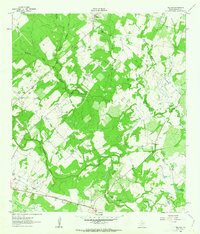
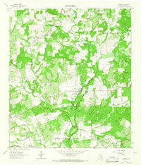
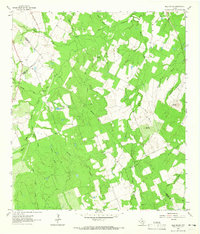
(24)- 1960 Map of Cheapside, 1962 Print
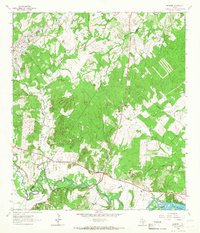
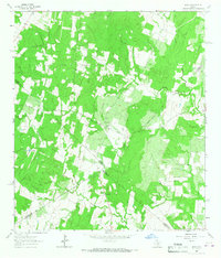
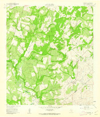 1960 Cheapside1962 Print · USGSThe rural landscape near the Gonzales and De Witt County line comes to life in this early 1960s survey. Genealogists and local historians can trace family ties at Mt Enon Cemetery and Rupert Cemetery or explore the geography around Cheapside and Five Mile Lake.2 unique versions available
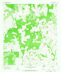
 - 1960 Map of Westhoff, 1962 Print
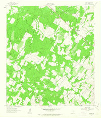
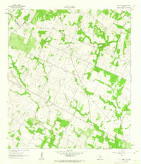
 1960 Westhoff1962 Print · USGSThe rural crossing at Westhoff during the early 1960s reveals a classic South Texas landscape of family ranches and rail-side industry. Genealogists and historians can locate legacy landmarks like St Aloysius Cem, the Du Bose Ranch Headquarters, and the Texas and New Orleans rail line.2 unique versions available
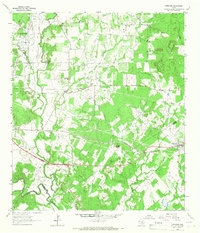
 - 1961 Map of Sample, 1963 Print
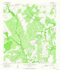
 1961 Sample1963 Print · USGSThe rural borderlands of Gonzales and De Witt counties come to life in the early sixties, showing the agricultural landscape anchored by the Southern Pacific rail line. Researchers can locate the Sample settlement, family-named landmarks like Van Cleave Mound, and the Billings Cem or Sample Cem burial sites.3 unique versions available
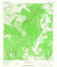
 - 1961 Map of Nixon, 1963 Print
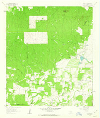
 1961 Nixon1963 Print · USGSThe South Texas prairie around Nixon is captured here in the early 1960s, showing a landscape shaped by the Southern Pacific railroad and local industry. Researchers can find many family landmarks, from the Claypits to rural sites like Union Valley Ch and Dewville Cem.3 unique versions available
 - 1961 Map of Pilgrim, 1963 Print
 1961 Pilgrim1963 Print · USGSGonzales County’s agricultural landscape is captured here in the early sixties, showing a rural community defined by its waterways and rail connections. Researchers can locate the Clabber Town Cem and follow the Southern Pacific tracks past Pilgrim and Claybottom Lake.2 unique versions available
 - 1961 Map of New Davy, 1963 Print
 1961 New Davy1963 Print · USGSDeWitt County ranch land and rural crossroads are captured here in the early sixties at the intersection of three Texas counties. Researchers can locate family landmarks like Sand Gate Cem and trace the paths of Little Salt Creek and Fifteenmile Creek.2 unique versions available
 - 1961 Map of Gillett, 1963 Print
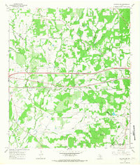
 1961 Gillett1963 Print · USGSSouthern Texas ranching and oil fields come into focus in the early sixties along the Wilson and Karnes County border. Researchers can trace the SOUTHERN PACIFIC line through Pandora or locate rural landmarks like the MANFORD GAS FIELD and El Negro Ranch.3 unique versions available
 - 1962 Map of Dewville, 1963 Print
 1962 Dewville1963 Print · USGSRanching and early oil exploration define this South Texas landscape in the early sixties. Researchers can trace family-named sites like Wells Ranch, the Sandy Chapel Cem, and the rural settlement of Dewville.2 unique versions available
 - 1962 Map of Dilworth, 1965 Print
 1962 Dilworth1965 Print · USGSSouth-central Texas ranching and farming lands appear here in the early 1960s, defined by the winding course of Peach Creek. Family historians can locate Little New York, St James Cemetery, and the Old Railroad Grade.2 unique versions available
 - 1962 Map of Gonzales North, 1965 Print
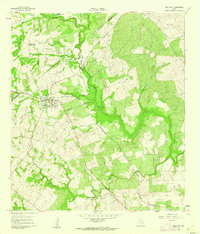
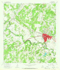
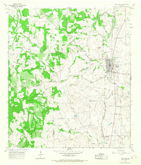
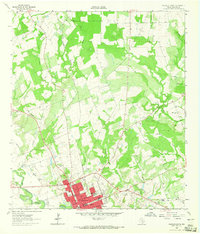 1962 Gonzales North1965 Print · USGSMid-century Gonzales and its northern hinterlands are captured here at the junction of the Guadalupe River and San Marcos River. Researchers can trace old family sites at Denton Creek Cem or follow the path of the Southern Pacific railroad.3 unique versions available
 - 1962 Map of Smiley, 1966 Print
 1962 Smiley1966 Print · USGSSmiley and its surrounding ranchlands are captured in the early sixties as a center for poultry farming and rail transport. Genealogists and local historians can locate several family and community landmarks, including Union Hill Cem, Lake Patterson, and the Southern Pacific line.2 unique versions available
 - 1962 Map of Leesville, 1966 Print
 1962 Leesville1966 Print · USGSThe rural stretch of Gonzales County comes into focus in the early sixties, showing a landscape defined by creek drainages and small crossroads communities. Genealogists can trace family landmarks and burial sites like Holmes Cem and Liberty Cem near Leesville and Bebe.2 unique versions available
 - 1963 Map of Bald Mound, 1965 Print
 1963 Bald Mound1965 Print · USGSThe rural intersection of Gonzales, Wilson, and Karnes counties is captured here in the early 1960s. Researchers can trace the local landscape through landmarks like Bald Mound, the remote Shockley crossing, and natural features like Flowing Well and Elm Creek.3 unique versions available
 - 1963 Map of Garfield, 1965 Print
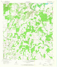
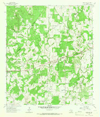
 1963 Garfield1965 Print · USGSThis South Texas countryside along the county line was transitioning into a modern ranching and energy landscape in the early sixties. Genealogists and local historians can trace family land via the settlements of Garfield and Old Davy or locate several Oil Wells and Gravel Pits.3 unique versions available
 - 1964 Map of Harwood, 1966 Print
 1964 Harwood1966 Print · USGSThe Harwood area in the mid-sixties reveals a landscape defined by the oil industry and the Southern Pacific rail line. Researchers can trace family history at the Plum Creek Cem and Lone Oak Cem or locate the historic Salt Flat Oil Field.3 unique versions available
 - 1964 Map of Delhi, 1966 Print
 1964 Delhi1966 Print · USGSCaldwell County's rural landscape at the mid-1960s shows a quiet crossroads centered on the Delhi settlement. Genealogists and historians can locate the Delhi Church and Delhi Cemetery while tracing the winding paths of Sandy Fork and Tenney Creek.2 unique versions available
 - 1964 Map of Belmont, 1966 Print
 1964 Belmont1966 Print · USGSThe Guadalupe River valley in the mid-sixties reveals a landscape of winding waterways and dispersed rural settlements near the county line. Genealogists can trace family landmarks like Nixon Cem and Nash Creek Cem or the rural St James Ch.3 unique versions available
 - 1964 Map of Luling, 1966 Print
 1964 Luling1966 Print · USGSLuling and the surrounding oil fields are captured here in the mid-1960s as the regional energy and rail economy thrived. Genealogists can locate family landmarks such as Highsmith Cemeteries, Prairie Lea Cem, and the Rosenwald Sch.3 unique versions available
 - 1964 Map of Sandy Fork, 1966 Print
 1964 Sandy Fork1966 Print · USGSCaldwell and Gonzales counties are captured here in the mid-1960s, showing a landscape shaped by the rail economy and small rural church centers. Researchers can trace family sites like Fullilove Cem, the village of Harwood, and the Southern Pacific line.2 unique versions available
 - 1964 Map of Waelder, 1966 Print
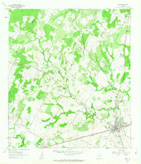
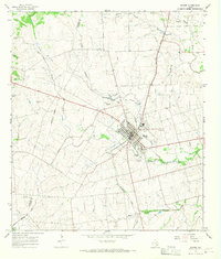
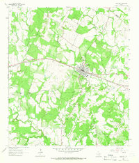 1964 Waelder1966 Print · USGSMid-century Gonzales County comes to life along the Southern Pacific tracks in the early 1960s. Researchers can locate family sites and rural landmarks like St Patricks church, Waelder School, and the local Oil Field.2 unique versions available
 - 1964 Map of Jeddo, 1967 Print
 1964 Jeddo1967 Print · USGSThe four-county corner of Central Texas is captured here in the mid-1960s, showing a landscape of wooded creeks and quiet rural settlements. Genealogists can trace family roots at St Phillips Cem or locate old community hubs like Salem and Jeddo.3 unique versions available
 - 1965 Map of Flatonia NW, 1967 Print
 1965 Flatonia NW1967 Print · USGSFayette and Gonzales counties are captured here in the mid-1960s as highway expansion began to reshape the rural landscape. Researchers can locate family burial sites like Sommers Cem and trace the path of the SOUTHERN PACIFIC through Armstrong.2 unique versions available
 - 1965 Map of Moulton, 1968 Print
 1965 Moulton1968 Print · USGSThe South Texas prairie around Moulton is captured here during the mid-sixties, showing the transition between established rail corridors and older settlements. Researchers can trace family history through sites like Old Moulton Cem, the Slavonic Cem, and the community of Henkhaus.2 unique versions available
 - 1965 Map of Shiner, 1968 Print
 1965 Shiner1968 Print · USGSShiner and the surrounding Lavaca County countryside appear here in the mid-1960s, a period of established rail transport and local industry. Genealogists and historians can trace the town's development through St Paul High Sch, Shiner Cem, and the Southern Pacific rail line.2 unique versions available
End of results
Showing maps 1-24 of 24
Top cities of Gonzales County
Frequently asked questions
- What are the different types of historical maps available for Gonzales County?
- What is the oldest map of Gonzales County?
- Where can I purchase historical maps of Gonzales County for my home or office?
- Where can I download high-res historical maps of Gonzales County?
- Are there historical topographic maps available for Gonzales County?
- Is there historical aerial imagery available for Gonzales County?
- Where are historical maps of Gonzales County sourced from?