2020s Maps of Kingsbury, Texas
Explore 3 historic maps of Kingsbury from the 2020s. These maps offer a rare glimpse into what life looked like during the 2020s — showing old roads, neighborhoods, homes, and landmarks that have changed or disappeared over time.
Whether you're researching your family's past, planning a metal detecting trip, or studying how Kingsbury's landscape evolved across the 2020s, these high-resolution maps are a powerful tool for exploring the history of this region.
- Focus on a specific era: All maps on this page are from the 2020s, giving you a focused view of this time period.
- See what’s changed: Compare century-old streets, trails, and buildings to today's modern landscape using overlays and satellite layers.
- Research with precision: Use these maps for genealogy, historical research, land use analysis, or educational projects.
- View, download, or print: Maps are fully viewable online in high resolution, and can be downloaded or printed for your own records.
Start exploring Kingsbury's history through authentic maps from the 2020s. This is your window into the past.
Kingsbury, TX maps
(3)- 2022 Map of Luling, 2022 Print
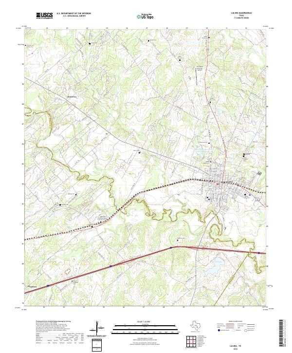 2022 Luling2022 Print · USGSThe Luling area at the start of the 2020s shows a complex network of rural cemeteries and river-driven geography at the Caldwell and Guadalupe county line. Genealogists can trace family history at San Juan Cem Number Two, Stairtown, and the Luling Catholic Cem.
 - 2022 Map of Darst Creek, 2022 Print
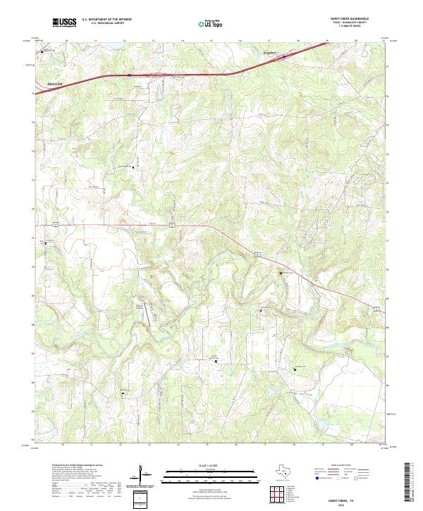 2022 Darst Creek2022 Print · USGSGuadalupe County's rural ranching landscape comes into focus during this contemporary period, showing the intricate network of local roads and family holdings. Genealogists can locate several small burial grounds such as Capote Baptist Cem, New-Salem Cem, and Brenner Cem.
 - 2022 Map of Kingsbury, 2022 Print
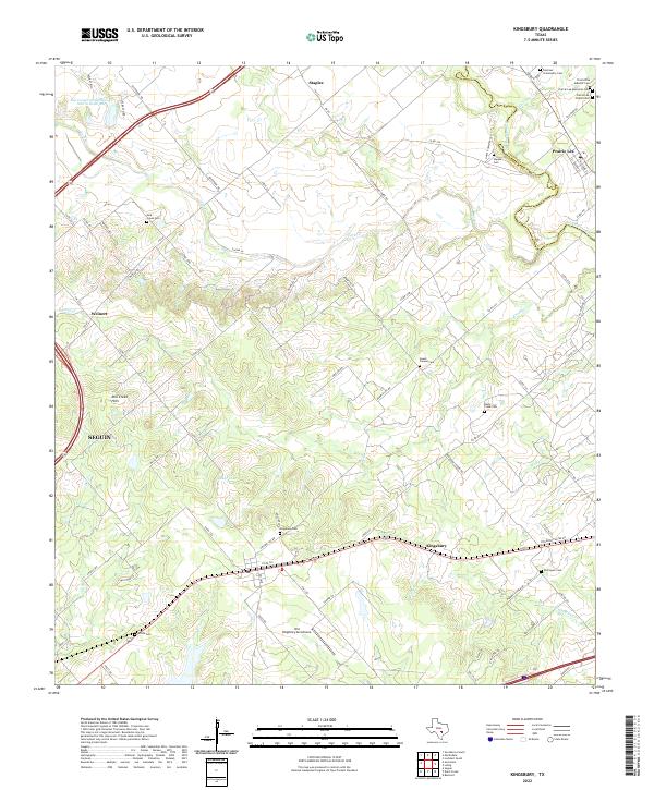 2022 Kingsbury2022 Print · USGSKingsbury and Prairie Lea are captured in this contemporary view of the Guadalupe and Caldwell County line. Genealogists can trace family heritage through a remarkable number of local burial sites, from Sweet Canaan Cem to the Old Kingsbury Aerodrome.
End of results
Showing maps 1-3 of 3
Top cities near Kingsbury
- San Marcos historical maps
- Seguin historical maps
- Lockhart historical maps
- Luling historical maps
- Martindale historical maps
- Staples historical maps
Frequently asked questions
- What are the different types of historical maps available for Kingsbury?
- What is the oldest map of Kingsbury?
- Where can I purchase historical maps of Kingsbury for my home or office?
- Where can I download high-res historical maps of Kingsbury?
- Are there historical topographic maps available for Kingsbury?
- Is there historical aerial imagery available for Kingsbury?
- Where are historical maps of Kingsbury sourced from?