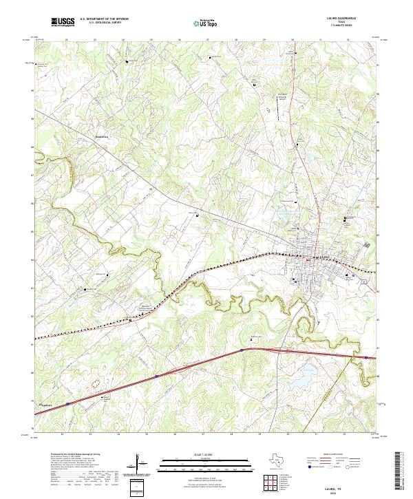
2022 Map of Luling
USGS Topo · Published 2022About this map
The San Marcos River carves a winding path through this South Texas landscape at the intersection of Caldwell, Guadalupe, and Gonzales counties. Centered on the town of Luling, the geography reveals a community deeply rooted in its local history and diverse heritage, evidenced by a dense concentration of burial sites including Luling City Cem, Luling Jewish Cem, and the Cementerio Bautista. The town’s layout is defined by its street grid, with E Fannin St and S Magnolia Ave anchoring the central district.
Find a feature on this map
119 named features on this map. Tap any name to fly to it.
Don’t see what you’re looking for? This feature index may not catch every label — zoom into the map to look around manually.
Map Details
Editions of this 2022 Luling Map
This is the sole edition of this map. No revisions or reprints were ever made.
Other maps of this area

1911 · San Marcos
USGS Topo · 1:125,000

1919 · San Marcos
USGS Topo · 1:125,000

1924 · San Marcos 3-d
USGS Topo · 1:48,000

1925 · San Marcos 4-c
USGS Topo · 1:48,000

1925 · San Marcos 1-d
USGS Topo · 1:48,000

1925 · San Marcos 4-a
USGS Topo · 1:48,000

1929 · Luling
USGS Topo · 1:62,500

1930 · Lockhart
USGS Topo · 1:62,500

1930 · Seguin
USGS Topo · 1:62,500

1953 · Seguin
USGS Topo · 1:250,000