
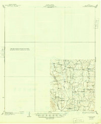
1930 Map of Lockhart
USGS Topo · Published 1930About this map
The rolling plains of Comanche Flat and the surrounding drainage basins characterize this central Texas landscape during the mid-1920s. Established by the State of Texas Board of Water Engineers, the map highlights a rural infrastructure built around small family-named centers and a robust network of country schools including Lovely Plant Sch, Harmony Grove Sch, and Ellison Sch. These schoolhouses, often spaced just miles apart, indicate the density of the rural population before mid-century consolidation.
Find a feature on this map
25 named features on this map. Tap any name to fly to it.
Don’t see what you’re looking for? This feature index may not catch every label — zoom into the map to look around manually.
Map Details
Editions of this 1930 Lockhart Map
2 editions found
Other maps of this area

1885 · Bastrop
USGS Topo · 1:125,000

1893 · Bastrop
USGS Topo · 1:125,000

1896 · Austin
USGS Topo · 1:125,000

1897 · Austin
USGS Topo · 1:125,000

1901 · Flatonia
USGS Topo · 1:125,000

1904 · Bastrop
USGS Topo · 1:125,000

1910 · Austin
USGS Topo · 1:125,000

1911 · San Marcos
USGS Topo · 1:125,000

1919 · San Marcos
USGS Topo · 1:125,000

1925 · San Marcos 1-d
USGS Topo · 1:48,000