Old Maps of Hardeman County, Texas for Genealogy
Trace your family roots with 151 historic maps of Hardeman County. These high-res maps reveal old neighborhoods, homesites, landmarks, and streets — helping you uncover where your ancestors lived and how the area evolved over time.
- Explore historic neighborhoods: Identify where your relatives may have lived in the 1800s or 1900s.
- Compare maps over time: Trace the changes in streets, buildings, and landmarks for multi-generational research.
- Perfect for genealogy & ancestry research: Used by family historians and researchers to map out lineage and migration.
These maps are an incredible resource for exploring your personal connection to Hardeman County's past.
Hardeman County, TX maps
(151)- 1927 Map of Quanah 3-a
 1927 Quanah 3-a1927 Print · USGSThe river breaks of North Texas are captured in the late 1920s as the Pease River divides Hardeman Co and Foard Co. Genealogists and local historians can locate the Forestburg School and trace the winding paths of Groesbeck Creek.
 - 1927 Map of Quanah 3-b
 1927 Quanah 3-b1927 Print · USGSThe North Texas plains meet the winding Pease River during the late 1920s as the regional county lines were being precisely defined. Researchers can trace the exact boundaries of Cottle, Hardeman, and Foard counties across this early aerial-assisted survey.
 - 1932 Map of Vivian
 1932 Vivian1932 Print · USGSThe winding valley of the Pease River dominates this north Texas landscape as it appeared in the early thirties. Local history researchers can trace early county lines and rural landmarks like the Forestburg Sch and Teacup Mountain.2 unique versions available
 - 1955 Map of Lawton, 1958 Print
 1955 Lawton1958 Print · USGSSouthwestern Oklahoma and North Texas are shown here in the mid-fifties, dominated by the Wichita Mountains and the vital Red River watershed. Genealogists and historians can trace the foundations of Lawton alongside rural landmarks like Rainy Mountain Church and Pleasant Hill School.5 unique versions available
 - 1958 Map of Vernon, 1959 Print
 1958 Vernon1959 Print · USGSWilbarger County is captured in the late fifties as the local economy balanced ranching traditions with growing civic infrastructure. Researchers can locate family landmarks such as Lockett High Sch, the Santa Rosa Roundup Rodeo Grounds, and Pleasant Home Ch.2 unique versions available
 - 1958 Map of Medicine Mound, 1959 Print
 1958 Medicine Mound1959 Print · USGSHardeman and Foard Counties are shown here in the late fifties, defined by the winding Pease River and the iconic Medicine Mounds. Researchers can locate the Pease River Battlefield, the town of Margaret, and the Panhandle and Santa Fe rail line.
 - 1958 Map of Elmer, 1960 Print
 1958 Elmer1960 Print · USGSThe Oklahoma-Texas borderlands are captured here in the late fifties as oil production and ranching shaped the landscape. Researchers can locate vanished rural landmarks like Amerada Camp, the Fargo Oil Field, and the Southside School.2 unique versions available
 - 1960 Map of Goodlett, 1962 Print
 1960 Goodlett1962 Print · USGSHardeman County at the dawn of the 1960s was a landscape defined by the Red River and a busy network of converging rail lines. Researchers can trace the layouts of small communities like Goodlett and Punkin Center or locate rural burial grounds including Elba Cem and Johnson Cem.2 unique versions available
 - 1960 Map of Teacup Mountain, 1962 Print
 1960 Teacup Mountain1962 Print · USGSFoard and Hardeman counties are captured in the early sixties as they were shaped by the winding Pease River. Local historians can trace family landmarks and geographic features like Teacup Mountain, Sugarloaf Mountain, and the remote Oil Well site.
 - 1960 Map of Quanah, 1963 Print
 1960 Quanah1963 Print · USGSThe Red River frontier comes to life in the early sixties, showing the vital rail-and-river connection between Oklahoma and the Texas Panhandle. Researchers can trace family roots through Eldorado Cem, King Sch, and the rail lines serving Quanah and Chillicothe.3 unique versions available
 - 1961 Map of Hollis, 1963 Print
 1961 Hollis1963 Print · USGSHarmon County, Oklahoma, in the early sixties showcases a landscape defined by the Prairie Dog Town Fork Red River and the arrival of modern infrastructure. Researchers can locate family landmarks like Bitter Creek Cem, Antioch Ch, and the local Drive-in Theater in Hollis.
 - 1975 Map of Hollis SE
 1975 Hollis SE1975 Print · USGSHarmon County at the Oklahoma-Texas border is seen from the air in the mid-seventies, showing the agricultural patterns of the southern plains. Researchers can trace the shifting sandbars of the Red River and the winding course of Sandy Louis Creek through this rural landscape.
 - 1975 Map of Quanah NE
 1975 Quanah NE1975 Print · USGSJackson County agriculture and the Texas border come into focus in the mid-seventies. Trace the shifting banks of the Red River and the path of Sandy Creek through a landscape of patterned fields.
 - 1975 Map of Quanah NW
 1975 Quanah NW1975 Print · USGSThe Red River valley south of Eldorado comes to life in this mid-seventies aerial survey of the Oklahoma-Texas borderlands. Genealogists and land researchers can trace the precise boundaries of farmsteads and rural roads near Sandy Creek and the wide banks of the Red River.
 - 1983 Map of Warrior Hollow, 1984 Print
 1983 Warrior Hollow1984 Print · USGSThe Pease River borderlands in the early 1980s come to life on this topographic study of the Foard County line. Researchers can locate the settlement of Thalia, a local Cem, and a Historical Marker situated near Mule Creek.
 - 1983 Map of Tolbert, 1984 Print
 1983 Tolbert1984 Print · USGSThe rural landscape of Wilbarger County in the early eighties shows a transition from prairie farmsteads to the banks of the Pease River. Researchers can locate the settlement of Tolbert along the Burlington Northern rail line and trace family sites near Farmers Valley.2 unique versions available
 - 1983 Map of Rayland, 1984 Print
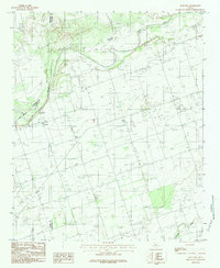 1983 Rayland1984 Print · USGSWilbarger County ranchlands and the winding Pease River are captured in the early eighties. Genealogists can trace family homesteads near Rayland or locate the rural Cem and Antelope Springs tucked into the breaks.2 unique versions available
 - 1983 Map of Big Mound, 1984 Print
 1983 Big Mound1984 Print · USGSHardeman County, Texas, is documented here in the early 1980s, highlighting the unique geological peaks of the eastern Rolling Plains. Trace the natural topography around Medicine Mounds, Lake Pauline, and the breaks of Copper Breaks State Park.
 - 1983 Map of Margaret, 1984 Print
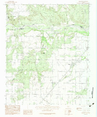 1983 Margaret1984 Print · USGSFoard County at the start of the eighties shows a landscape of ranching and river management. Trace the settlement at Margaret, the red-clay canyons of Copper Breaks State Park, and the winding course of the Pease River.2 unique versions available
 - 1983 Map of Medicine Mound, 1984 Print
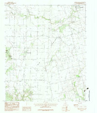 1983 Medicine Mound1984 Print · USGSHardeman County, Texas, was characterized by its cattle-ranching landscape and distinctive geological rises in the early eighties. Genealogists and historians can trace the roads around Medicine Mound, the streets of Chillicothe, and landmarks like Cedar Mound.
 - 1984 Map of Teacup Mountain, 1985 Print
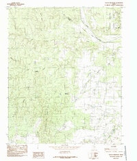 1984 Teacup Mountain1985 Print · USGSThe broken red-rock country of Foard County comes into focus in the mid-1980s, centered on the Pease River and Copper Breaks State Park. Genealogists and local historians can trace named natural landmarks like Teacup Mountain, Sugarloaf Mountain, and Bowley Canyon.
 - 1984 Map of Quanah NE, 1985 Print
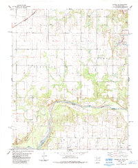 1984 Quanah NE1985 Print · USGSThe Oklahoma-Texas borderlands are captured here in the mid-1980s, documenting the rural landscape along the Red River. Genealogists and local historians can locate the Odema Cem and trace industrial sites like the Creta Mine or the Burlington Northern rail line.
 - 1984 Map of Quanah West, 1985 Print
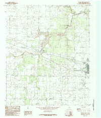 1984 Quanah West1985 Print · USGSHardeman County, Texas, was defined by its railroad arteries and creek drainage systems in the 1980s. Genealogists and local historians can trace the paths of the Burlington Northern Railroad, the settlement at Acme, and the legacy of the Old RR Grade.
 - 1984 Map of Maybell Canyon, 1985 Print
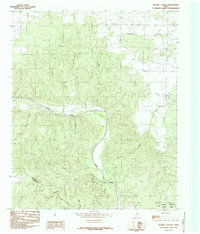 1984 Maybell Canyon1985 Print · USGSThe Pease River corridor in Hardeman and Foard Counties is shown here as it appeared in the late seventies. Researchers can trace the rugged breaks of Maybell Canyon, the boundaries of Copper Breaks State Park, and several named tributaries like Arkansos Creek.
 - 1984 Map of Goodlett, 1985 Print
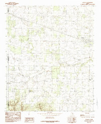 1984 Goodlett1985 Print · USGSHardeman County in the late seventies is captured here at the transition between the rolling plains and the rugged breaks. Genealogists can trace the rural layouts of Goodlett, Wheatland, and Lazare, while exploring local landmarks like Hepsidam Hill.
Showing maps 1-25 of 151
Top cities of Hardeman County
Frequently asked questions
- What are the different types of historical maps available for Hardeman County?
- What is the oldest map of Hardeman County?
- Where can I purchase historical maps of Hardeman County for my home or office?
- Where can I download high-res historical maps of Hardeman County?
- Are there historical topographic maps available for Hardeman County?
- Is there historical aerial imagery available for Hardeman County?
- Where are historical maps of Hardeman County sourced from?