Old Maps of Humble, Texas for Academic Research
Study the evolution of Humble with 50 high-resolution historic maps. Whether you're teaching, researching, or modeling changes in land use, these maps provide essential visual documentation of urban, environmental, and geographic change.
- Analyze long-term change: Track patterns in development, transportation, and natural features.
- Ideal for environmental or urban studies: Support academic projects with primary historical map data.
- Use in the classroom or lab: Educators and researchers rely on these maps to bring historical context to life.
These maps are a powerful tool for teaching, research, and visualizing how Humble has changed over the decades.
Humble, TX maps
(50)- 1916 Map of Harmaston
 1916 Harmaston1916 Print · USGSCoastal Harris County was a network of railroad stops and bayous during the early twentieth century. Trace the early settlement patterns of Harmaston and Victor along the Beaumont Sour Lake and Western tracks near Ingram Marsh.2 unique versions available
 - 1916 Map of Moonshine Hill
 1916 Moonshine Hill1916 Print · USGSHarris and Montgomery counties appear here in the early twentieth century as a complex landscape of river forks and wetlands. Genealogists and historians can trace old property lines and natural landmarks like Odom Lake Swamp, Bosman Lake, and the H. E. and W. T. rail line.3 unique versions available
 - 1916 Map of Humble
 1916 Humble1916 Print · USGSHarris County is captured here in the early twentieth century as small rail-side settlements began to dot the coastal prairie. Local historians can trace the foundations of Humble and Mt Houston or locate the rural Higgs School and a small Cem near the winding Greens Bayou.2 unique versions available
 - 1919 Map of Humble
 1919 Humble1919 Print · USGSHarris County at the height of the early oil era is defined by the convergence of major rail lines and bayou-side settlements. Genealogists and industrial historians can trace the early footprints of Humble, the location of Higgs School, and the dense rail network of the International and Great Northern.3 unique versions available
 - 1919 Map of Weeden
 1919 Weeden1919 Print · USGSSoutheast Texas at the end of the Great War was a landscape of creek-fed bottomlands and emerging rail hubs. Trace the early layout of Humble and locate family landmarks like the Tullus Cemetery or the route of the Bender Tramroad.2 unique versions available
 - 1920 Map of Harmaston
 1920 Harmaston1920 Print · USGSCoastal Harris County near the San Jacinto River comes into focus during the early oil boom era. Researchers can trace the path of the Beaumont Sour Lake and Western railroad and locate early industrial sites like the Oil Tanks or the river Ferry near Harmaston.2 unique versions available
 - 1920 Map of Moonshine Hill
 1920 Moonshine Hill1920 Print · USGSHarris County at the height of the 1920s oil boom reveals a landscape of river bends and early settlements. Trace the original footprints of Moonshine Hill and the Huffman School alongside the oxbows of Horseshoe Lake and Blue Lake.2 unique versions available
 - 1944 Map of Harmaston
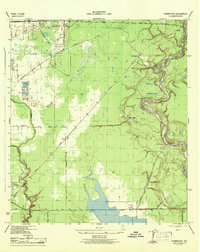 1944 Harmaston1944 Print · USGSCoastal Harris County in the mid-1940s is defined by the winding San Jacinto River and its industrial waterworks. Genealogists and local historians can trace the early rail stops at Harmaston and Victor or the riverside oxbows like Grassy Lake.
 - 1946 Map of Humble
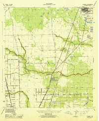 1946 Humble1946 Print · USGSNorthern Harris County comes alive in this post-war survey, showing the growth of the railroad corridor between Humble and Mt Houston. Researchers can trace old family landmarks like Koinm Cem, the Marrs Sch, and early settlements like Bordersville.
 - 1950 Map of Houston, 1953 Print
 1950 Houston1953 Print · USGSCoastal Texas in the early fifties reveals a landscape of massive civil engineering and industrial transit. Genealogists and researchers can trace the growth of the Houston suburbs and the maritime infrastructure of Galveston Bay, including the Gulf Freeway and the Texas City Dike.
 - 1954 Map of Harmaston, 1956 Print
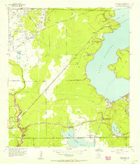 1954 Harmaston1956 Print · USGSEastern Harris County in the mid-fifties shows the rising waters of the reservoir era alongside established rail and oil corridors. Genealogists and local historians can trace the Harrington Cem and settlements like Harmaston and Dyersdale before modern sprawl arrived.
 - 1954 Map of Humble, 1956 Print
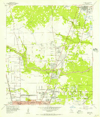 1954 Humble1956 Print · USGSNortheast of Houston during the mid-fifties, this area shows the transition from oil fields to burgeoning suburbs. Genealogists and historians can locate family-named landmarks and institutions like Rosewood Park Cemetery, Bordersville, and the Aldine Sch.
 - 1954 Map of Beaumont, 1964 Print
 1954 Beaumont1964 Print · USGSSoutheast Texas in the mid-fifties reveals a landscape of massive national forests, emerging reservoirs, and a booming oil economy. Genealogists and researchers can trace rural settlements like Dallardsville and Village Mills or locate early drilling sites at Sour Lake Oil Field.3 unique versions available
 - 1956 Map of Houston, 1963 Print
 1956 Houston1963 Print · USGSSoutheast Texas in the mid-fifties is captured here as a powerhouse of oil and maritime trade. Genealogists and historians can trace the foundations of Houston and its ports, alongside landmarks like the Rice Institute and the Spindletop Oil Field.2 unique versions available
 - 1957 Map of Beaumont
 1957 Beaumont1957 Print · USGSSoutheast Texas in the mid-fifties is defined by the timber-rich lands between the Trinity River and Beaumont. Trace the history of the Alabama and Coushatti Indian Reservation or locate early campus sites like Prairie View College.
 - 1961 Map of Moonshine Hill, 1962 Print
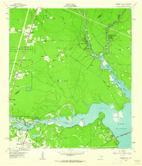 1961 Moonshine Hill1962 Print · USGSHarris and Montgomery counties appear at a crossroads in the early sixties as oil production and suburban growth meet the San Jacinto riverfront. Researchers can trace family roots at White Oak Cem, locate the wells of Riverside Field, or find early subdivisions like Walden Woods.4 unique versions available
 - 1961 Map of Maedan, 1962 Print
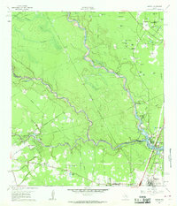 1961 Maedan1962 Print · USGSThe Montgomery and Harris County borderlands come alive in this early 1960s survey, showing the confluence of river bottomlands and emerging rail-side communities. Trace the roots of Bordersville and Maedan or locate family markers at Enloe Cem and Tetter Cem.2 unique versions available
 - 1967 Map of Humble
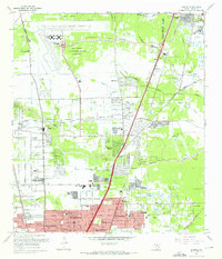 1967 Humble1967 Print · USGSNorthern Harris County is caught in a moment of rapid suburban and industrial expansion in the late sixties. Researchers can trace family sites at Rosewood Park Cem or locate the early footprints of Houston Intercontinental Airport and Douglas MacArthur High Sch.2 unique versions available
 - 1967 Map of Harmaston
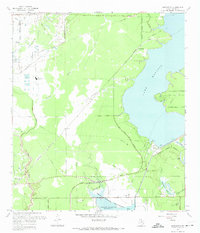 1967 Harmaston1967 Print · USGSNortheast Harris County in the late sixties shows the balance between oil production and the new reservoirs serving the Houston metro area. Genealogists and historians can trace the Missouri Pacific corridor through Harmaston, find the Jacinto Cem, or locate the Riverside Oil Field.2 unique versions available
 - 1975 Map of Houston, 1977 Print
 1975 Houston1977 Print · USGSThe Texas Gulf Coast in the mid-seventies shows a sprawling Houston metropolis linked to the sea by the massive Houston Ship Channel. Researchers can trace the mid-century industrial landscape from the Astrodome to the Lyndon B. Johnson Space Center.2 unique versions available
 - 1982 Map of Humble
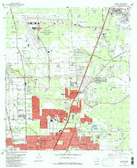 1982 Humble1982 Print · USGSNorth of Houston in the early eighties, the landscape is defined by the growth of modern aviation and expanding suburbs. Researchers can trace family roots through numerous sites like Brookside Memorial Park (Cem), Bordersville, and Mac Arthur High Sch.
 - 1982 Map of Maedan
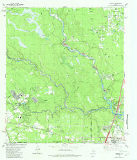 1982 Maedan1982 Print · USGSSoutheast Texas in the early eighties shows a shifting landscape where sprawling river bottomlands meet growing residential communities. Genealogists and local historians can locate several family burial grounds like Enloe Cem, early schools including Teague Sch, and the rail-side community of Bordersville.
 - 1982 Map of Harmaston
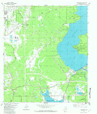 1982 Harmaston1982 Print · USGSNortheast of Houston in the early 1980s, this area balances burgeoning residential developments with vital water and energy infrastructure. Genealogists and historians can trace the Old Pacific Railroad Grade, locate the Harrington Cem, and see the extent of the Riverside Oil Field.
 - 1984 Map of Beaumont
 1984 Beaumont1984 Print · USGSSoutheast Texas in the late seventies and early eighties shows a landscape of expanding reservoirs and deep timber industry. Researchers can trace the development of the Sam Houston National Forest or locate regional landmarks like Grabbs Prairie and the Wynne State Prison Farm.3 unique versions available
 - 1985 Map of Conroe
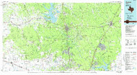 1985 Conroe1985 Print · USGSSoutheast Texas in the mid-eighties shows a landscape of timberlands and new lakeside developments. Researchers can trace the legacy of rail lines like the Southern Pacific RR or locate rural communities such as Plantersville, Yarboro, and Hufsmith.2 unique versions available
Showing maps 1-25 of 50
Top cities near Humble
- Houston historical maps
- The Woodlands historical maps
- Conroe historical maps
- Atascocita historical maps
- Kingwood historical maps
- Baytown historical maps
See more
Top neighborhoods of Humble
Frequently asked questions
- What are the different types of historical maps available for Humble?
- What is the oldest map of Humble?
- Where can I purchase historical maps of Humble for my home or office?
- Where can I download high-res historical maps of Humble?
- Are there historical topographic maps available for Humble?
- Is there historical aerial imagery available for Humble?
- Where are historical maps of Humble sourced from?