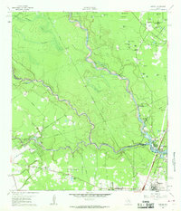
1961 Map of Maedan
USGS Topo · Published 1962About this map
The West Fork San Jacinto River carves a winding path through this early 1960s landscape, marking the transition from the piney woods of Montgomery County to the growing northern outskirts of Harris County. The community of Bordersville sits just north of Humble, where the Southern Pacific railroad corridor facilitates regional transport. The map records a dense network of water features and local landmarks, from the small settlements of Maedan and Sorters to the numerous wetlands like Little Alligator Pond and Mink Pond. Cultural sites including Enloe Cem and Tetter Cem provide specific points of interest for genealogical research. The emergence of residential areas like Forest Shadows and Freeway Oaks reflects the mid-century suburban expansion into the river bottomlands, while older structures like Lakeview Park Ch and Oak Grove Ch remain as established community anchors.
Find a feature on this map
63 named features on this map. Tap any name to fly to it.
Don’t see what you’re looking for? This feature index may not catch every label — zoom into the map to look around manually.
Map Details
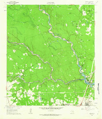
Editions of this 1961 Maedan Map
2 editions found
Other maps of this area

1916 · Aldine
USGS Topo · 1:24,000

1916 · Harmaston
USGS Topo · 1:24,000

1916 · Moonshine Hill
USGS Topo · 1:24,000

1916 · Humble
USGS Topo · 1:24,000

1916 · Spring
USGS Topo · 1:24,000

1919 · Aldine
USGS Topo · 1:31,680

1919 · Humble
USGS Topo · 1:31,680

1919 · Weeden
USGS Topo · 1:31,680

1920 · Spring
USGS Topo · 1:31,680

1920 · Harmaston
USGS Topo · 1:31,680