Old Maps of Uncertain, Texas for Academic Research
Study the evolution of Uncertain with 17 high-resolution historic maps. Whether you're teaching, researching, or modeling changes in land use, these maps provide essential visual documentation of urban, environmental, and geographic change.
- Analyze long-term change: Track patterns in development, transportation, and natural features.
- Ideal for environmental or urban studies: Support academic projects with primary historical map data.
- Use in the classroom or lab: Educators and researchers rely on these maps to bring historical context to life.
These maps are a powerful tool for teaching, research, and visualizing how Uncertain has changed over the decades.
Uncertain, TX maps
(17)- 1944 Map of Caddo Lake, 1954 Print
 1944 Caddo Lake1954 Print · USGSThe Texas-Louisiana borderlands come into focus in the 1940s, showing the intricate bayou networks and rural communities along the state line. Genealogists can locate family landmarks like Jefferson Forks, Shiloh Sch, and the McDonald Cem tucked between the waters of James Bayou.
 - 1946 Map of Caddo Lake
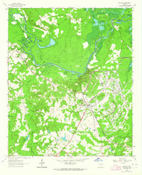
 1946 Caddo Lake1946 Print · USGSThe Texas-Louisiana borderlands come into focus in the mid-1940s, showing a landscape shaped by the waters of Caddo Lake. Genealogists and local historians can trace the foundations of rural communities through sites like Latex, Republican Ch, and Shiloh Sch.
 - 1956 Map of Tyler
 1956 Tyler1956 Print · USGSEast Texas was a powerhouse of oil production and rail transport during the mid-fifties, centered on the sprawling East Texas Oil Field. Researchers can trace the heritage of industrial hubs like Kilgore, military sites such as the Longhorn Ordnance Works, and many rural landmarks like Mount Enterprise.5 unique versions available
 - 1962 Map of Potters Point, 1964 Print
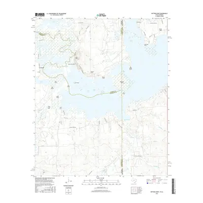
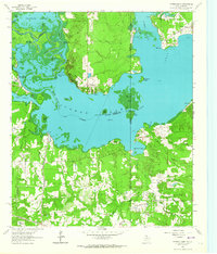 1962 Potters Point1964 Print · USGSCaddo Lake and the borderlands of Texas and Louisiana appear here in the early sixties, showing a landscape defined by its bayous and early industry. Trace the historic landings and settlements of Uncertain, Swansons Landing, and the riverside Elizabeth Ch.3 unique versions available
 - 1962 Map of Karnack, 1964 Print
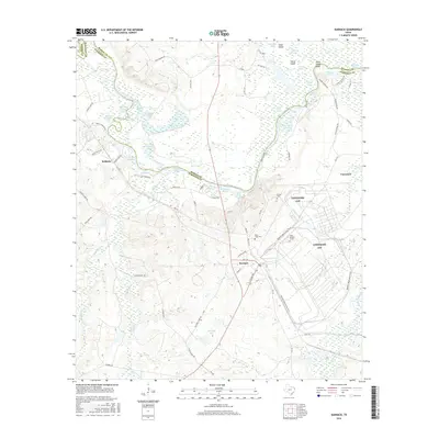
 1962 Karnack1964 Print · USGSHarrison County in the early sixties reveals a landscape shaped by military industry and the winding waters of the Cypress Bayou. Researchers can trace the sprawling Longhorn Ordnance Works and the homes of Karnack and Baldwin.2 unique versions available
 - 1984 Map of Tyler
 1984 Tyler1984 Print · USGSEast Texas at the peak of its reservoir-building era shows a landscape defined by new lakes and established rail corridors. Trace the path of the St Louis Southwestern RR or locate industrial sites like the Longhorn Ordnance Works.3 unique versions available
 - 1986 Map of Marshall
 1986 Marshall1986 Print · USGSEast Texas and the Louisiana borderlands are shown in the mid-1980s during a period of sustained industrial and energy production. Researchers can trace family roots through settlements like Ebenezer or study the impact of the Longhorn Army Ammunition Plant and Rodessa Oil Field.2 unique versions available
 - 2010 Map of Potters Point, 2010 Print
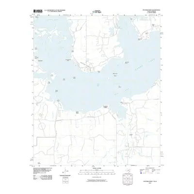 2010 Potters Point2010 Print · USGSCovers Uncertain, including Ferry Lake, South Shore, and other nearby areas
 - 2010 Map of Karnack, 2010 Print
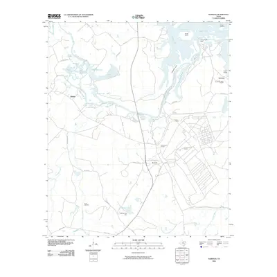 2010 Karnack2010 Print · USGSCovers Uncertain, including Karnack, Baldwin, and other nearby areas
 - 2013 Map of Karnack, 2013 Print
 2013 Karnack2013 Print · USGSCovers Uncertain, including Karnack, Baldwin, and other nearby areas
 - 2013 Map of Potters Point, 2013 Print
 2013 Potters Point2013 Print · USGSCovers Uncertain, including Ferry Lake, South Shore, and other nearby areas
 - 2016 Map of Potters Point, 2016 Print
 2016 Potters Point2016 Print · USGSCovers Uncertain, including Ferry Lake, South Shore, and other nearby areas
 - 2016 Map of Karnack, 2016 Print
 2016 Karnack2016 Print · USGSCovers Uncertain, including Karnack, Baldwin, and other nearby areas
 - 2019 Map of Karnack, 2019 Print
 2019 Karnack2019 Print · USGSCovers Uncertain, including Karnack, Baldwin, and other nearby areas
 - 2019 Map of Potters Point, 2019 Print
 2019 Potters Point2019 Print · USGSCovers Uncertain, including Ferry Lake, South Shore, and other nearby areas
 - 2022 Map of Karnack, 2022 Print
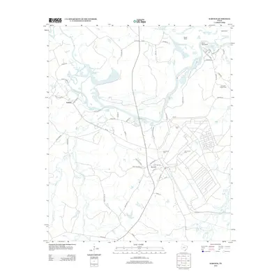
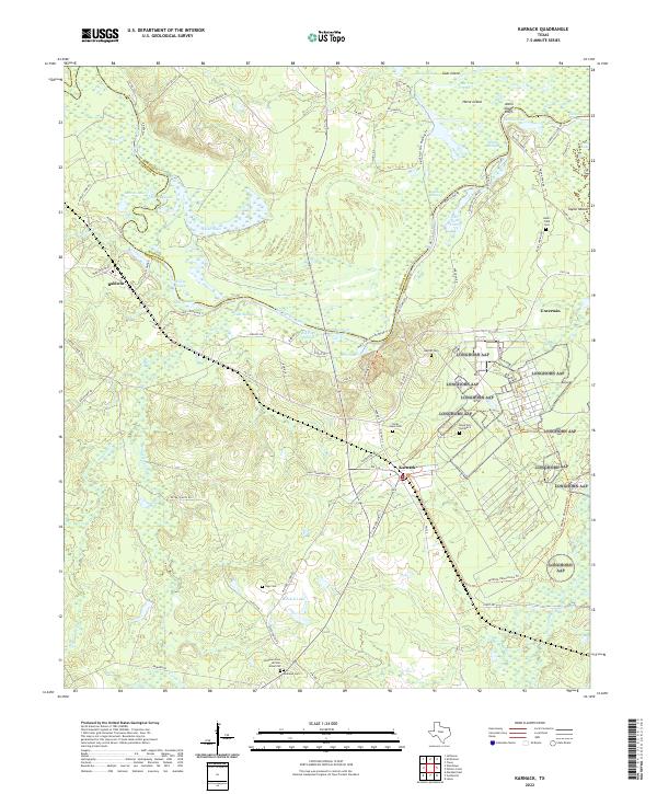 2022 Karnack2022 Print · USGSHarrison County in the early 2020s shows a landscape dominated by the winding Big Cypress Bayou and the community of Karnack. Genealogists and historians can locate several family burial grounds, including Beers Field Cem, Sipp Cem, and the Andrews Cem African American.
 - 2022 Map of Potters Point, 2022 Print
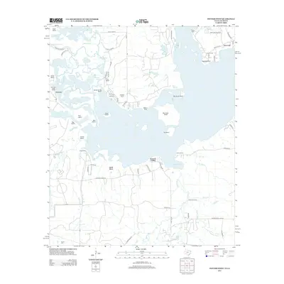
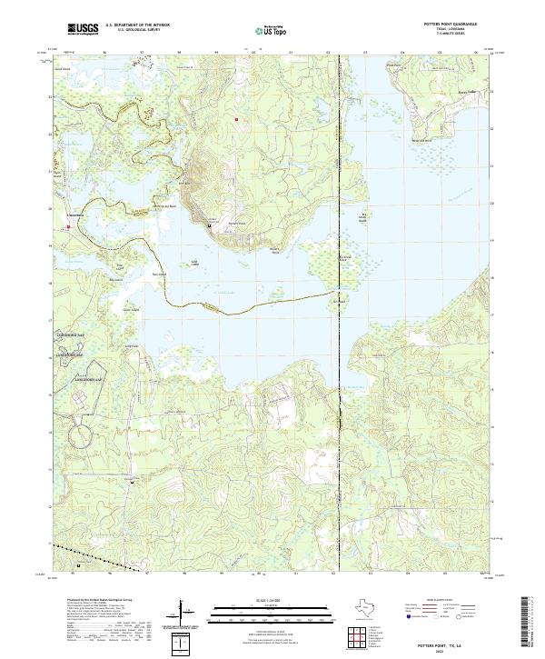 2022 Potters Point2022 Print · USGSCaddo Lake and the cypress-lined bayous of the Texas-Louisiana border appear here in remarkable detail. Genealogists and local historians can trace family locations near Uncertain, Potters Point, and the Elizabeth Cem.
End of results
Showing maps 1-17 of 17
Top cities near Uncertain
- Shreveport historical maps
- Marshall historical maps
- Vivian historical maps
- Blanchard historical maps
- Waskom historical maps
- Jefferson historical maps
See more
Frequently asked questions
- What are the different types of historical maps available for Uncertain?
- What is the oldest map of Uncertain?
- Where can I purchase historical maps of Uncertain for my home or office?
- Where can I download high-res historical maps of Uncertain?
- Are there historical topographic maps available for Uncertain?
- Is there historical aerial imagery available for Uncertain?
- Where are historical maps of Uncertain sourced from?