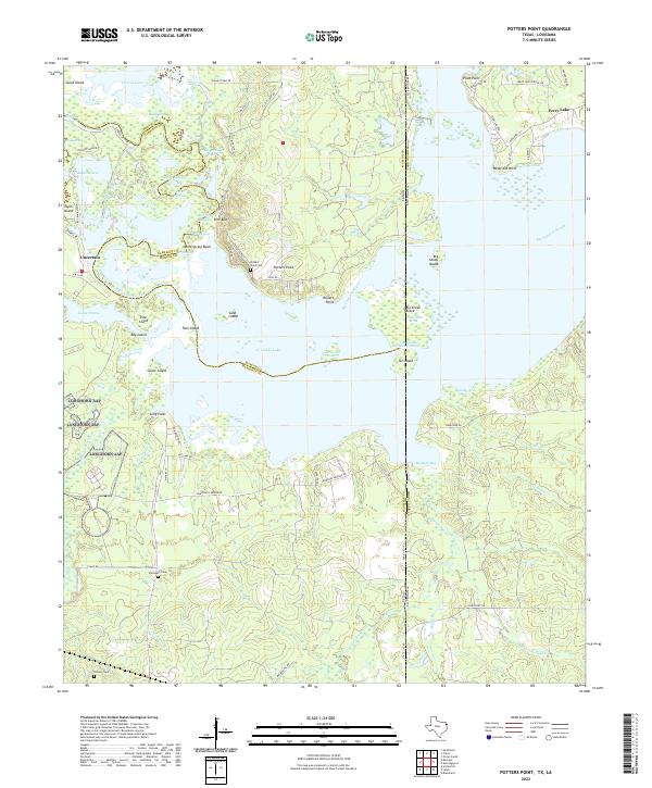
2022 Map of Potters Point
USGS Topo · Published 2022About this map
Caddo Lake and the intricate wetlands of the Texas-Louisiana border dominate this landscape, where the Big Cypress Bayou feeds into a labyrinth of sloughs and brakes. The settlement of Uncertain sits on the western edge of the water, a gateway to a maze-like terrain of islands and points such as Goose Island and Long Point. This area is defined by its fluid boundaries, both natural and political, as the state line divides the lake between Harrison County, Texas, and Caddo Parish, Louisiana.
Find a feature on this map
82 named features on this map. Tap any name to fly to it.
Don’t see what you’re looking for? This feature index may not catch every label — zoom into the map to look around manually.
Map Details
Editions of this 2022 Potters Point Map
This is the sole edition of this map. No revisions or reprints were ever made.
Other maps of this area

1932 · Hosston SW
USGS Topo · 1:31,680

1944 · Kildare
USGS Topo · 1:62,500

1944 · Caddo Lake
USGS Topo · 1:62,500

1946 · Caddo Lake
USGS Topo · 1:62,500

1948 · Kildare
USGS Topo · 1:62,500

1948 · Mooringsport
USGS Topo · 1:62,500

1948 · Vivian
USGS Topo · 1:62,500

1955 · Shreveport
USGS Topo · 1:250,000

1955 · Mooringsport
USGS Topo · 1:62,500

1956 · Shreveport
USGS Topo · 1:250,000