
1955 Map of Mooringsport
USGS Topo · Published 1956About this map
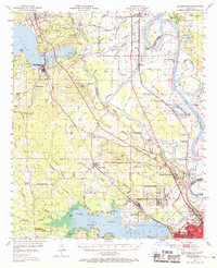
Shreveport and its northern surroundings are defined by the winding course of the Red River and an extensive network of waterways and industrial infrastructure. The landscape reveals the heavy footprint of the Shreveport Oil Field and the And Oil Field, where numerous wells and radio towers like Radio Tower (KWKH) stand alongside rural settlements. Notable cultural landmarks include the Sentell Plantation and a dense distribution of country schools and churches, such as Rosenwald Sch and Rose of Sharon Ch, which served the local farming and oil-working communities of the mid-1950s.
Find a feature on this map
101 named features on this map. Tap any name to fly to it.
Don’t see what you’re looking for? This feature index may not catch every label — zoom into the map to look around manually.
Map Details
Editions of this 1955 Mooringsport Map
3 editions found
Other maps of this area

1932 · Bossier SW
USGS Topo · 1:31,680

1932 · Shreveport SE
USGS Topo · 1:31,680

1932 · Hosston SW
USGS Topo · 1:31,680

1932 · Hosston SE
USGS Topo · 1:31,680

1932 · Bossier NW
USGS Topo · 1:31,680

1932 · Shreveport NE
USGS Topo · 1:31,680

1941 · Forbing
USGS Topo · 1:31,680

1943 · Waskom
USGS Topo · 1:62,500

1944 · Kildare
USGS Topo · 1:62,500

1944 · Caddo Lake
USGS Topo · 1:62,500