Old Maps of Hays, Texas for Metal Detecting
Plan your next treasure hunt with 33 historic maps of Hays. Find old homesites, ghost towns, trails, and gathering spots that may be lost to time — perfect for identifying promising metal detecting locations.
- Locate forgotten sites: Uncover places like long-lost settlements, abandoned rail lines, or gathering spots.
- Plan better hunts: Use map overlays combined with LiDAR or satellite views to narrow in on historically rich areas.
- Made for detectorists: Thousands of hobbyists use these maps to discover relics, coins, and hidden history.
Use these historic maps to boost your research and find new opportunities beneath the surface of Hays.
Hays, TX maps
(33)- 1896 Map of Austin
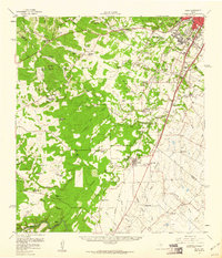
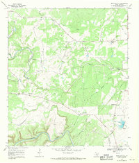
 1896 Austin1896 Print · USGSAustin and its surrounding counties are shown in the mid-1890s, capturing the transition from frontier river crossings to a rail-centered regional hub. Researchers can trace historic river access points like Cameron Ferry alongside vanished landmarks such as Johnson's Institute and Moore & Berry's Store.
 - 1897 Map of Austin
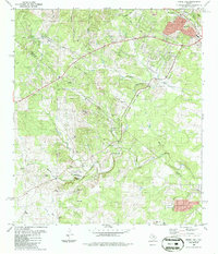
 1897 Austin1897 Print · USGSTexas in the late 1890s reveals a capital city defined by its river and an expanding railroad network. Genealogists and historians can trace family-named landmarks and early centers of learning like Saint Edward's College, Johnson's Institute, and Anderson Mill.
 - 1910 Map of Austin
 1910 Austin1910 Print · USGSAustin and the surrounding Travis County hill country are captured here at the start of the twentieth century. Genealogists and researchers can locate pioneer landmarks like Anderson Mill, Mc.Kinney Falls, and numerous river crossings including Lohmann Ford.3 unique versions available
 - 1954 Map of Austin, 1964 Print
 1954 Austin1964 Print · USGSCentral Texas is captured during a period of steady growth as the capital city and its neighboring farm towns began to modernize. Researchers can trace historic rail corridors like the Southern Pacific RR or locate landmarks such as Bergstrom Air Force Base and Pilot Knob.4 unique versions available
 - 1955 Map of Oak Hill, 1956 Print
 1955 Oak Hill1956 Print · USGSSouthwest of Austin in the mid-fifties, this area shows a landscape of rural schoolhouses and family farms before the suburban boom. Genealogists can locate family landmarks like the Oak Hill Cem, the St Elmo Sch (Aband), and the Kenchion settlement.
 - 1958 Map of Buda, 1960 Print
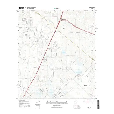
 1958 Buda1960 Print · USGSBuda and the southern reaches of Travis and Hays Counties are seen here in the late fifties during a period of steady ranching and early suburban growth. Genealogists and local historians can trace family ranch lands and historic sites like Science Hall, Goforth, and the Old San Antonio Road.2 unique versions available
 - 1966 Map of Oak Hill, 1969 Print
 1966 Oak Hill1969 Print · USGSSouthwest Austin was undergoing a transformation in the late sixties as suburban development reached into Travis County. Researchers can trace early family sites and rural landmarks like Kineheonville, Manchaca, and Williamson Creek Cem.2 unique versions available
 - 1968 Map of Signal Hill, 1971 Print
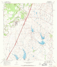
 1968 Signal Hill1971 Print · USGSTexas ranching life and early suburban development converge on the Travis and Hays county line during the late sixties. Researchers can trace family landmarks like Cedar Valley, Oliver Cem, and legacy properties such as Signal Hill Ranch.3 unique versions available
 - 1968 Map of Buda, 1971 Print
 1968 Buda1971 Print · USGSThe Hays and Travis County borderlands come to life in this late sixties survey of the Buda area. Genealogists and historians can trace family names and early rural centers through sites like Allen Cem, Science Hall, and the Martin Ch.4 unique versions available
 - 1968 Map of Mountain City, 1971 Print
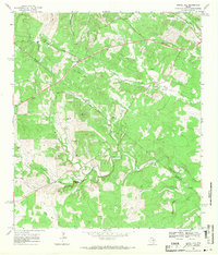
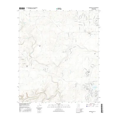
 1968 Mountain City1971 Print · USGSTexas Hill Country ranching life is well-documented here in the late sixties, showing the vast estates and rural outposts south of Austin. Researchers can trace family legacies at Kuykendall Ranch, Ruby Ranch, and the Barton Cem near the banks of Onion Creek.4 unique versions available
 - 1985 Map of Austin
 1985 Austin1985 Print · USGSCentral Texas in the mid-eighties reveals a region in transition, balancing rapid urban growth in Austin with deep-rooted rural landscapes. Genealogists and historians can trace family locations near St Johns Ch, the Science Hall schoolhouse, and long-standing communities like Webberville and Manchaca.3 unique versions available
 - 1986 Map of Signal Hill
 1986 Signal Hill1986 Print · USGSTexas Hill Country terrain meets the growing outskirts of Austin in the mid-1980s. Researchers can locate historic family sites like Oliver Cem, the landmark Friday Mountain, and rural features such as Friendship Ch and the Boys Camp.2 unique versions available
 - 1988 Map of Oak Hill
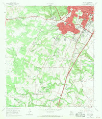
 1988 Oak Hill1988 Print · USGSSouthwest Austin and its neighboring hill country communities are captured during a period of rapid suburbanization in the late eighties. Genealogists and local historians can locate several family burial grounds, including Brown Cem and Live Oak Cem, alongside major landmarks like St Edwards University and the A F Siding railroad spur.
 - 2010 Map of Mountain City, 2010 Print
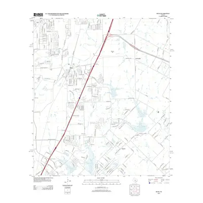
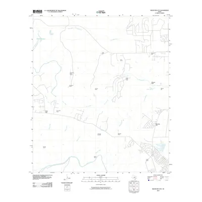 2010 Mountain City2010 Print · USGSCovers Hays, including Kyle, Buda, and other nearby areas
 - 2010 Map of Signal Hill, 2010 Print
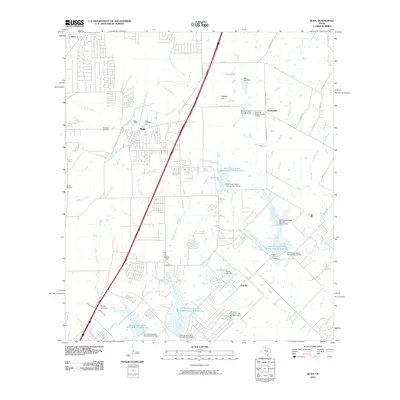
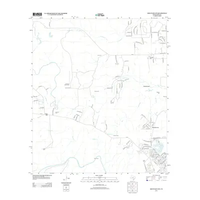
 2010 Signal Hill2010 Print · USGSCovers Hays, including Austin, Dripping Springs, and other nearby areas
 - 2010 Map of Oak Hill, 2010 Print
 2010 Oak Hill2010 Print · USGSCovers Hays, including Austin, Sunset Valley, and other nearby areas
 - 2010 Map of Buda, 2010 Print
 2010 Buda2010 Print · USGSCovers Hays, including Austin, Kyle, and other nearby areas
 - 2013 Map of Buda, 2013 Print
 2013 Buda2013 Print · USGSCovers Hays, including Austin, Kyle, and other nearby areas
 - 2013 Map of Oak Hill, 2013 Print
 2013 Oak Hill2013 Print · USGSCovers Hays, including Austin, Sunset Valley, and other nearby areas
 - 2013 Map of Signal Hill, 2013 Print
 2013 Signal Hill2013 Print · USGSCovers Hays, including Austin, Dripping Springs, and other nearby areas
 - 2013 Map of Mountain City, 2013 Print
 2013 Mountain City2013 Print · USGSCovers Hays, including Kyle, Buda, and other nearby areas
 - 2016 Map of Oak Hill, 2016 Print
 2016 Oak Hill2016 Print · USGSCovers Hays, including Austin, Sunset Valley, and other nearby areas
 - 2016 Map of Mountain City, 2016 Print
 2016 Mountain City2016 Print · USGSCovers Hays, including Kyle, Buda, and other nearby areas
 - 2016 Map of Signal Hill, 2016 Print
 2016 Signal Hill2016 Print · USGSCovers Hays, including Austin, Dripping Springs, and other nearby areas
 - 2016 Map of Buda, 2016 Print
 2016 Buda2016 Print · USGSCovers Hays, including Austin, Kyle, and other nearby areas
Showing maps 1-25 of 33
Top cities near Hays
- Austin historical maps
- San Marcos historical maps
- Kyle historical maps
- Lakeway historical maps
- Buda historical maps
- Lockhart historical maps
See more
Frequently asked questions
- What are the different types of historical maps available for Hays?
- What is the oldest map of Hays?
- Where can I purchase historical maps of Hays for my home or office?
- Where can I download high-res historical maps of Hays?
- Are there historical topographic maps available for Hays?
- Is there historical aerial imagery available for Hays?
- Where are historical maps of Hays sourced from?