2020s Maps of Wimberley, Texas
Explore 3 historic maps of Wimberley from the 2020s. These maps offer a rare glimpse into what life looked like during the 2020s — showing old roads, neighborhoods, homes, and landmarks that have changed or disappeared over time.
Whether you're researching your family's past, planning a metal detecting trip, or studying how Wimberley's landscape evolved across the 2020s, these high-resolution maps are a powerful tool for exploring the history of this region.
- Focus on a specific era: All maps on this page are from the 2020s, giving you a focused view of this time period.
- See what’s changed: Compare century-old streets, trails, and buildings to today's modern landscape using overlays and satellite layers.
- Research with precision: Use these maps for genealogy, historical research, land use analysis, or educational projects.
- View, download, or print: Maps are fully viewable online in high resolution, and can be downloaded or printed for your own records.
Start exploring Wimberley's history through authentic maps from the 2020s. This is your window into the past.
Wimberley, TX maps
(3)- 2022 Map of Wimberley, 2022 Print
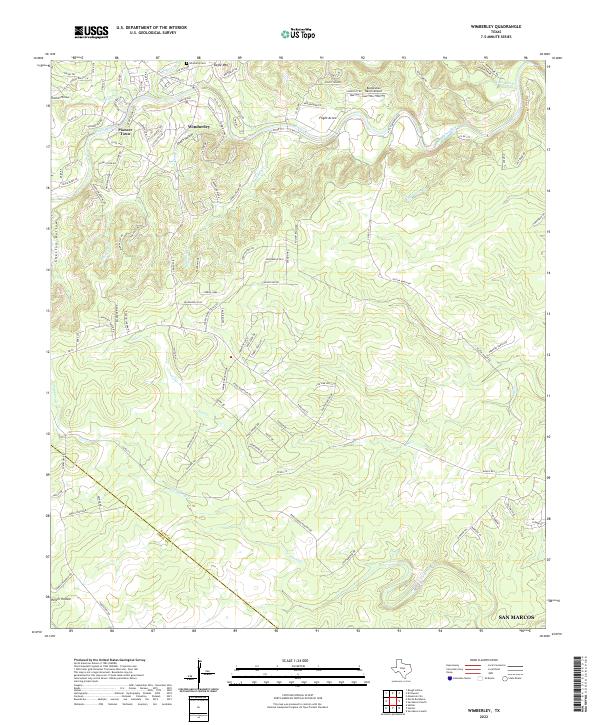 2022 Wimberley2022 Print · USGSHays County's river-carved landscape is documented here during a period of steady growth. Local historians can trace the development of Wimberley and Pioneer Town, locate the Wimberly Cem, and follow the winding course of the Blanco River.
 - 2022 Map of Driftwood, 2022 Print
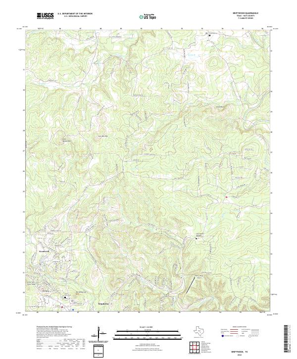 2022 Driftwood2022 Print · USGSHays County in the early 2020s shows the modern evolution of the Hill Country as residential growth moves into the high ridges. Researchers can trace established landmarks like Old Baldy and Lone Woman Mtn alongside local burial sites at Driftwood Cem and Saint Marys Cem.
 - 2022 Map of Devils Backbone, 2022 Print
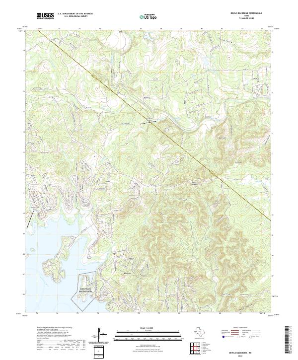 2022 Devils Backbone2022 Print · USGSThe Texas Hill Country and the high ridges of the Devils Backbone are captured in this recent survey. Local researchers can trace family landmarks and rural sites like Hugo Cem, Moon Mtn, and the shores of Canyon Lake.
End of results
Showing maps 1-3 of 3
Top cities near Wimberley
- Austin historical maps
- New Braunfels historical maps
- San Marcos historical maps
- Kyle historical maps
- Buda historical maps
- Dripping Springs historical maps
See more
Top neighborhoods of Wimberley
Frequently asked questions
- What are the different types of historical maps available for Wimberley?
- What is the oldest map of Wimberley?
- Where can I purchase historical maps of Wimberley for my home or office?
- Where can I download high-res historical maps of Wimberley?
- Are there historical topographic maps available for Wimberley?
- Is there historical aerial imagery available for Wimberley?
- Where are historical maps of Wimberley sourced from?