1980s Maps of Henderson County, Texas
Explore 15 historic maps of Henderson County from the 1980s. These maps offer a rare glimpse into what life looked like during the 1980s — showing old roads, neighborhoods, homes, and landmarks that have changed or disappeared over time.
Whether you're researching your family's past, planning a metal detecting trip, or studying how Henderson County's landscape evolved across the 1980s, these high-resolution maps are a powerful tool for exploring the history of this region.
- Focus on a specific era: All maps on this page are from the 1980s, giving you a focused view of this time period.
- See what’s changed: Compare century-old streets, trails, and buildings to today's modern landscape using overlays and satellite layers.
- Research with precision: Use these maps for genealogy, historical research, land use analysis, or educational projects.
- View, download, or print: Maps are fully viewable online in high resolution, and can be downloaded or printed for your own records.
Start exploring Henderson County's history through authentic maps from the 1980s. This is your window into the past.
Henderson County, TX maps
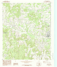
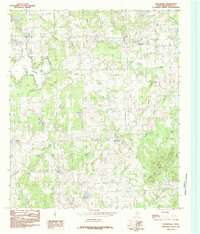
(15)- 1984 Map of Tyler
 1984 Tyler1984 Print · USGSEast Texas at the peak of its reservoir-building era shows a landscape defined by new lakes and established rail corridors. Trace the path of the St Louis Southwestern RR or locate industrial sites like the Longhorn Ordnance Works.3 unique versions available
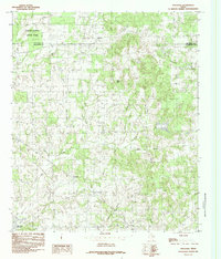
 - 1984 Map of Coon Creek Lake
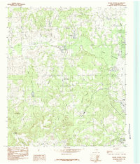
 1984 Coon Creek Lake1984 Print · USGSThe Henderson and Anderson county border in the mid-1980s reveals a landscape defined by its waterways and small-scale industry. Researchers can trace the drainage of Coon Creek and find specific landmarks like Murchison Lake, Old Lake, and a local Mine.
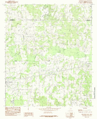
 - 1984 Map of Athens
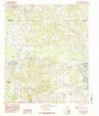
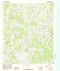
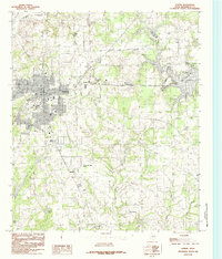 1984 Athens1984 Print · USGSAthens and its rural Henderson County surroundings are captured in the mid-1980s as the town grew toward the new Lake Athens. Researchers can trace old neighborhood boundaries near Virginia Hill or explore the drainage systems of Coon Creek and Shelton Mill Branch.2 unique versions available
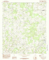
 - 1984 Map of Brownsboro
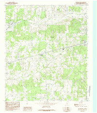
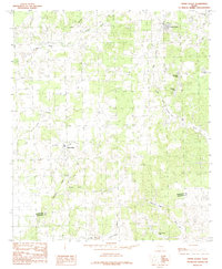
 1984 Brownsboro1984 Print · USGSThe rural Henderson County landscape near Brownsboro is shown here in the mid-eighties as modern reservoirs began to reshape the local terrain. Genealogists and local historians can trace family-named sites and vanished landmarks from Union Hill and Cottonwood to the shores of Lake Palestine.
 - 1984 Map of Mallard Hill
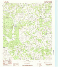
 1984 Mallard Hill1984 Print · USGSHenderson County, Texas, was undergoing steady transition in the late seventies and early eighties as residential growth expanded between ATHENS and Malakoff. Researchers can trace old family locations and landmarks like Crescent Heights, Mallard Hill, and the shores of Cedar Creek Reservoir.
 - 1984 Map of Poynor
 1984 Poynor1984 Print · USGSEast Texas ranch lands and creek bottoms define this area in the late seventies and early eighties. Genealogists and researchers can trace local family landmarks like the Pleasant Hill Cemetery and the small communities of Poynor, Frankston, and Fosterville.
 - 1984 Map of Moore Station
 1984 Moore Station1984 Print · USGSHenderson County, Texas, is captured here in the mid-eighties as the local landscape adapts to the presence of Lake Palestine. Researchers can trace old family sites and rural settlements from Moore Station and Fincastle to the Antioch Ch.
 - 1984 Map of La Rue
 1984 La Rue1984 Print · USGSThe Henderson and Anderson county line was a patchwork of small lakes and timberland in the late seventies. Researchers can trace rural developments like LaRue and Fincastle alongside family-named landmarks such as Pharris Lakes and Rock Hill.
 - 1984 Map of Cross Roads
 1984 Cross Roads1984 Print · USGSHenderson and Anderson Counties are shown in the 1980s as a landscape of rural settlements and recreational lakes. Genealogists and local historians can trace family-named water bodies like McElvaney Lake and Perryman Lake or the community at Cross Roads.
 - 1984 Map of Leagueville
 1984 Leagueville1984 Print · USGSHenderson County's rural communities and creek-fed landscapes are captured here in the mid-1980s. Local researchers can trace family lands near the settlements of Leagueville and New York, or locate specific features like Tater Hill Mountain and Steele Lakes.
 - 1984 Map of Stockard
 1984 Stockard1984 Print · USGSHenderson County's rural landscape is captured in the mid-eighties, showing the transition from traditional farmsteads to recreational spaces. Genealogists and researchers can trace local landmarks like Stockard, Pickens, and the early footprint of Purtis Creek State Park.
 - 1984 Map of Murchison East
 1984 Murchison East1984 Print · USGSHenderson and Van Zandt Counties were transitioning through a period of rural industrialization in the mid-1980s. Local researchers can trace the development of the Refinery near Opelika or locate family sites around Murchison, Brownsboro, and Edom.
 - 1984 Map of Murchison West
 1984 Murchison West1984 Print · USGSThe Henderson and Van Zandt county line comes alive in the late seventies and early eighties, showing a landscape of rural crossroads and creek-fed bottomlands. Researchers can trace the development of Murchison, locate the community at Bethel, and follow the waters of Kickapoo Creek and Jackson Lake.
 - 1985 Map of Tyler
 1985 Tyler1985 Print · USGSEast Texas in the mid-eighties centers on the growth of Tyler and the expansive waters of Lake Palestine. Genealogists and researchers can trace family landmarks like Henry's Chapel and Browning Cem alongside the routes of the Southern Pacific RR.
 - 1985 Map of Corsicana, 1986 Print
 1985 Corsicana1986 Print · USGSNorth Central Texas was defined by its expanding water reservoirs and deep-rooted rail corridors in the mid-eighties. Researchers can trace the heritage of local communities through landmarks like Southwestern Bible Institute, Navarro College, and rural markers such as Derrs Chapel.2 unique versions available
End of results
Showing maps 1-15 of 15
Top cities of Henderson County
- Athens historical maps
- Gun Barrel City historical maps
- Chandler historical maps
- Tool historical maps
- Malakoff historical maps
- Seven Points historical maps
See more
Frequently asked questions
- What are the different types of historical maps available for Henderson County?
- What is the oldest map of Henderson County?
- Where can I purchase historical maps of Henderson County for my home or office?
- Where can I download high-res historical maps of Henderson County?
- Are there historical topographic maps available for Henderson County?
- Is there historical aerial imagery available for Henderson County?
- Where are historical maps of Henderson County sourced from?