
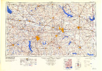
1984 Map of Tyler
USGS Topo · Published 1984About this map
Longhorn Ordnance Works and the extensive water management systems of the Sabine River basin define this East Texas landscape in the mid-1980s. Centered on the growing hub of Tyler, the map reveals a region transitioning through post-war industrialization and the creation of major reservoirs. The intricate network of the St Louis Southwestern RR and Texas & Pacific RR remains prominent, connecting established rail towns like Marshall, Longview, and Mineola.
Find a feature on this map
165 named features on this map. Tap any name to fly to it.
Don’t see what you’re looking for? This feature index may not catch every label — zoom into the map to look around manually.
Map Details
Editions of this 1984 Tyler Map
3 editions found

Other maps of this area

1907 · Atlanta
USGS Topo · 1:62,500

1910 · Linden
USGS Topo · 1:62,500

1910 · Atlanta
USGS Topo · 1:62,500

1914 · Daingerfield
USGS Topo · 1:62,500

1920 · Kemp
USGS Topo · 1:62,500

1932 · Hosston NW
USGS Topo · 1:31,680

1932 · Hosston SW
USGS Topo · 1:31,680

1935 · Henderson
USGS Topo · 1:48,000

1936 · Kilgore
USGS Topo · 1:48,000

1937 · Troupe
USGS Topo · 1:48,000