
1984 Map of Tyler
USGS Topo · Published 1984About this map
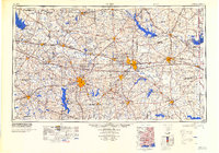
Tyler, Longview, and Marshall anchor this 1984 survey of Northeast Texas, a landscape defined by its transition from the Piney Woods to the post oak savannah. The map captures the region's massive mid-century water projects, showing major reservoirs like Lake Tawakoni, Lake Fork Reservoir, and Lake O' the Pines fully established. These man-made lakes sit alongside the natural course of the Sabine River and Neches River, illustrating the complex hydrology developed to support regional industry and growing populations.
Find a feature on this map
329 named features on this map. Tap any name to fly to it.
Don’t see what you’re looking for? This feature index may not catch every label — zoom into the map to look around manually.
Map Details
Editions of this 1984 Tyler Map
3 editions found

Other maps of this area

1907 · Atlanta
USGS Topo · 1:62,500

1910 · Linden
USGS Topo · 1:62,500

1910 · Atlanta
USGS Topo · 1:62,500

1914 · Daingerfield
USGS Topo · 1:62,500

1920 · Kemp
USGS Topo · 1:62,500

1932 · Hosston NW
USGS Topo · 1:31,680

1932 · Hosston SW
USGS Topo · 1:31,680

1935 · Henderson
USGS Topo · 1:48,000

1936 · Kilgore
USGS Topo · 1:48,000

1937 · Troupe
USGS Topo · 1:48,000