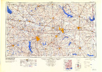
1984 Map of Tyler
USGS Topo · Published 1984About this map
Tyler and Longview serve as the primary hubs for this 1980s-era map of East Texas, a region defined by its dense network of reservoirs and deep-rooted timber and oil heritage. The Sabine River snakes through the center of the sheet, feeding into the expansive Toledo Bend Reservoir to the southeast. This period shows the mature landscape of the East Texas Oil Field, where towns like Kilgore and Gladewater sit at the heart of a complex industrial and transport grid.
Find a feature on this map
190 named features on this map. Tap any name to fly to it.
Don’t see what you’re looking for? This feature index may not catch every label — zoom into the map to look around manually.
Map Details
Editions of this 1984 Tyler Map
3 editions found


Other maps of this area

1907 · Atlanta
USGS Topo · 1:62,500

1910 · Linden
USGS Topo · 1:62,500

1910 · Atlanta
USGS Topo · 1:62,500

1914 · Daingerfield
USGS Topo · 1:62,500

1920 · Kemp
USGS Topo · 1:62,500

1932 · Hosston NW
USGS Topo · 1:31,680

1932 · Hosston SW
USGS Topo · 1:31,680

1935 · Henderson
USGS Topo · 1:48,000

1936 · Kilgore
USGS Topo · 1:48,000

1937 · Troupe
USGS Topo · 1:48,000