Old Maps of Henderson County, Texas for Metal Detecting
Plan your next treasure hunt with 159 historic maps of Henderson County. Find old homesites, ghost towns, trails, and gathering spots that may be lost to time — perfect for identifying promising metal detecting locations.
- Locate forgotten sites: Uncover places like long-lost settlements, abandoned rail lines, or gathering spots.
- Plan better hunts: Use map overlays combined with LiDAR or satellite views to narrow in on historically rich areas.
- Made for detectorists: Thousands of hobbyists use these maps to discover relics, coins, and hidden history.
Use these historic maps to boost your research and find new opportunities beneath the surface of Henderson County.
Henderson County, TX maps
(159)- 1920 Map of Kemp
 1920 Kemp1920 Print · USGSNortheast Texas at the start of the 1920s reveals a landscape of railroad towns and rural post offices at the junction of three counties. Genealogists can trace early homesteads and schoolhouses near Mabank, Prairieville, and Ansley.
 - 1946 Map of Bullard, 1960 Print
 1946 Bullard1960 Print · USGSEast Texas rail and river life converge in the 1940s as the St Louis Southwestern tracks link rural farming hubs. Trace local family history through numerous landmarks like Larissa Cem, the Kickapoo Monument, and Mount Selman.2 unique versions available
 - 1948 Map of Bullard
 1948 Bullard1948 Print · USGSNortheastern Cherokee and southern Smith counties are captured here in the late forties, showcasing a network of rural schools and rail-fed towns. Genealogists can trace family sites at Larissa Cem, Mount Comfort Ch, and the high ground of Kickapoo Mtn.
 - 1948 Map of Tyler, 1964 Print
 1948 Tyler1964 Print · USGSSmith County and the growing city of Tyler are captured here in the late 1940s, showing a landscape of rail-driven commerce and established rural communities. Local historians can trace family roots through numerous landmarks like Camp Ford, Pounds Field, and Texas College.2 unique versions available
 - 1948 Map of Brownsboro, 1966 Print
 1948 Brownsboro1966 Print · USGSHenderson and Van Zandt counties appear here in the late 1940s as a landscape of rural schoolhouses and family cemeteries along the St Louis Southwestern rails. Genealogists can locate family landmarks like Old Norwegian Cem, Smith Chapel, and Prairie Springs Cem.
 - 1948 Map of Martins Mill, 1974 Print
 1948 Martins Mill1974 Print · USGSVan Zandt and Henderson counties are shown here in the late 1940s, revealing a landscape of small agricultural settlements and rural school districts. Genealogists can trace family roots through numerous sites like Liberty Cem, Walnut Sch, and the St Louis Southwestern Railroad corridor.
 - 1949 Map of Tyler
 1949 Tyler1949 Print · USGSMid-century Smith County is captured here at a peak of rail and aviation development, centered on the growing hub of Tyler. Genealogists and historians can trace numerous country churches and schools like Lanes Chapel and Young Hill Sch, alongside the sprawling grounds of Camp Ford.
 - 1949 Map of Martins Mill
 1949 Martins Mill1949 Print · USGSEast Texas rural life is preserved here in the late 1940s as farm-to-market roads linked the communities of Martins Mills and Murchison. Genealogists can trace family names through dozens of landmarks like Cool Springs Ch, Lone Star Sch, and Carter Cem.
 - 1949 Map of Brownsboro
 1949 Brownsboro1949 Print · USGSEast Texas at the end of the 1940s reveals a network of railroad towns and oil fields at the Henderson and Smith county line. Genealogy researchers can trace local family roots through sites like Old Norwegian Cem, Sexton Chapel, and Arc Ridge Sch.
 - 1949 Map of Frankston, 1964 Print
 1949 Frankston1964 Print · USGSEast Texas ranching and timber country at the end of the 1940s was defined by the Southern Pacific rail line and small rural school districts. Researchers can find many family landmarks, from Moores Station and Fincastle to the Lapoynor Sch and Alligator Cem.3 unique versions available
 - 1949 Map of Athens, 1966 Print
 1949 Athens1966 Print · USGSMid-century Henderson County is captured here at a moment when rural life centered on local institutions like Gum Creek Sch and Shelby Chapel. You can trace the path of the Southern Pacific through Athens and locate old family landmarks like Richardson Cem and Beck Chapel.3 unique versions available
 - 1950 Map of Athens
 1950 Athens1950 Print · USGSHenderson County center at mid-century, where the rail lines of the St Louis Southwestern and Southern Pacific cross. Genealogists can locate family landmarks like Metzkoff Cem, the Junior College, and Shelby Chapel.
 - 1950 Map of Frankston
 1950 Frankston1950 Print · USGSThe Southern Pacific corridor between Henderson and Anderson Counties comes alive in this mid-century survey. Genealogists and historians can trace family roots at New York and Fincastle, or locate rural landmarks like Central High Sch and Rounsavall Cem.
 - 1954 Map of Dallas, 1963 Print
 1954 Dallas1963 Print · USGSNorth Texas in the mid-fifties and early sixties reveals a landscape of rapid urban growth and water management. Genealogists and historians can trace the evolution of the metroplex through landmarks like Hensley Field, Boles Orphan Home, and the Texas & Pacific RR.4 unique versions available
 - 1956 Map of Tyler
 1956 Tyler1956 Print · USGSEast Texas was a powerhouse of oil production and rail transport during the mid-fifties, centered on the sprawling East Texas Oil Field. Researchers can trace the heritage of industrial hubs like Kilgore, military sites such as the Longhorn Ordnance Works, and many rural landmarks like Mount Enterprise.5 unique versions available
 - 1957 Map of Kemp
 1957 Kemp1957 Print · USGSThe rural borders of Kaufman and Henderson counties come alive in this early twentieth-century survey of the Texas and New Orleans Railroad corridor. Researchers can trace defunct post offices and local landmarks like Ansley and the remote settlement at Prairieville.
 - 1958 Map of Dallas
 1958 Dallas1958 Print · USGSNorth Texas in the late fifties shows the dramatic expansion of the Metroplex as it absorbs surrounding farm towns. Genealogists and historians can trace old rail lines like the Missouri-Kansas-Texas and locate early lakefront developments at Eagle Mountain Lake and Lake Worth Village.
 - 1960 Map of Tool, 1961 Print
 1960 Tool1961 Print · USGSThe rural Henderson County landscape of the early 1960s is preserved here, centered on the creek-fed agricultural lands near the Trinity River. Genealogists and local historians can trace the foundations of Tool, Tolosa, and Aley, alongside family landmarks like Baker Cem and King Cem.3 unique versions available
 - 1960 Map of Mabank, 1961 Print
 1960 Mabank1961 Print · USGSThe crossroads of Henderson, Kaufman, and Van Zandt counties are captured here in the early sixties, showing a landscape defined by small-town life and the railroad. Genealogists can trace family roots through landmarks like Elam Grove Ch, Mabank Cem, and rural outposts such as Payne Springs.5 unique versions available
 - 1960 Map of Creslenn Ranch, 1961 Print
 1960 Creslenn Ranch1961 Print · USGSThe Trinity River bottoms and the Cayuga oil country are captured here at the start of the 1960s. Genealogists and local historians can trace the Princeton Cem, the remote Creslenn Ranch, and landmarks like Hall Lake and Trinidad.3 unique versions available
 - 1960 Map of Malakoff, 1961 Print
 1960 Malakoff1961 Print · USGSThe Trinity River valley in 1960 reveals a landscape of industrial power and small-town growth between Trinidad and Malakoff. Genealogists and historians can trace local landmarks like the St Paul Industrial Sch, Kilman Hospital, and Isaac Cem.4 unique versions available
 - 1961 Map of Kerens, 1962 Print
 1961 Kerens1962 Print · USGSKerens and the fertile Trinity River bottomlands are captured here in the early sixties, showing a landscape defined by rail, oil, and water. Genealogists and researchers can locate Oak Grove Ch, the Bazette Oil Field, and family-named water features like Singletary Lake.3 unique versions available
 - 1962 Map of Bazette, 1965 Print
 1962 Bazette1965 Print · USGSThe Trinity River bottomlands and the crossroads of Bazette are captured here in the early sixties. Genealogists and local historians can trace family locations through Phillips Cem, Roane Ch, and the numerous Oil Wells scattered across the prairie.2 unique versions available
 - 1962 Map of Rosser SW, 1965 Print
 1962 Rosser SW1965 Print · USGSNavarro County in the early 1960s was a landscape of rural family farms and emerging water management systems along the Trinity River. Local researchers can locate Rice Cem, the Hopewell Ch, and several named reservoirs along Grays Creek.
 - 1962 Map of Styx, 1965 Print
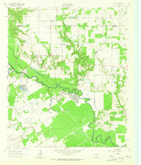 1962 Styx1965 Print · USGSHenderson and Kaufman Counties in the early 1960s were defined by the deep bends of the Trinity River and small rural outposts. Researchers can trace family history at Timothy Cem, locate the old Finch Sch, or find the crossroads at Styx.2 unique versions available
Showing maps 1-25 of 159
Top cities of Henderson County
- Athens historical maps
- Gun Barrel City historical maps
- Chandler historical maps
- Tool historical maps
- Malakoff historical maps
- Seven Points historical maps
See more
Frequently asked questions
- What are the different types of historical maps available for Henderson County?
- What is the oldest map of Henderson County?
- Where can I purchase historical maps of Henderson County for my home or office?
- Where can I download high-res historical maps of Henderson County?
- Are there historical topographic maps available for Henderson County?
- Is there historical aerial imagery available for Henderson County?
- Where are historical maps of Henderson County sourced from?