2020s Maps of Howard County, Texas
Explore 25 historic maps of Howard County from the 2020s. These maps offer a rare glimpse into what life looked like during the 2020s — showing old roads, neighborhoods, homes, and landmarks that have changed or disappeared over time.
Whether you're researching your family's past, planning a metal detecting trip, or studying how Howard County's landscape evolved across the 2020s, these high-resolution maps are a powerful tool for exploring the history of this region.
- Focus on a specific era: All maps on this page are from the 2020s, giving you a focused view of this time period.
- See what’s changed: Compare century-old streets, trails, and buildings to today's modern landscape using overlays and satellite layers.
- Research with precision: Use these maps for genealogy, historical research, land use analysis, or educational projects.
- View, download, or print: Maps are fully viewable online in high resolution, and can be downloaded or printed for your own records.
Start exploring Howard County's history through authentic maps from the 2020s. This is your window into the past.
Howard County, TX maps
(25)- 2022 Map of Hayrick Mountain, 2022 Print
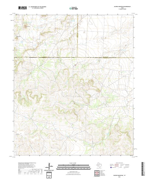 2022 Hayrick Mountain2022 Print · USGSSterling County rangeland comes into focus in this contemporary survey where the boundaries of three Texas counties meet. Researchers can trace the ranching landscape through landmarks like Hayrick Mtn, Rockwater Hole, and Gardener Draw.
 - 2022 Map of Lucian Wells Ranch, 2022 Print
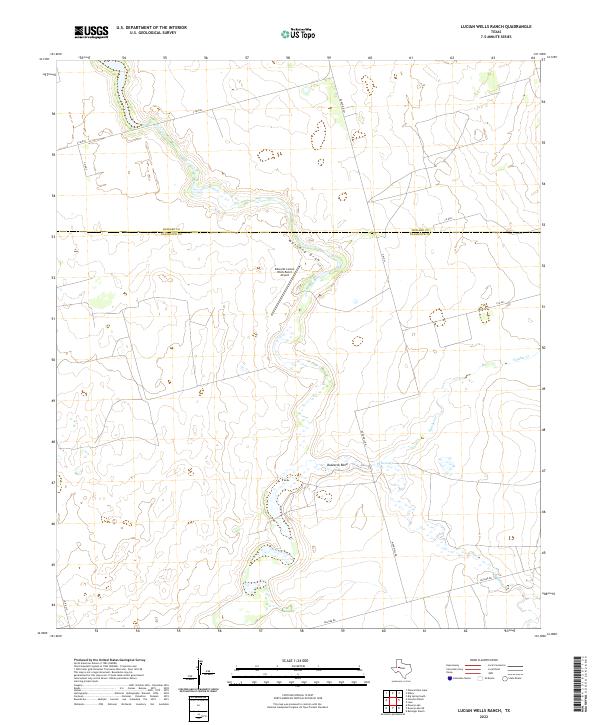 2022 Lucian Wells Ranch2022 Print · USGSThe Glasscock County ranching frontier is shown in detail during the early 2020s, highlighting the expansive livestock estates and essential watercourses of the high plains. Trace the winding paths of Mustang Draw and Buzzards Bend alongside the Edwards Lucian Wells Ranch Airport.
 - 2022 Map of Knott, 2022 Print
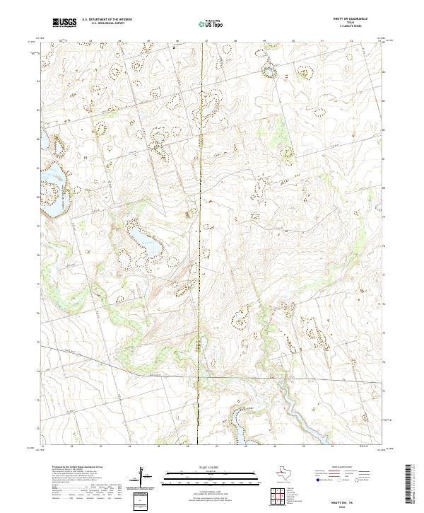
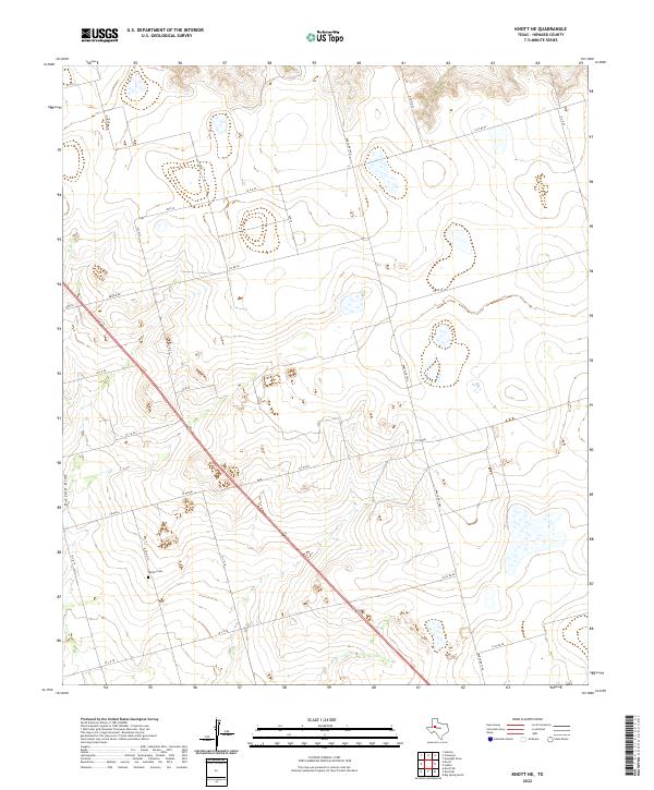
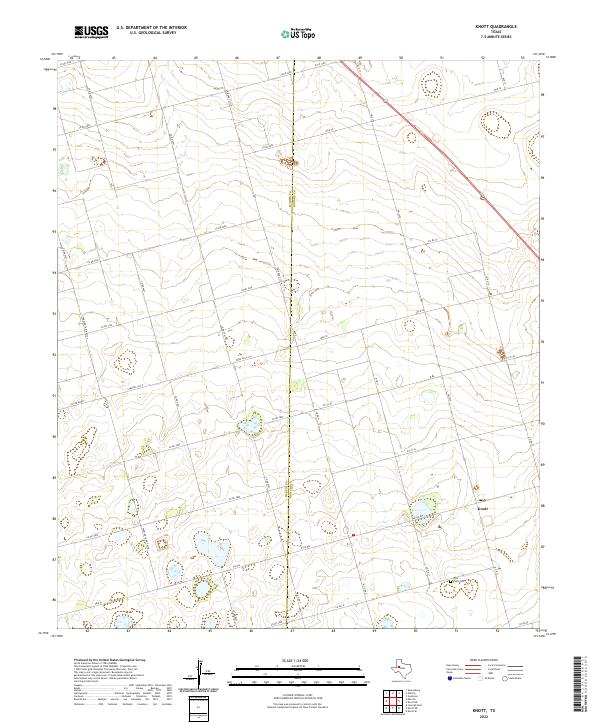 2022 Knott2022 Print · USGSHoward County ranching and farming lands are captured here in the early twenty-first century. Researchers can locate the West Knott Cem and trace the rural road network connecting Knott to the surrounding Martin County line.
 - 2022 Map of Luther, 2022 Print
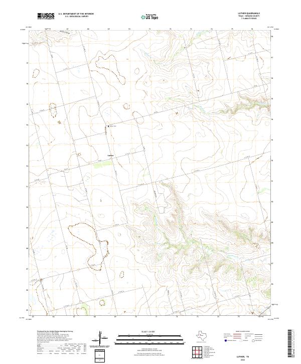 2022 Luther2022 Print · USGSThe community of Luther is captured here in the early 2020s, showing a West Texas landscape defined by rural ranch roads and wide draws. Genealogists and local researchers can pinpoint the Luther Cem and trace the paths of Morgan Cr and Wildcat Cr.
 - 2022 Map of Ira SW, 2022 Print
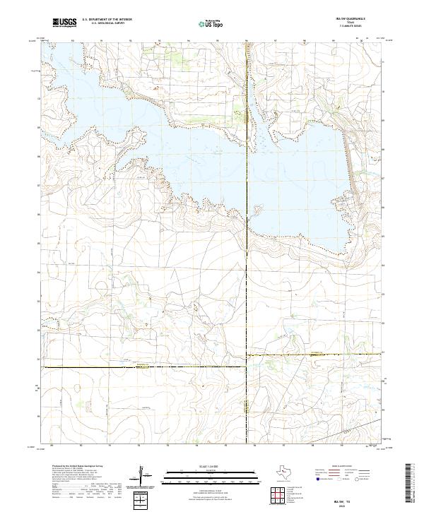 2022 Ira SW2022 Print · USGSThe upper Colorado River basin comes into focus in the 2020s where Borden, Scurry, Howard, and Mitchell counties meet. Trace ranching routes and water access points near Lake J B Thomas, Sourdough Rd, and the remote Dunn Lake.
 - 2022 Map of Vealmoor, 2022 Print
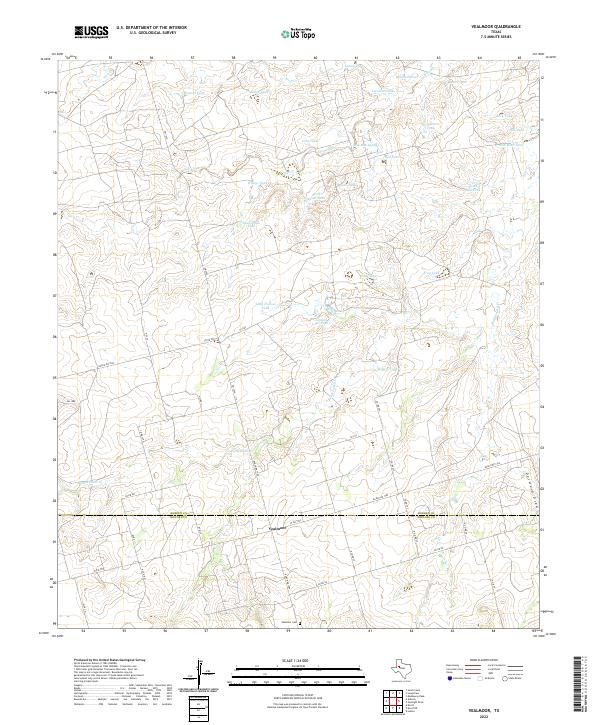 2022 Vealmoor2022 Print · USGSThe West Texas ranching community of Vealmoor is shown in detail during the early 2020s, highlighting its position on the Borden and Howard county line. Genealogy and local history researchers can locate the Vealmoor Cem and trace dozens of water features like Six Section Tank and Rattlesnake Cr.
 - 2022 Map of Hyman, 2022 Print
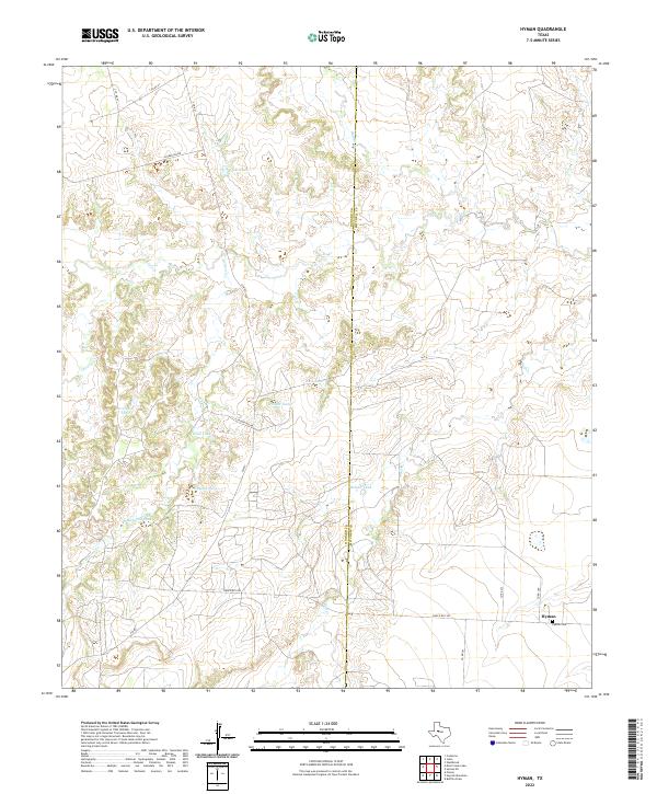 2022 Hyman2022 Print · USGSHoward County ranching and water management are the focus of this West Texas survey from the early 2020s. Researchers can trace the layout of the Hyman settlement and its namesake Hyman Cemetery, or locate water features like Rankin Lake and Magnolia Tank.
 - 2022 Map of Big Spring North, 2022 Print
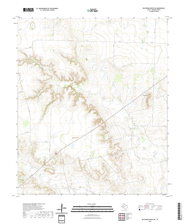
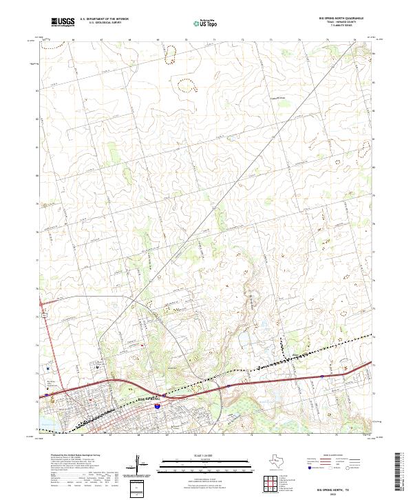 2022 Big Spring North2022 Print · USGSThe northern reaches of Big Spring and the surrounding Texas plains are captured here in the early twenty-first century. Genealogists and local historians can trace the footprints of Howard College, Mount Olive Cem, and the Big Spring State Hospital.
 - 2022 Map of Big Spring North NE, 2022 Print
 2022 Big Spring North NE2022 Print · USGSHoward County ranch lands are detailed in this recent survey of the plains northeast of Big Spring. Local researchers can trace the landscape from the heights of Flattop Mountain to the drainage basins of Morgan Creek and Wildhorse Creek.
 - 2022 Map of Houston Ranch, 2022 Print
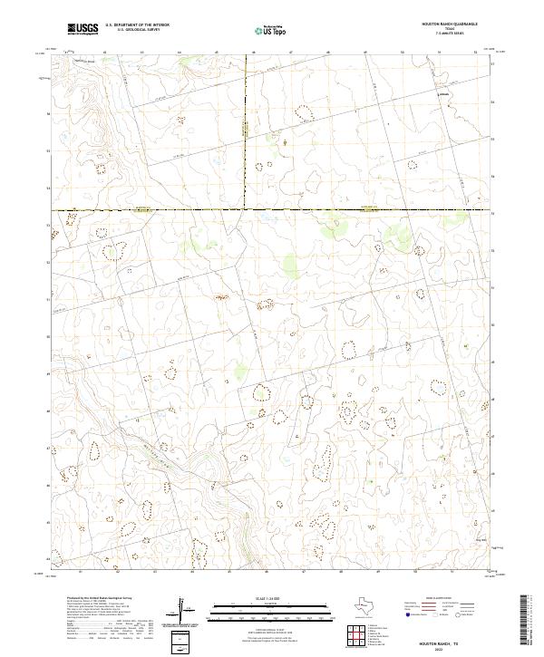 2022 Houston Ranch2022 Print · USGSWest Texas ranch lands are documented here in the early 2020s where three counties converge. Genealogists and researchers can trace the rural network around Lomax and locate landmarks like Hog Mtn and the seasonal path of Mustang Draw.
 - 2022 Map of Gunsight Draw SE, 2022 Print
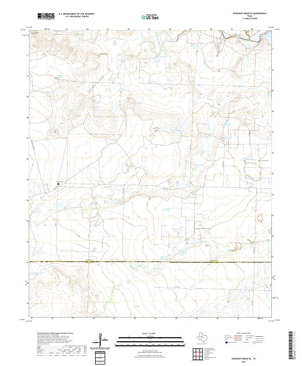 2022 Gunsight Draw SE2022 Print · USGSBorden and Howard Counties were primarily ranching territory when this map was updated, showing a landscape defined by water management. You can trace family histories at Fairview Cem or locate old ranching landmarks like Mother-in-Law Tank and Cedar Point.
 - 2022 Map of Knott SW, 2022 Print
 2022 Knott SW2022 Print · USGSHoward and Martin Counties are captured here in the early twenty-first century, showing the vast ranching and energy landscape. Researchers can locate Knott Cem and trace the paths of Sulphur Springs Draw and Red Lake.
 - 2022 Map of Lees, 2022 Print
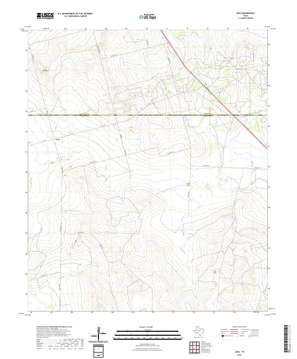 2022 Lees2022 Print · USGSThe rural landscape around the Howard and Glasscock county line comes into focus in this recent survey. Researchers can trace the path of the N Concho River and locate the small settlement of Lees along Ranch Rd 33 and FM 461.
 - 2022 Map of Gunsight Draw, 2022 Print
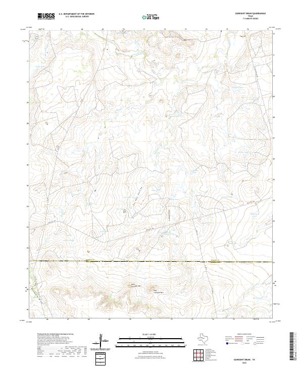 2022 Gunsight Draw2022 Print · USGSThe Borden and Howard County line bisects this ranching landscape during the early twenty-first century. Researchers can trace the rugged drainages of Gunsight Draw and German Hollow or locate landmarks like West Gunsight Mtn.
 - 2022 Map of Forsan, 2022 Print
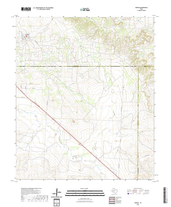 2022 Forsan2022 Print · USGSThe West Texas town of Forsan sits at a crossroads of ranching and river drainage in the early 2020s. Genealogists and local historians can trace the three-county borders and specific land-access routes like Sisson Rd near the N Concho River.
 - 2022 Map of Knott NE, 2022 Print
 2022 Knott NE2022 Print · USGSHoward County ranching country is documented here in the early 2020s, showing a landscape defined by expansive land tracts and isolated landmarks. Genealogists and local researchers can locate Phillips Cem and trace the path of Buzzard Draw through this rural network.
 - 2022 Map of Natural Dam Lake, 2022 Print
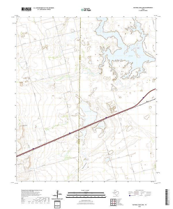 2022 Natural Dam Lake2022 Print · USGSHoward County ranch lands and the community of Morita are documented here in the early twenty-first century. Researchers can trace the unique hydrology of Natural Dam Lake and Red Salt Lake or locate named landmarks like Indian Point and Calf Tank.
 - 2022 Map of Moss Creek Lake, 2022 Print
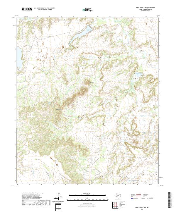 2022 Moss Creek Lake2022 Print · USGSHoward County's high plains and deep draws are shown here in the early twenty-first century, centered on the waters of Moss Creek Lake. Trace the local topography from the heights of Signal Peak down to historic water sources like Barnett Spring and Moss Spring.
 - 2022 Map of Iatan, 2022 Print
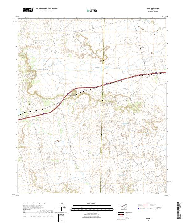 2022 Iatan2022 Print · USGSThe West Texas plains at the Howard and Mitchell county line come into focus in this contemporary survey. Researchers can trace land use through features like Iatan Cem, the topography of Rattlesnake Gap, and livestock tanks like California Tank.
 - 2022 Map of Ackerly, 2022 Print
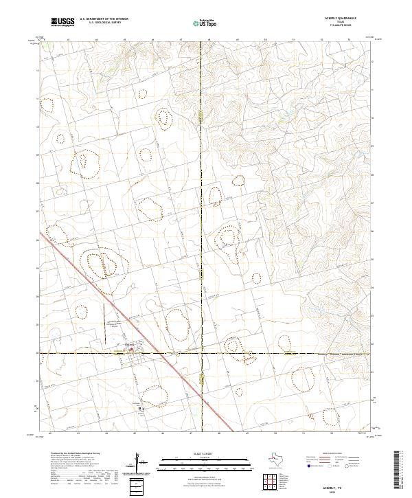 2022 Ackerly2022 Print · USGSThe West Texas town of Ackerly is captured at the unique four-county junction of Dawson, Borden, Martin, and Howard. Researchers can trace local lineage at Fairhaven Cem or locate the Coleman Cattle Company Number 1 Airport amidst a network of ranch-to-market roads.
 - 2022 Map of Coahoma, 2022 Print
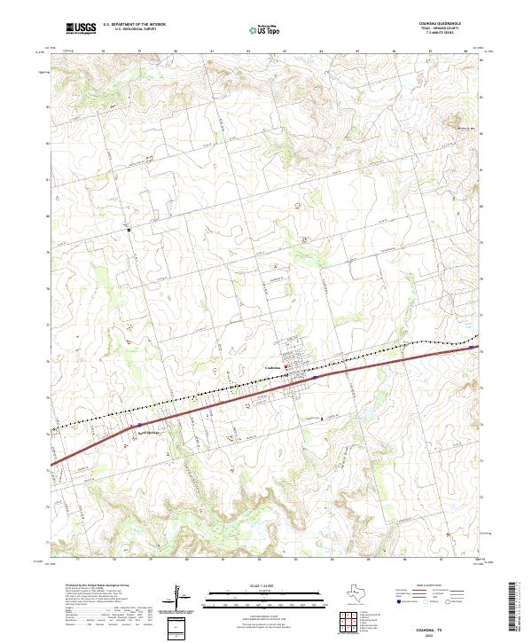 2022 Coahoma2022 Print · USGSHoward County ranching and transit life are on display in the early 2020s as the community of Coahoma continues to thrive. Genealogists can trace family connections at Salem Cem and Coahoma Cem, or locate landmarks like Wildhorse Mtn.
 - 2022 Map of Knott SE, 2022 Print
 2022 Knott SE2022 Print · USGSHoward County's rural landscape comes into focus during the early 2020s, revealing the intersection of West Texas ranching and the northern edge of Big Spring. Genealogists can locate family landmarks like Moore Community Cem or trace the legacy of local agriculture along Coop-Gin Rd.
 - 2022 Map of Big Spring South, 2022 Print
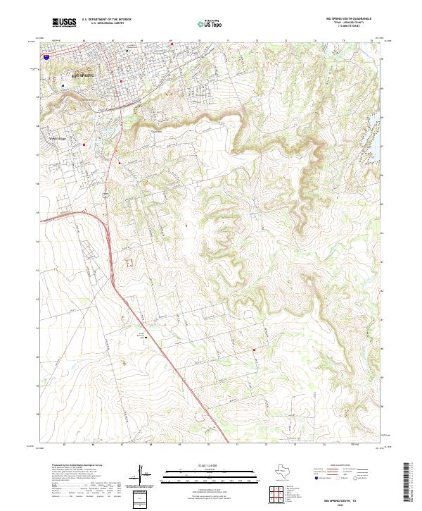 2022 Big Spring South2022 Print · USGSHoward County's high plains meet the growing city of Big Spring in the early 2020s. Researchers can trace local landmarks like Trinity Memorial Park, the heights of Scenic Mtn, and the waters of Comanche Trail Lake.
 - 2022 Map of Vincent, 2022 Print
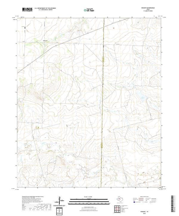 2022 Vincent2022 Print · USGSVincent and the Howard-Mitchell county line are captured in this recent survey of the West Texas plains. Genealogists can trace family connections at Vincent Cem or follow the paths of Hasting Cr and Morgan Cr across the landscape.
 - 2022 Map of Elbow, 2022 Print
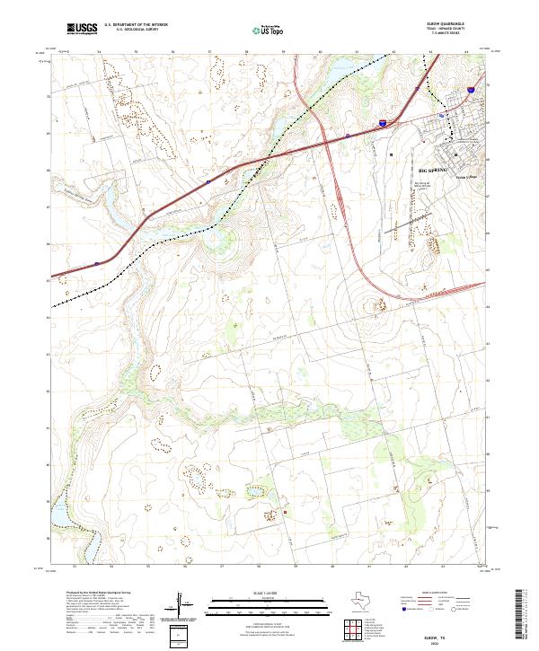 2022 Elbow2022 Print · USGSThe outskirts of Howard County come into focus in 2022, showing the western expansion of Big Spring and its surrounding ranchlands. Researchers can trace the development of the Mc Mahon-Wrinkle Airport and local landmarks like Webb Village.
End of results
Showing maps 1-25 of 25
Top cities of Howard County
Frequently asked questions
- What are the different types of historical maps available for Howard County?
- What is the oldest map of Howard County?
- Where can I purchase historical maps of Howard County for my home or office?
- Where can I download high-res historical maps of Howard County?
- Are there historical topographic maps available for Howard County?
- Is there historical aerial imagery available for Howard County?
- Where are historical maps of Howard County sourced from?