Old Maps of Dell City, Texas for Academic Research
Study the evolution of Dell City with 6 high-resolution historic maps. Whether you're teaching, researching, or modeling changes in land use, these maps provide essential visual documentation of urban, environmental, and geographic change.
- Analyze long-term change: Track patterns in development, transportation, and natural features.
- Ideal for environmental or urban studies: Support academic projects with primary historical map data.
- Use in the classroom or lab: Educators and researchers rely on these maps to bring historical context to life.
These maps are a powerful tool for teaching, research, and visualizing how Dell City has changed over the decades.
Dell City, TX maps
(6)- 1951 Map of Dell City, 1952 Print
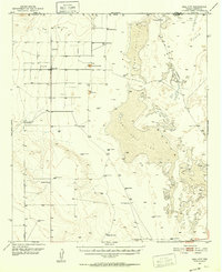 1951 Dell City1952 Print · USGSHudspeth County ranching and the vast salt flats are captured here in the early fifties as irrigation began to transform the basin. Researchers can trace the Butterfield Trail, find remote outposts like List Ranch, and locate the Salt Flat Airfield.2 unique versions available
 - 1954 Map of Van Horn, 1964 Print
 1954 Van Horn1964 Print · USGSThe Trans-Pecos region of West Texas comes into focus in the mid-1950s as a vital corridor of rail and desert commerce. Researchers can trace the path of the Texas and Pacific through Van Horn or locate remote rail sidings like Borracho and Laska Siding.2 unique versions available
 - 1958 Map of Van Horn
 1958 Van Horn1958 Print · USGSWest Texas ranching and rail history come alive in this 1950s survey of the Trans-Pecos desert during the era of major steam-to-diesel transition. Genealogists and historians can trace family-named outposts like Mayfield Ranch or locate the ruins of Presidio Viejo along the Rio Grande.
 - 1984 Map of Dell City, 1985 Print
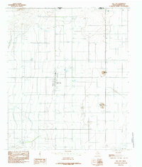 1984 Dell City1985 Print · USGSDell City and the northern reaches of Hudspeth County appear here in the early 1980s as a thriving desert agricultural hub. Researchers can trace the layout of the town's community spaces like the Rodeo Ground and Athletic Fields, or locate outlying landmarks such as Round Mountain and the Airport.
 - 1985 Map of Dell City
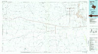 1985 Dell City1985 Print · USGSThe northern Chihuahuan Desert in the mid-1980s reveals a landscape of isolated farming hubs and vast salt basins. Genealogists and researchers can trace the roads and water tanks around Dell City, the remote outpost at Salt Flat, and the rugged slopes of the Sierra Diablo.2 unique versions available
 - 2022 Map of Dell City, 2022 Print
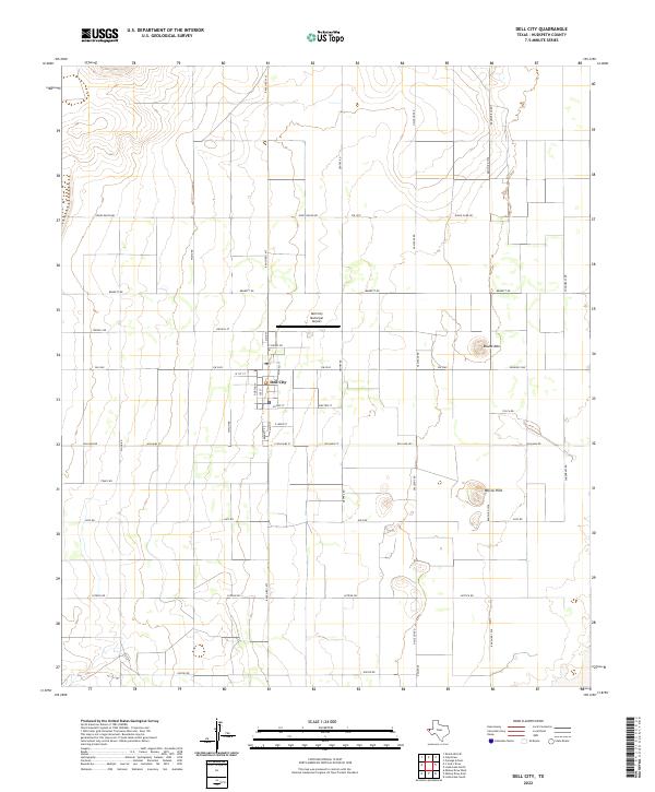 2022 Dell City2022 Print · USGSDell City stands as a managed agricultural and ranching hub in West Texas during the early twenty-first century. Researchers can trace the town's street grid and outlying landmarks like Round Mtn, Judge Ziler Rd, and Wilcox Hills.
End of results
Showing maps 1-6 of 6
Frequently asked questions
- What are the different types of historical maps available for Dell City?
- What is the oldest map of Dell City?
- Where can I purchase historical maps of Dell City for my home or office?
- Where can I download high-res historical maps of Dell City?
- Are there historical topographic maps available for Dell City?
- Is there historical aerial imagery available for Dell City?
- Where are historical maps of Dell City sourced from?