1950s Maps of Hunt County, Texas
Explore 9 historic maps of Hunt County from the 1950s. These maps offer a rare glimpse into what life looked like during the 1950s — showing old roads, neighborhoods, homes, and landmarks that have changed or disappeared over time.
Whether you're researching your family's past, planning a metal detecting trip, or studying how Hunt County's landscape evolved across the 1950s, these high-resolution maps are a powerful tool for exploring the history of this region.
- Focus on a specific era: All maps on this page are from the 1950s, giving you a focused view of this time period.
- See what’s changed: Compare century-old streets, trails, and buildings to today's modern landscape using overlays and satellite layers.
- Research with precision: Use these maps for genealogy, historical research, land use analysis, or educational projects.
- View, download, or print: Maps are fully viewable online in high resolution, and can be downloaded or printed for your own records.
Start exploring Hunt County's history through authentic maps from the 1950s. This is your window into the past.
Hunt County, TX maps
(9)- 1953 Map of Texarkana, 1964 Print
 1953 Texarkana1964 Print · USGSThe Texas-Arkansas borderlands are captured here in the mid-fifties, during a decade of massive military and hydraulic engineering projects. Genealogists and researchers can locate family landmarks like Old Boston Cem, Siloam Ch, and the vast Red River Arsenal.4 unique versions available
 - 1954 Map of Dallas, 1963 Print
 1954 Dallas1963 Print · USGSNorth Texas in the mid-fifties and early sixties reveals a landscape of rapid urban growth and water management. Genealogists and historians can trace the evolution of the metroplex through landmarks like Hensley Field, Boles Orphan Home, and the Texas & Pacific RR.4 unique versions available
 - 1954 Map of Sherman, 1964 Print
 1954 Sherman1964 Print · USGSThe Red River valley and North Texas plains are captured here in the mid-fifties, showing the region as new reservoirs like Lake Texoma and Lavon Reservoir reshaped the land. Genealogists can trace family roots through specific local landmarks like Courtney P O, Pilot Grove Sch, and New Hope Ch.2 unique versions available
 - 1956 Map of Texarkana
 1956 Texarkana1956 Print · USGSThe Ark-La-Tex borderlands come alive in the mid-fifties, showing the transition from a rail-dependent rural economy to a post-war industrial landscape. Researchers can trace the massive Red River Ordnance Depot and find towns like Talco, Bogata, and Naples.
 - 1956 Map of Tyler
 1956 Tyler1956 Print · USGSEast Texas was a powerhouse of oil production and rail transport during the mid-fifties, centered on the sprawling East Texas Oil Field. Researchers can trace the heritage of industrial hubs like Kilgore, military sites such as the Longhorn Ordnance Works, and many rural landmarks like Mount Enterprise.5 unique versions available
 - 1956 Map of Quinlan, 1957 Print
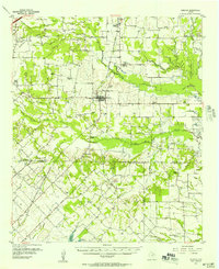 1956 Quinlan1957 Print · USGSNortheast Texas at the height of the post-war era is depicted here through its network of small crossroads communities and family farms. Researchers can trace rural lineages through local landmarks like Union Valley Sch, the Boys Home (Orphanage), and the Masonic Cem near Quinlan.3 unique versions available
 - 1956 Map of Emory, 1957 Print
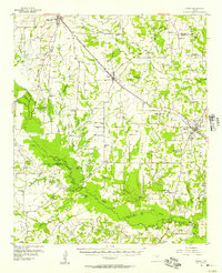 1956 Emory1957 Print · USGSRains County and its neighbors are shown here in the mid-fifties, just as the Sabine River valley prepared for the construction of the Iron Bridge Damsite. Genealogists can trace family roots through numerous small landmarks like Bright Star Ch, Cody Sch, and Parks Cem.3 unique versions available
 - 1958 Map of Dallas
 1958 Dallas1958 Print · USGSNorth Texas in the late fifties shows the dramatic expansion of the Metroplex as it absorbs surrounding farm towns. Genealogists and historians can trace old rail lines like the Missouri-Kansas-Texas and locate early lakefront developments at Eagle Mountain Lake and Lake Worth Village.
 - 1958 Map of Sherman, 1959 Print
 1958 Sherman1959 Print · USGSNorth Texas and Southern Oklahoma were undergoing significant development in the late fifties as the Red River Valley transit networks matured. Researchers can trace historic family-named locations such as Saddler Bend, the grounds of Perrin AFB, and early shoreline developments at Lake Texoma.
End of results
Showing maps 1-9 of 9
Top cities of Hunt County
- Greenville historical maps
- Commerce historical maps
- Caddo Mills historical maps
- West Tawakoni historical maps
- West Tawakoni historical maps
- Quinlan historical maps
See more
Frequently asked questions
- What are the different types of historical maps available for Hunt County?
- What is the oldest map of Hunt County?
- Where can I purchase historical maps of Hunt County for my home or office?
- Where can I download high-res historical maps of Hunt County?
- Are there historical topographic maps available for Hunt County?
- Is there historical aerial imagery available for Hunt County?
- Where are historical maps of Hunt County sourced from?