1900s (20th Century) Maps of Hutchinson County, Texas
Explore 33 historic maps of Hutchinson County from the 1900s (20th Century). These maps offer a rare glimpse into what life looked like during the 1900s — showing old roads, neighborhoods, homes, and landmarks that have changed or disappeared over time.
Whether you're researching your family's past, planning a metal detecting trip, or studying how Hutchinson County's landscape evolved across the 1900s, these high-resolution maps are a powerful tool for exploring the history of this region.
- Focus on a specific era: All maps on this page are from the 1900s, giving you a focused view of this time period.
- See what’s changed: Compare century-old streets, trails, and buildings to today's modern landscape using overlays and satellite layers.
- Research with precision: Use these maps for genealogy, historical research, land use analysis, or educational projects.
- View, download, or print: Maps are fully viewable online in high resolution, and can be downloaded or printed for your own records.
Start exploring Hutchinson County's history through authentic maps from the 1900s. This is your window into the past.
Hutchinson County, TX maps
(33)- 1939 Map of Sanford
 1939 Sanford1939 Print · USGSThe Texas Panhandle comes alive in the late 1930s as ranching and oil industries converge along the Canadian River. Researchers can trace the layout of Fritch and Sanford, or locate family landmarks like Deahl Ranch and Ingerton Ranch.2 unique versions available
 - 1953 Map of Sanford
 1953 Sanford1953 Print · USGSIn the early 1950s, the Texas Panhandle was a landscape of rapid energy growth centered on the Canadian River. Researchers can trace the industrial footprint of the Merchant Oil Field and find historic sites like Sanford Cemetery and the Oil City School (Aband).
 - 1953 Map of Plemons, 1954 Print
 1953 Plemons1954 Print · USGSHutchinson County in the early fifties was a landscape of intensive energy production and remote ranching. Researchers can trace the layout of Plemons and locate hundreds of active oil wells across the Moore Watkins Oil Field.3 unique versions available
 - 1953 Map of Stinnett, 1954 Print
 1953 Stinnett1954 Print · USGSHutchinson County is captured at the height of the mid-century petroleum boom, showing the intersection of heavy industry and High Plains settlement. Researchers can trace oil infrastructure and worker housing at Supreme Camp, Dial, and the sprawling Stinnett Oil Field.
 - 1953 Map of Stinnett Station, 1954 Print
 1953 Stinnett Station1954 Print · USGSHutchinson County in the early fifties shows a rugged landscape of ranching outposts and deep canyon breaks. Researchers can trace the network of ranch roads and windmills connecting Stinnett Station, Britain Ranch, and the waters of Bent Waters Canyon.2 unique versions available
 - 1953 Map of Deal, 1954 Print
 1953 Deal1954 Print · USGSThe Texas Panhandle in the early fifties was a landscape of expansive cattle spreads and critical rail infrastructure. Trace the Rock Island Line past Poling Ranch and Bennett Ranch, or locate industrial landmarks like the Huber Water Sta.
 - 1953 Map of Borger SE, 1954 Print
 1953 Borger SE1954 Print · USGSCarson County was at the height of its mid-century energy boom when this survey recorded the industrial expansion across the Panhandle. Researchers can trace the extensive network of the Burnett Oil Field and Garner Oil Field, including infrastructure like the Burnett Booster Sta and numerous gas wells.
 - 1953 Map of Pringle, 1954 Print
 1953 Pringle1954 Print · USGSHutchinson County ranching and energy development converge in the Texas Panhandle during the early fifties. Researchers can trace the Chicago Rock Island and Pacific rail line as it passes through Pringle near the Rocking D Ranch and numerous oil wells.
 - 1953 Map of McBride, 1955 Print
 1953 McBride1955 Print · USGSThe Texas Panhandle's energy and ranching landscapes converge in the early fifties as petroleum infrastructure expands across the plains. Genealogists and historians can trace industrial settlements like Burnett Camp and the rail stop at Mc Bride near the 6666 Ranch.2 unique versions available
 - 1953 Map of Phillips, 1955 Print
 1953 Phillips1955 Print · USGSThe Texas Panhandle oil boom is in full swing on this mid-century survey of the Borger Oil Field. Local researchers can trace industrial sites like the Refinery and Texroy, or find family roots at Phillips Camp and Haile Ch.
 - 1953 Map of Borger, 1955 Print
 1953 Borger1955 Print · USGSMid-century Borger is captured here during its height as an industrial powerhouse, showing a landscape defined by oil fields and chemical plants. Researchers can trace the development of worker communities like Philrich and Electric City or locate family history at Highland Park Cem.
 - 1954 Map of Perryton, 1966 Print
 1954 Perryton1966 Print · USGSThe High Plains of the Texas and Oklahoma panhandles are shown during a period of steady growth in the mid-1950s. Genealogists and researchers can trace rail history and local landmarks like Panhandle A & M College, Spurlock Chapel, and the isolated Lord Station.3 unique versions available
 - 1954 Map of Amarillo, 1966 Print
 1954 Amarillo1966 Print · USGSThe Texas Panhandle in the mid-1960s shows a landscape of rising industrial power and deep-rooted ranching tradition. Local historians can trace the paths of the Panhandle and Santa Fe railroad or locate sites like the Pantex Ordnance Plant and Mobeetie.2 unique versions available
 - 1958 Map of Perryton
 1958 Perryton1958 Print · USGSThe Oklahoma Panhandle and Texas borderlands come alive in this mid-century survey, showing the vital rail-and-ranch economy of the High Plains. Researchers can trace historic stops along the Chicago Rock Island and Pacific and locate rural landmarks like Bethel Church and Spurlock Chapel.
 - 1958 Map of Amarillo
 1958 Amarillo1958 Print · USGSThe Texas Panhandle in the mid-1950s reveals a landscape of expanding military installations and oil-rich rail towns. Local historians can trace the development of Amarillo Air Force Base or locate smaller settlements like Magic City and New Mobeetie.
 - 1970 Map of Sanford, 1973 Print
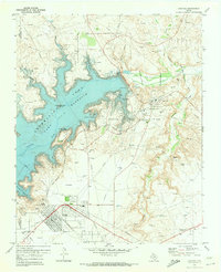 1970 Sanford1973 Print · USGSHutchinson County underwent a dramatic transformation in the early seventies as the Canadian River was impounded to form a new recreation hub. Genealogists and industrial historians can trace the development of Fritch, locate the Sanford Cem, and study the sprawling Sanford Yake Oil Field.
 - 1970 Map of Borger, 1973 Print
 1970 Borger1973 Print · USGSThe Texas Panhandle petroleum landscape is on full display here in the 1970s, from the industrial plants of Bunavista to the city of Borger. Researchers can trace local landmarks like Highland Park (Cem), Frank Phillips College, and the sprawling Dial Oil Field.2 unique versions available
 - 1970 Map of Phillips, 1973 Print
 1970 Phillips1973 Print · USGSHutchinson County at the height of the Texas oil boom reveals a landscape transformed by extraction and industry. Follow the development of the company town of Phillips and trace historical land use through Haile Ch, the Borger Oil Field, and Spring Creek Sch.2 unique versions available
 - 1971 Map of Skellytown NW, 1973 Print
 1971 Skellytown NW1973 Print · USGSThe Texas Panhandle comes into sharp focus during the early 1970s, revealing a landscape defined by ranching and the oil industry. Researchers can trace family-named locales like Pacher and Meadows or locate specific industrial sites such as Jims Lake and various Oil Wells.
 - 1971 Map of Skellytown NE, 1974 Print
 1971 Skellytown NE1974 Print · USGSThe Texas Panhandle reveals its ranching and energy foundations in the early 1970s across this Roberts County landscape. Genealogists and historians can trace family land at Price Ranch and Hayhook Ranch, or locate water infrastructure like the Jog Section Windmill.
 - 1971 Map of Adobe Creek SW, 1974 Print
 1971 Adobe Creek SW1974 Print · USGSThe Texas Panhandle north of Skellytown is captured here in the early 1970s, showing a landscape defined by ranching and river drainages. You can trace the wide Canadian River valley and find local landmarks like Antelope, Corral, and the winding White Deer Creek.
 - 1971 Map of Garden Springs, 1974 Print
 1971 Garden Springs1974 Print · USGSThe Texas Panhandle breaks along the Canadian River are documented here in the early 1970s. Genealogists and historians can trace ranching legacies at Brainard Ranch and Morrison Ranch or locate early energy infrastructure and remote sites like Pats Creek Camp.
 - 1971 Map of Adobe Creek SE, 1974 Print
 1971 Adobe Creek SE1974 Print · USGSThe Texas Panhandle ranchlands are captured in the early 1970s as industrial pipelines began crossing the traditional cattle country. Researchers can trace old ranching boundaries and water infrastructure through labels like Morrison Ranch, Sandhill Windmill, and the Roberts Co line.
 - 1973 Map of Spearman SE, 1976 Print
 1973 Spearman SE1976 Print · USGSThe Texas Panhandle at the meeting of four counties shows a landscape transformed by the mid-century energy boom. Trace the industrial footprint of the Gasoline Plant and Gravel Pits or follow the deep draws of Pats Creek and Willow Creek.
 - 1974 Map of Morse, 1977 Print
 1974 Morse1977 Print · USGSThe High Plains of the Texas Panhandle are captured here in the mid-1970s, focused on the rail-connected community of Morse. Genealogists and historians can trace the Lieb Cem, the busy Morse Junction, and the winding path of Palo Duro Creek.
Showing maps 1-25 of 33
Top cities of Hutchinson County
Frequently asked questions
- What are the different types of historical maps available for Hutchinson County?
- What is the oldest map of Hutchinson County?
- Where can I purchase historical maps of Hutchinson County for my home or office?
- Where can I download high-res historical maps of Hutchinson County?
- Are there historical topographic maps available for Hutchinson County?
- Is there historical aerial imagery available for Hutchinson County?
- Where are historical maps of Hutchinson County sourced from?