1970s Maps of Hutchinson County, Texas
Explore 16 historic maps of Hutchinson County from the 1970s. These maps offer a rare glimpse into what life looked like during the 1970s — showing old roads, neighborhoods, homes, and landmarks that have changed or disappeared over time.
Whether you're researching your family's past, planning a metal detecting trip, or studying how Hutchinson County's landscape evolved across the 1970s, these high-resolution maps are a powerful tool for exploring the history of this region.
- Focus on a specific era: All maps on this page are from the 1970s, giving you a focused view of this time period.
- See what’s changed: Compare century-old streets, trails, and buildings to today's modern landscape using overlays and satellite layers.
- Research with precision: Use these maps for genealogy, historical research, land use analysis, or educational projects.
- View, download, or print: Maps are fully viewable online in high resolution, and can be downloaded or printed for your own records.
Start exploring Hutchinson County's history through authentic maps from the 1970s. This is your window into the past.
Hutchinson County, TX maps
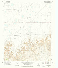
(16)- 1970 Map of Sanford, 1973 Print
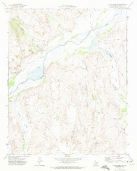
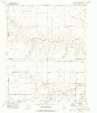
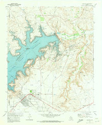 1970 Sanford1973 Print · USGSHutchinson County underwent a dramatic transformation in the early seventies as the Canadian River was impounded to form a new recreation hub. Genealogists and industrial historians can trace the development of Fritch, locate the Sanford Cem, and study the sprawling Sanford Yake Oil Field.
 - 1970 Map of Borger, 1973 Print
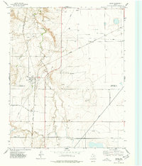
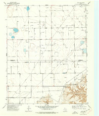
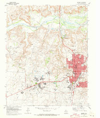 1970 Borger1973 Print · USGSThe Texas Panhandle petroleum landscape is on full display here in the 1970s, from the industrial plants of Bunavista to the city of Borger. Researchers can trace local landmarks like Highland Park (Cem), Frank Phillips College, and the sprawling Dial Oil Field.2 unique versions available
 - 1970 Map of Phillips, 1973 Print
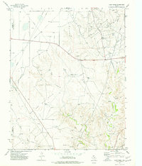
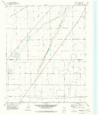
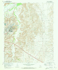 1970 Phillips1973 Print · USGSHutchinson County at the height of the Texas oil boom reveals a landscape transformed by extraction and industry. Follow the development of the company town of Phillips and trace historical land use through Haile Ch, the Borger Oil Field, and Spring Creek Sch.2 unique versions available
 - 1971 Map of Skellytown NW, 1973 Print
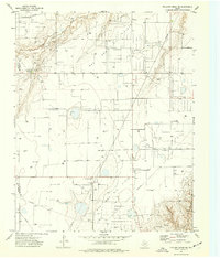
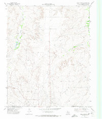 1971 Skellytown NW1973 Print · USGSThe Texas Panhandle comes into sharp focus during the early 1970s, revealing a landscape defined by ranching and the oil industry. Researchers can trace family-named locales like Pacher and Meadows or locate specific industrial sites such as Jims Lake and various Oil Wells.
 - 1971 Map of Skellytown NE, 1974 Print
 1971 Skellytown NE1974 Print · USGSThe Texas Panhandle reveals its ranching and energy foundations in the early 1970s across this Roberts County landscape. Genealogists and historians can trace family land at Price Ranch and Hayhook Ranch, or locate water infrastructure like the Jog Section Windmill.
 - 1971 Map of Adobe Creek SW, 1974 Print
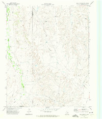
 1971 Adobe Creek SW1974 Print · USGSThe Texas Panhandle north of Skellytown is captured here in the early 1970s, showing a landscape defined by ranching and river drainages. You can trace the wide Canadian River valley and find local landmarks like Antelope, Corral, and the winding White Deer Creek.
 - 1971 Map of Garden Springs, 1974 Print
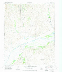 1971 Garden Springs1974 Print · USGSThe Texas Panhandle breaks along the Canadian River are documented here in the early 1970s. Genealogists and historians can trace ranching legacies at Brainard Ranch and Morrison Ranch or locate early energy infrastructure and remote sites like Pats Creek Camp.
 - 1971 Map of Adobe Creek SE, 1974 Print
 1971 Adobe Creek SE1974 Print · USGSThe Texas Panhandle ranchlands are captured in the early 1970s as industrial pipelines began crossing the traditional cattle country. Researchers can trace old ranching boundaries and water infrastructure through labels like Morrison Ranch, Sandhill Windmill, and the Roberts Co line.
 - 1973 Map of Spearman SE, 1976 Print
 1973 Spearman SE1976 Print · USGSThe Texas Panhandle at the meeting of four counties shows a landscape transformed by the mid-century energy boom. Trace the industrial footprint of the Gasoline Plant and Gravel Pits or follow the deep draws of Pats Creek and Willow Creek.
 - 1974 Map of Morse, 1977 Print
 1974 Morse1977 Print · USGSThe High Plains of the Texas Panhandle are captured here in the mid-1970s, focused on the rail-connected community of Morse. Genealogists and historians can trace the Lieb Cem, the busy Morse Junction, and the winding path of Palo Duro Creek.
 - 1974 Map of Camp Creek, 1977 Print
 1974 Camp Creek1977 Print · USGSHutchinson and Moore Counties are shown in the mid-1970s as industrial development transforms the Panhandle ranching landscape. Trace the shift from agriculture to energy through the Herring Ranch, the Old RR Grade, and an extensive gas and oil field.
 - 1974 Map of Pollard Creek NE, 1977 Print
 1974 Pollard Creek NE1977 Print · USGSHutchinson County is captured in the mid-1970s during a period of intensive energy production across the Panhandle plains. Researchers can trace the sprawling infrastructure of the Gas And Oil Field and locate localized points like Stewart Station and the Pumping Sta.
 - 1974 Map of Capps Switch SE, 1977 Print
 1974 Capps Switch SE1977 Print · USGSThe Texas Panhandle comes into sharp focus during the 1970s as energy production and rail transit define the landscape. Researchers can trace the Chicago Rock Island and Pacific rail line through Hutch and locate numerous Gas Wells near Morse.
 - 1974 Map of Holt, 1977 Print
 1974 Holt1977 Print · USGSThe Texas Panhandle comes into focus during the mid-seventies as energy production reshapes the high plains of Hansford and Hutchinson counties. Researchers can trace the layout of Holt, follow the winding path of Johns Creek, and locate numerous Gas Wells and local pipelines.
 - 1974 Map of Morse SE, 1977 Print
 1974 Morse SE1977 Print · USGSThe High Plains of the Texas Panhandle are captured in the mid-1970s as a landscape defined by energy production and rail transport. Researchers can trace the industrial grid of Oil Wells and Gas Wells alongside the Atchison Topeka and Santa Fe railroad.
 - 1979 Map of Adobe Creek
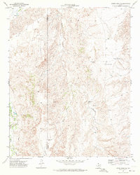
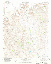 1979 Adobe Creek1979 Print · USGSHutchinson County ranchlands are captured here in the early seventies, showing the vast spreads before modern intensification. Trace the canyon breaks of Adobe Creek to find Turkey Track Ranch, a Historical Marker, and several remote Landing Strips.
End of results
Showing maps 1-16 of 16
Top cities of Hutchinson County
Frequently asked questions
- What are the different types of historical maps available for Hutchinson County?
- What is the oldest map of Hutchinson County?
- Where can I purchase historical maps of Hutchinson County for my home or office?
- Where can I download high-res historical maps of Hutchinson County?
- Are there historical topographic maps available for Hutchinson County?
- Is there historical aerial imagery available for Hutchinson County?
- Where are historical maps of Hutchinson County sourced from?