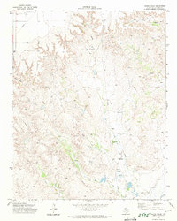
1979 Map of Adobe Creek
USGS Topo · Published 1979About this map
Turkey Track Ranch anchors this high-plains landscape in Hutchinson County, illustrating the large-scale ranching operations characteristic of the Texas Panhandle. The terrain is defined by the erosion patterns of Adobe Creek and Bent Creek as they cut through the caprock toward the Canadian River in the south. These drainage systems, including Waters Canyon and the West Fork Johns Creek, create a complex network of draws and breaks that dictated early settlement and land use.
Find a feature on this map
12 named features on this map. Tap any name to fly to it.
Don’t see what you’re looking for? This feature index may not catch every label — zoom into the map to look around manually.
Map Details
Editions of this 1979 Adobe Creek Map
This is the sole edition of this map. No revisions or reprints were ever made.
Other maps of this area

1953 · Plemons
USGS Topo · 1:24,000

1953 · Stinnett Station
USGS Topo · 1:24,000

1954 · Perryton
USGS Topo · 1:250,000

1954 · Amarillo
USGS Topo · 1:250,000

1958 · Perryton
USGS Topo · 1:250,000

1958 · Amarillo
USGS Topo · 1:250,000

1971 · Adobe Creek SW
USGS Topo · 1:24,000

1971 · Garden Springs
USGS Topo · 1:24,000

1971 · Adobe Creek SE
USGS Topo · 1:24,000

1973 · Spearman SE
USGS Topo · 1:24,000