
1953 Map of Plemons
USGS Topo · Published 1954About this map
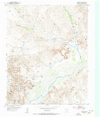
The settlement of Plemons serves as the focal point of this mid-century survey of the Texas Panhandle. Situated above the braided channel of the Canadian River, the townsite is surrounded by a landscape defined by the extraction economy of the Moore Watkins Oil Field. The map reveals a high density of oil wells, oil tanks, and a pipe line that cut across the dissected terrain of the High Plains.
Find a feature on this map
19 named features on this map. Tap any name to fly to it.
Don’t see what you’re looking for? This feature index may not catch every label — zoom into the map to look around manually.
Map Details
Editions of this 1953 Plemons Map
3 editions found
Other maps of this area

1953 · Stinnett
USGS Topo · 1:24,000

1953 · Stinnett Station
USGS Topo · 1:24,000

1953 · Pringle
USGS Topo · 1:24,000

1953 · Phillips
USGS Topo · 1:24,000

1953 · Borger
USGS Topo · 1:24,000

1954 · Amarillo
USGS Topo · 1:250,000

1958 · Amarillo
USGS Topo · 1:250,000

1970 · Borger
USGS Topo · 1:24,000

1970 · Phillips
USGS Topo · 1:24,000

1971 · Skellytown NW
USGS Topo · 1:24,000