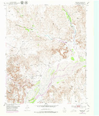
1953 Map of Plemons
USGS Topo · Published 1979About this map
Plemons sits on a high terrace overlooking the Canadian River, appearing here in the mid-20th century as a modest settlement defined by its proximity to the wide riverbed and local petroleum production. The landscape is heavily marked by the Moore Watkins Oil Field, with numerous Oil Wells and a dense network of Pipe Lines cutting through the breaks and plains. Cultural history is evident in the presence of a local Cem and unidentified Ruins near the banks of Smokehouse Creek. Topographic features are prominent, with several named survey points like Vabm 2976 Bluff and Vabm 3169 Dial providing vertical control over the dissected terrain. The drainage network is complex, with Bugby Creek, Moore Creek, and Bear Creek all feeding into the primary river valley, illustrating the rugged hydrologic character of the Hutchinson County panhandle.
Find a feature on this map
29 named features on this map. Tap any name to fly to it.
Don’t see what you’re looking for? This feature index may not catch every label — zoom into the map to look around manually.
Map Details
Editions of this 1953 Plemons Map
3 editions found
Other maps of this area

1953 · Plemons
USGS Topo · 1:24,000

1953 · Stinnett
USGS Topo · 1:24,000

1953 · Stinnett Station
USGS Topo · 1:24,000

1953 · Pringle
USGS Topo · 1:24,000

1953 · Phillips
USGS Topo · 1:24,000

1953 · Borger
USGS Topo · 1:24,000

1954 · Amarillo
USGS Topo · 1:250,000

1958 · Amarillo
USGS Topo · 1:250,000

1970 · Borger
USGS Topo · 1:24,000

1970 · Phillips
USGS Topo · 1:24,000