
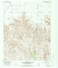
1953 Map of Stinnett Station
USGS Topo · Published 1954About this map
Stinnett Station and the neighboring Britain Ranch anchor this 1953 topographic survey of the Texas Panhandle landscape. The terrain is defined by the sharp transition from the level high plains down into the complex drainage systems of Bent Waters Canyon and Moore Creek. This transition reveals a land shaped by the constant search for water and resources, evidenced by numerous scattered Windmill sites and a Caliche Pit that hint at the local ranching and road-building requirements of the era. The presence of Sand Dunes near the southern boundary of the quadrangle suggests the influence of wind and arid conditions on the local geography. Surveyors established several vertical control points across the ridges, including VABM Bugby and VABM Lark, which provide precise elevations for the surrounding breaks and ravines feeding into Carson Creek.
Find a feature on this map
18 named features on this map. Tap any name to fly to it.
Don’t see what you’re looking for? This feature index may not catch every label — zoom into the map to look around manually.
Map Details
Editions of this 1953 Stinnett Station Map
2 editions found
Other maps of this area

1953 · Plemons
USGS Topo · 1:24,000

1953 · Stinnett
USGS Topo · 1:24,000

1953 · Pringle
USGS Topo · 1:24,000

1954 · Perryton
USGS Topo · 1:250,000

1954 · Amarillo
USGS Topo · 1:250,000

1958 · Perryton
USGS Topo · 1:250,000

1958 · Amarillo
USGS Topo · 1:250,000

1971 · Adobe Creek SW
USGS Topo · 1:24,000

1974 · Morse
USGS Topo · 1:24,000
1974 · Holt
USGS Topo · 1:24,000