
1953 Map of Pringle
USGS Topo · Published 1954About this map
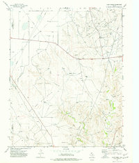
Pringle stands as a central waypoint in Hutchinson County, defined by the diagonal transit of the Chicago Rock Island and Pacific railroad. Surveyed in the early 1950s, the landscape reveals a heavy industrial overlay of petroleum extraction and rural agriculture. Numerous oil wells and oil tanks are clustered in the western portion of the quadrangle, while a network of pipe lines and a telephone line crisscross the plains to support this emerging energy infrastructure.
Find a feature on this map
21 named features on this map. Tap any name to fly to it.
Don’t see what you’re looking for? This feature index may not catch every label — zoom into the map to look around manually.
Map Details
Editions of this 1953 Pringle Map
This is the sole edition of this map. No revisions or reprints were ever made.
Other maps of this area

1953 · Plemons
USGS Topo · 1:24,000

1953 · Stinnett
USGS Topo · 1:24,000

1953 · Stinnett Station
USGS Topo · 1:24,000

1954 · Perryton
USGS Topo · 1:250,000

1954 · Amarillo
USGS Topo · 1:250,000

1958 · Perryton
USGS Topo · 1:250,000

1958 · Amarillo
USGS Topo · 1:250,000

1974 · Morse
USGS Topo · 1:24,000
1974 · Camp Creek
USGS Topo · 1:24,000
1974 · Pollard Creek NE
USGS Topo · 1:24,000