Old Maps of Jack County, Texas for Metal Detecting
Plan your next treasure hunt with 129 historic maps of Jack County. Find old homesites, ghost towns, trails, and gathering spots that may be lost to time — perfect for identifying promising metal detecting locations.
- Locate forgotten sites: Uncover places like long-lost settlements, abandoned rail lines, or gathering spots.
- Plan better hunts: Use map overlays combined with LiDAR or satellite views to narrow in on historically rich areas.
- Made for detectorists: Thousands of hobbyists use these maps to discover relics, coins, and hidden history.
Use these historic maps to boost your research and find new opportunities beneath the surface of Jack County.
Jack County, TX maps
(129)- 1954 Map of Sherman, 1964 Print
 1954 Sherman1964 Print · USGSThe Red River valley and North Texas plains are captured here in the mid-fifties, showing the region as new reservoirs like Lake Texoma and Lavon Reservoir reshaped the land. Genealogists can trace family roots through specific local landmarks like Courtney P O, Pilot Grove Sch, and New Hope Ch.2 unique versions available
 - 1954 Map of Wichita Falls, 1966 Print
 1954 Wichita Falls1966 Print · USGSNorth Texas in the mid-fifties is captured here as a landscape of expanding oil fields and vital rail corridors. Genealogists and historians can trace family roots through rural landmarks like Bacon Chapel and the rail-side growth of Seymour and Archer City.3 unique versions available
 - 1958 Map of Wichita Falls
 1958 Wichita Falls1958 Print · USGSNorth Texas during the late fifties reveals a landscape defined by the booming petroleum industry and established rail hubs. Researchers can trace the development of Wichita Falls and discover rural landmarks like Barton's Chapel or the Hull-Silk Oil Field.
 - 1958 Map of Sherman, 1959 Print
 1958 Sherman1959 Print · USGSNorth Texas and Southern Oklahoma were undergoing significant development in the late fifties as the Red River Valley transit networks matured. Researchers can trace historic family-named locations such as Saddler Bend, the grounds of Perrin AFB, and early shoreline developments at Lake Texoma.
 - 1960 Map of Gibtown, 1961 Print
 1960 Gibtown1961 Print · USGSThe rural borderlands of Jack, Wise, and Parker counties appear here in the early 1960s as a landscape of cattle ranching and emerging oil production. Trace family roots at Ebenezer Cem and Gibtown, or follow the path of the Old RR Grade near Rock Hollow.2 unique versions available
 - 1960 Map of Wizard Wells, 1961 Print
 1960 Wizard Wells1961 Print · USGSThe Jacksboro area in the early sixties is defined here by the rising waters of Lake Bridgeport and a thriving energy industry. Researchers can find Wizard Wells Cem, trace the Rock Island and Pacific line, and locate dozens of early gas wells.2 unique versions available
 - 1960 Map of Jacksboro, 1962 Print
 1960 Jacksboro1962 Print · USGSJacksboro was evolving into a regional center during the early 1960s, balancing its frontier heritage with modern industry. Researchers can find deep family roots at Oakwood Cem and Dark Corner Cem or trace the site of Fort Richardson (Historical).3 unique versions available
 - 1961 Map of Bartons Chapel, 1962 Print
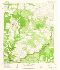 1961 Bartons Chapel1962 Print · USGSJack County ranch lands are documented here in the early sixties as the oil industry began to mark the landscape. Genealogists can trace family roots at Bartons Chapel Cem and Springdale Cem or locate the rural Sparks Spring Ch.
 - 1961 Map of Perrin, 1962 Print
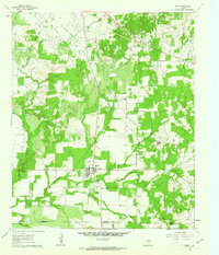 1961 Perrin1962 Print · USGSNorth Texas ranching and petroleum production meet in the early sixties near the intersection of Jack, Palo Pinto, and Parker Counties. Local historians can trace the Old Railroad Grade, locate the High Sch in Perrin, and explore the Rusmag Field oil operations.2 unique versions available
 - 1961 Map of Selma, 1963 Print
 1961 Selma1963 Print · USGSThe rural borderlands of North Texas are captured here in the early sixties as the waters of Lake Amon G Carter reach their modern levels. Researchers can trace family roots at Selma Cem or Crafton Cem and locate industrial landmarks like the Bowie SW Oil Field.2 unique versions available
 - 1961 Map of Jacksboro NE, 1963 Print
 1961 Jacksboro NE1963 Print · USGSJack County's petroleum and transit corridors are well-defined in the early sixties as the energy industry transformed the North Texas landscape. Researchers can trace the Rusmag Oil Field infrastructure, the Carroll Creek (Cem), and the active Chicago Rock Island and Pacific rail line.2 unique versions available
 - 1961 Map of Crafton, 1963 Print
 1961 Crafton1963 Print · USGSThe Jack and Wise county line comes alive in the early sixties, showing the rural landscape as Lake Bridgeport met the West Fork Trinity River. Genealogists and local historians can trace family roots at the Thomas Norwood Cem or locate old homesteads near Crafton and Cundiff.2 unique versions available
 - 1962 Map of Antelope Creek NE, 1982 Print
 1962 Antelope Creek NE1982 Print · USGSThis North Central Texas landscape on the Baylor and Throckmorton county line captures the region's mid-century petroleum and water development. Researchers can trace the expansion of the Millers Creek Reservoir and identify early Oil Wells along Marys Creek.
 - 1964 Map of Senate, 1967 Print
 1964 Senate1967 Print · USGSSenate and the surrounding Jack County prairies are captured in the mid-1960s as a landscape of oil wells and rail lines. Trace family history at Winn Hill Cem or locate the old Mountain Home Missionary Ch along the Pacific and Rock Island line.2 unique versions available
 - 1964 Map of Cundiff, 1967 Print
 1964 Cundiff1967 Print · USGSJack County in the mid-1960s was a landscape defined by the winding West Fork Trinity River and an active oil and gas industry. Local historians can trace family roots at Barton Springs Cem or locate industrial sites like the Refinery and numerous Gas Well operations.
 - 1964 Map of Johnson Lake, 1967 Print
 1964 Johnson Lake1967 Print · USGSJack County's oil and gas landscape is captured here during the mid-sixties, showing a countryside where industry met traditional rural life. Family historians and researchers can locate Groves Cem and Patton Cem or trace the West Fork Trinity River and Johnson Lake.
 - 1964 Map of Darnell Branch, 1967 Print
 1964 Darnell Branch1967 Print · USGSIn the early 1960s, the North Texas prairie here was a landscape of ranching and oil extraction at the meeting of four counties. Researchers can trace the winding West Fork Trinity River and locate energy landmarks like Burns-Jones Field or Spy Knob.
 - 1964 Map of Bryson, 1967 Print
 1964 Bryson1967 Print · USGSBryson and the surrounding North Texas oil country are documented here in the early sixties. Researchers can trace the Chicago Rock Island and Pacific rail line through town to find the local Refinery, High Sch, and nearby Rock Creek Cem.2 unique versions available
 - 1964 Map of Lynn Creek, 1967 Print
 1964 Lynn Creek1967 Print · USGSTexas oil and ranch country in the mid-1960s reveals a land transitioning between traditional agriculture and industrial extraction. Researchers can trace the path of an Old Railroad Grade or locate family markers at Roberts Branch Cem and Lynn Creek Chapel.2 unique versions available
 - 1964 Map of Newport, 1967 Print
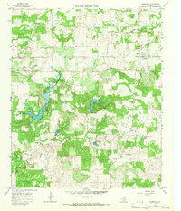 1964 Newport1967 Print · USGSJack County and Clay County during the early 1960s reveal a landscape of emerging oil extraction and traditional rural settlements. Researchers can trace family history through the Newport Cem or locate old sites at Truce, Graves, and Spradling.
 - 1964 Map of Antelope, 1967 Print
 1964 Antelope1967 Print · USGSThe community of Antelope and the surrounding North Texas ranchlands are captured here in the early sixties as the local petroleum industry expanded. Researchers can trace family sites near McKinlay and Shannon, or locate the Antelope Cem along the West Fork Trinity River.2 unique versions available
 - 1964 Map of Postoak, 1967 Print
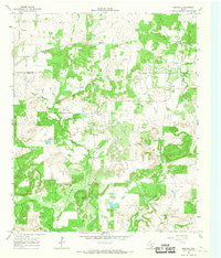 1964 Postoak1967 Print · USGSThe rolling hills of Jack and Clay Counties are captured in the mid-1960s, showing the rural settlement of Postoak and the surrounding ranch land. Genealogists can trace local landmarks like Prospect Cem, Silver Hill Cem, and the high point of Bear Mtn.2 unique versions available
 - 1964 Map of Markley, 1967 Print
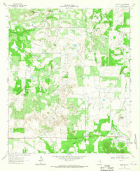 1964 Markley1967 Print · USGSNorth Texas ranching and oil country come into focus in the 1960s as petroleum development reaches across the Young and Jack County line. Researchers can find old community anchors like Plum Grove Ch and Graceland Cem or trace the Old Railroad Grade through Jermyn.2 unique versions available
 - 1967 Map of Long Hollow, 1970 Print
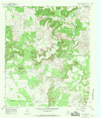 1967 Long Hollow1970 Print · USGSThe ranching and oil country of North Texas comes to life in this late-sixties survey of the Jack and Palo Pinto county line. Genealogists and researchers can trace family landmarks and remote burial sites like Halsell Ranch Cem, Long Hollow Cem, and the high ground of Deck Mountain.2 unique versions available
 - 1967 Map of Ross Mountain, 1982 Print
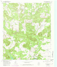 1967 Ross Mountain1982 Print · USGSNorth Texas hill country meets the energy frontier in the late 1960s where Young, Jack, and Palo Pinto counties converge. Genealogists and historians can locate remote family sites like Center Ridge Cemetery and trace the early footprint of the oil industry near Bear Mountain.
Showing maps 1-25 of 129
Top cities of Jack County
Frequently asked questions
- What are the different types of historical maps available for Jack County?
- What is the oldest map of Jack County?
- Where can I purchase historical maps of Jack County for my home or office?
- Where can I download high-res historical maps of Jack County?
- Are there historical topographic maps available for Jack County?
- Is there historical aerial imagery available for Jack County?
- Where are historical maps of Jack County sourced from?