1900s (20th Century) Maps of Jefferson County, Texas
Explore 90 historic maps of Jefferson County from the 1900s (20th Century). These maps offer a rare glimpse into what life looked like during the 1900s — showing old roads, neighborhoods, homes, and landmarks that have changed or disappeared over time.
Whether you're researching your family's past, planning a metal detecting trip, or studying how Jefferson County's landscape evolved across the 1900s, these high-resolution maps are a powerful tool for exploring the history of this region.
- Focus on a specific era: All maps on this page are from the 1900s, giving you a focused view of this time period.
- See what’s changed: Compare century-old streets, trails, and buildings to today's modern landscape using overlays and satellite layers.
- Research with precision: Use these maps for genealogy, historical research, land use analysis, or educational projects.
- View, download, or print: Maps are fully viewable online in high resolution, and can be downloaded or printed for your own records.
Start exploring Jefferson County's history through authentic maps from the 1900s. This is your window into the past.
Jefferson County, TX maps
(90)- 1926 Map of Terry
 1926 Terry1926 Print · USGSCoastal Orange County was a hub of energy and rail transit in the mid-twenties, centered on the Neches River wetlands. Researchers can trace early infrastructure like the Southern Pacific tracks and the Mansfield Gulf Ferry Road.
 - 1926 Map of Lakeview
 1926 Lakeview1926 Print · USGSThe Neches River lowlands are captured here in the mid-1920s, showing a landscape defined by marshy sloughs and emerging industry. Genealogists and historians can locate family landmarks like the Williamson Church or trace old routes to Colliers Ferry.
 - 1926 Map of Vidor
 1926 Vidor1926 Print · USGSThe Neches River basin in the mid-1920s shows a landscape of winding waterways and emerging rail corridors. Researchers can trace the early footprint of Vidor and find rural landmarks like the Magnolia Grove School alongside the Kansas City Southern line.
 - 1932 Map of Sabine Pass NE
 1932 Sabine Pass NE1932 Print · USGSThe maritime border between Louisiana and Texas is captured here in the early 1930s as a hub of coastal engineering and rail transport. Researchers can trace the industrial shoreline along the Southern Pacific railroad and the historical East Bdy Old Military Reservation.
 - 1932 Map of Beaumont
 1932 Beaumont1932 Print · USGSThe Neches River lowlands and the growing settlement of Vidor are captured here during the early thirties. Genealogists can locate family landmarks like Magnolia Grove Sch, Williamson Ch, and the river crossing at Colliers Ferry.2 unique versions available
 - 1932 Map of Port Arthur NE
 1932 Port Arthur NE1932 Print · USGSThe Louisiana coast near the Texas border comes alive in this early Depression-era survey of the coastal marshes. Local historians can trace the foundations of Rosenthal-Brown Camp and the reach of the Willow Bayou Canal along the edges of Sabine Lake.
 - 1943 Map of West of Johnson Bayou, 1952 Print
 1943 West of Johnson Bayou1952 Print · USGSThe Louisiana coast at the edge of the Texas border was a land of intricate bayous and chenier ridges during the 1940s. Genealogists and local historians can trace family land along landmarks like Blue Buck Ridge, Garrison Ridge, and the activity at Johnsons Bayou Landing.
 - 1943 Map of West of Greens Bayou, 1952 Print
 1943 West of Greens Bayou1952 Print · USGSThe Gulf Coast at the height of the Second World War was a vital corridor of shipping and natural marshlands. Researchers can trace the industrial waterway through Sabine Lake and find remote family-named landmarks like Stewts Island and Marceaux Island.
 - 1943 Map of Port Arthur North, 1953 Print
 1943 Port Arthur North1953 Print · USGSSoutheast Texas at the height of its mid-century industrial growth shows a landscape defined by petrochemical hubs and new suburban neighborhoods. Local researchers can trace family roots through landmarks like Thomas Jefferson High School, Calvary Cem, and the enclave of Pear Ridge.
 - 1943 Map of Terry, 1953 Print
 1943 Terry1953 Print · USGSCoastal Texas during the war years reveals a landscape of industrial waterways and remote rail outposts along the Orange and Jefferson County line. Researchers can trace the Southern Pacific line through Terry and locate historic sites like Wallace Cem and Evergreen Ch.
 - 1943 Map of Port Arthur South, 1954 Print
 1943 Port Arthur South1954 Print · USGSPort Arthur's industrial waterfront and the coastal marshlands of the Texas-Louisiana border are captured here during the 1940s. Researchers can trace the rail lines of the Southern Pacific, locate the Radio Tower (WPA), and see the layout of the Port Arthur Pleasure Pier.2 unique versions available
 - 1943 Map of Fannett East, 1959 Print
 1943 Fannett East1959 Print · USGSJefferson County is mapped during the early 1940s, showing a coastal landscape of bayous and railroads at the height of its mid-century industrial growth. Researchers can trace family history at Broussard Cem or follow the Gulf Colorado and Santa Fe line through Cheek.2 unique versions available
 - 1943 Map of Beaumont East, 1960 Print
 1943 Beaumont East1960 Print · USGSIn the midst of the Second World War, the Texas Gulf Coast's industrial heart thrived along the Neches River and its vital shipping channels. Genealogists and historians can trace the early layout of Lamar College, the famous Spindletop Oil Field, and family plots in Anthony Cem.
 - 1944 Map of Sabine Pass
 1944 Sabine Pass1944 Print · USGSCoastal Jefferson County is captured here in the mid-1940s as a landscape of vast marshes and strategic waterways. Genealogists and local historians can trace the settlement of Sabine Pass and locate early burial sites like Pace Cem and Mc Gaffey Cem.
 - 1944 Map of Texas Point
 1944 Texas Point1944 Print · USGSThe maritime borderlands of Jefferson County and Cameron Parish are captured here during the 1940s, showing a landscape defined by gulf commerce and coastal defense. Maritime historians can trace the West Jetty and East Jetty or locate the U S Quarantine Station and Sabine Pass Lighthouse Reservation.
 - 1945 Map of Fannett East
 1945 Fannett East1945 Print · USGSJefferson County coastal prairies and bayous are captured here during the mid-1940s. Researchers can trace local lineage through Broussard Cem, visit the old Fannett School, and map the water-driven economy of Lovell Lake and Bayou Din.
 - 1945 Map of Nolte
 1945 Nolte1945 Print · USGSThe coastal prairie at the borders of Liberty, Chambers, and Jefferson Counties is captured here in the mid-1940s. Genealogists and researchers can trace early rural life through landmarks like the Pumping Station at Blair, Oak Island, and Willis Marsh.
 - 1946 Map of Port Arthur NE
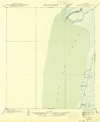 1946 Port Arthur NE1946 Print · USGSCoastal Cameron Parish at the state border shows a landscape of tidal marshes and seasonal outposts in the mid-1940s. Genealogists and historians can trace old camps and waterways like Rosenthal-Brown Camp, Willow Camp, and Pines Ridge.
 - 1946 Map of Sabine Pass NE
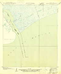 1946 Sabine Pass NE1946 Print · USGSThe coastal border of Louisiana and Texas is captured in the mid-1940s as a vital maritime and rail hub. Trace the historical navigation works at Sabine Pass, including the Southern Pacific rail line and the Lighthouse.
 - 1946 Map of Port Arthur SE
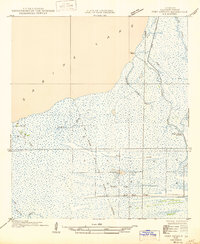 1946 Port Arthur SE1946 Print · USGSCoastal Cameron Parish at the mid-century is a network of marshy bayous and low-lying ridges along the Sabine Lake shore. Local historians can trace the settlement at Johnson Bayou, find the Johnson Bayou Landing, and follow the Old Military Reservation Boundary across the wetlands.
 - 1950 Map of Houston, 1953 Print
 1950 Houston1953 Print · USGSCoastal Texas in the early fifties reveals a landscape of massive civil engineering and industrial transit. Genealogists and researchers can trace the growth of the Houston suburbs and the maritime infrastructure of Galveston Bay, including the Gulf Freeway and the Texas City Dike.
 - 1952 Map of Lake Charles
 1952 Lake Charles1952 Print · USGSSouthwest Louisiana is captured here in the mid-fifties, showing a landscape defined by the rise of the petrochemical industry and deep-water navigation. Researchers can trace family roots through numerous small-town settlements and oil developments like Nibletts Bluff, the Lockport Oil Field, and Starks.
 - 1954 Map of Port Arthur
 1954 Port Arthur1954 Print · USGSThe Texas and Louisiana coastlines meet here in the mid-fifties, showing the industrial rise of Port Arthur alongside vast wildlife preserves. Researchers can trace remote coastal settlements and infrastructure like Pecan Island, the Sabine Pass Lighthouse, and the North Island School.
 - 1954 Map of Lake Charles, 1964 Print
 1954 Lake Charles1964 Print · USGSSouthwest Louisiana in the mid-fifties is defined by its massive petroleum industry and its complex network of bayous and rail lines. Researchers can trace the development of the Sulphur Mines Oil Field or locate historic settlements like Longville and De Quincy.3 unique versions available
 - 1954 Map of Beaumont, 1964 Print
 1954 Beaumont1964 Print · USGSSoutheast Texas in the mid-fifties reveals a landscape of massive national forests, emerging reservoirs, and a booming oil economy. Genealogists and researchers can trace rural settlements like Dallardsville and Village Mills or locate early drilling sites at Sour Lake Oil Field.3 unique versions available
Showing maps 1-25 of 90
Top cities of Jefferson County
- Beaumont historical maps
- Port Arthur historical maps
- Nederland historical maps
- Groves historical maps
- Port Neches historical maps
- Bevil Oaks historical maps
See more
Frequently asked questions
- What are the different types of historical maps available for Jefferson County?
- What is the oldest map of Jefferson County?
- Where can I purchase historical maps of Jefferson County for my home or office?
- Where can I download high-res historical maps of Jefferson County?
- Are there historical topographic maps available for Jefferson County?
- Is there historical aerial imagery available for Jefferson County?
- Where are historical maps of Jefferson County sourced from?