1950s Maps of Jefferson County, Texas
Explore 21 historic maps of Jefferson County from the 1950s. These maps offer a rare glimpse into what life looked like during the 1950s — showing old roads, neighborhoods, homes, and landmarks that have changed or disappeared over time.
Whether you're researching your family's past, planning a metal detecting trip, or studying how Jefferson County's landscape evolved across the 1950s, these high-resolution maps are a powerful tool for exploring the history of this region.
- Focus on a specific era: All maps on this page are from the 1950s, giving you a focused view of this time period.
- See what’s changed: Compare century-old streets, trails, and buildings to today's modern landscape using overlays and satellite layers.
- Research with precision: Use these maps for genealogy, historical research, land use analysis, or educational projects.
- View, download, or print: Maps are fully viewable online in high resolution, and can be downloaded or printed for your own records.
Start exploring Jefferson County's history through authentic maps from the 1950s. This is your window into the past.
Jefferson County, TX maps
(21)- 1950 Map of Houston, 1953 Print
 1950 Houston1953 Print · USGSCoastal Texas in the early fifties reveals a landscape of massive civil engineering and industrial transit. Genealogists and researchers can trace the growth of the Houston suburbs and the maritime infrastructure of Galveston Bay, including the Gulf Freeway and the Texas City Dike.
 - 1952 Map of Lake Charles
 1952 Lake Charles1952 Print · USGSSouthwest Louisiana is captured here in the mid-fifties, showing a landscape defined by the rise of the petrochemical industry and deep-water navigation. Researchers can trace family roots through numerous small-town settlements and oil developments like Nibletts Bluff, the Lockport Oil Field, and Starks.
 - 1954 Map of Port Arthur
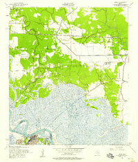
 1954 Port Arthur1954 Print · USGSThe Texas and Louisiana coastlines meet here in the mid-fifties, showing the industrial rise of Port Arthur alongside vast wildlife preserves. Researchers can trace remote coastal settlements and infrastructure like Pecan Island, the Sabine Pass Lighthouse, and the North Island School.
 - 1954 Map of Lake Charles, 1964 Print
 1954 Lake Charles1964 Print · USGSSouthwest Louisiana in the mid-fifties is defined by its massive petroleum industry and its complex network of bayous and rail lines. Researchers can trace the development of the Sulphur Mines Oil Field or locate historic settlements like Longville and De Quincy.3 unique versions available
 - 1954 Map of Beaumont, 1964 Print
 1954 Beaumont1964 Print · USGSSoutheast Texas in the mid-fifties reveals a landscape of massive national forests, emerging reservoirs, and a booming oil economy. Genealogists and researchers can trace rural settlements like Dallardsville and Village Mills or locate early drilling sites at Sour Lake Oil Field.3 unique versions available
 - 1955 Map of Sour Lake, 1956 Print
 1955 Sour Lake1956 Print · USGSCoastal Texas prairies and oil fields are captured here in the mid-1950s as petroleum production shaped the local economy. Genealogists can locate family landmarks like Pine Ridge Ch, Henderson Sch, and the Grayburg Cem along the old rail lines.2 unique versions available
 - 1956 Map of Houston, 1963 Print
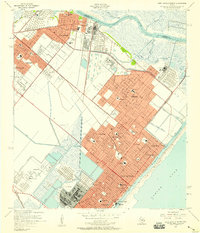
 1956 Houston1963 Print · USGSSoutheast Texas in the mid-fifties is captured here as a powerhouse of oil and maritime trade. Genealogists and historians can trace the foundations of Houston and its ports, alongside landmarks like the Rice Institute and the Spindletop Oil Field.2 unique versions available
 - 1956 Map of Port Arthur, 1965 Print
 1956 Port Arthur1965 Print · USGSThe Texas and Louisiana coastlines meet here in the mid-fifties, showing a landscape of sprawling marshes and growing refinery towns. Genealogists and historians can trace ridge settlements like Grand Cheniere or find the Sabine Pass Lighthouse and Pecan Island.3 unique versions available
 - 1957 Map of Beaumont
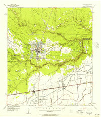
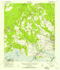
 1957 Beaumont1957 Print · USGSSoutheast Texas in the mid-fifties is defined by the timber-rich lands between the Trinity River and Beaumont. Trace the history of the Alabama and Coushatti Indian Reservation or locate early campus sites like Prairie View College.
 - 1957 Map of Sabine Pass
 1957 Sabine Pass1957 Print · USGSThe Texas and Louisiana borderlands meet at the Gulf in the late fifties, where maritime activity and coastal marsh define the terrain. Genealogists and historians can trace the Old Railroad Grade, locate the Pace Cem, and find the Lighthouse (Abandoned) on the Sabine shoreline.2 unique versions available
 - 1957 Map of Sabine Pass
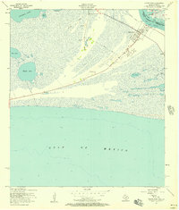 1957 Sabine Pass1957 Print · USGSThe Jefferson County coast at the Texas-Louisiana border reveals its mid-century character as a maritime and industrial hub. Genealogists and historians can trace local family landmarks like Pace Cem and McGaffey Cem or the remnants of an Old Railroad Grade.3 unique versions available
 - 1957 Map of Port Arthur South, 1958 Print
 1957 Port Arthur South1958 Print · USGSThe industrial waterfront of Port Arthur in the late fifties is defined by its deep-water canals and rail-linked refineries. Genealogists and historians can trace local schools like Lincoln High Sch or follow the Old Railroad Grade through the marsh.3 unique versions available
 - 1957 Map of West of Johnson Bayou, 1958 Print
 1957 West of Johnson Bayou1958 Print · USGSCoastal Cameron Parish in the late fifties is shown here as a landscape of marsh and chenier ridges. Researchers can trace the importance of high ground at Garrison Ridge or locate the historic Johnsons Bayou Landing near Deep Johnsons Bayou.3 unique versions available
 - 1957 Map of Orangefield, 1958 Print
 1957 Orangefield1958 Print · USGSSoutheast Texas at the peak of the mid-century oil boom is detailed here, showing the intricate intersection of rail lines and bayous. Genealogists can locate family landmarks such as Linscomb Cem, Winfree Ch, and the settlement of Mauriceville.2 unique versions available
 - 1957 Map of Terry, 1958 Print
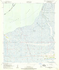
 1957 Terry1958 Print · USGSThe Texas Gulf Coast comes into focus in the 1950s as a landscape of marshy bayous, rail-side hamlets, and rising oil industry. Researchers can trace family history through numerous small burial grounds like Thomas Cem or locate the old landing at Bessie Heights near the Neches River.6 unique versions available
 - 1957 Map of West of Greens Bayou, 1958 Print
 1957 West of Greens Bayou1958 Print · USGSThe maritime borderlands of Southeast Texas and Louisiana appear in the late fifties as a vast network of islands and industrial waterways. Researchers can trace the original paths of the Sabine River and Neches River around landmarks like Sydney Island and the marshes of the Sabine National Wildlife Refuge.4 unique versions available
 - 1957 Map of Port Arthur North, 1958 Print
 1957 Port Arthur North1958 Print · USGSSoutheast Texas industrial centers thrive mid-century as the refinery and shipping corridor expands between the Neches River and Sabine Lake. Genealogy and local history researchers can locate specific family landmarks including Port Neches-Groves High Sch, Greenlawn Memorial Park, and the St Marys Hospital campus.4 unique versions available
 - 1957 Map of Texas Point, 1958 Print
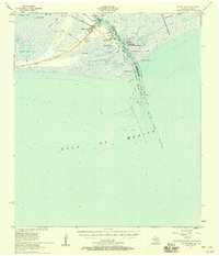
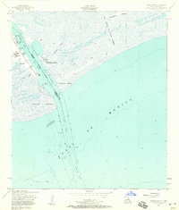 1957 Texas Point1958 Print · USGSThe Texas-Louisiana borderlands come alive in the late fifties at the mouth of the Sabine Pass Channel. Maritime researchers can trace the coastal defenses and navigation aids of the era, from the U.S. Coast Guard Sta to the Lighthouse (Abandoned) and Pilot Station.3 unique versions available
 - 1957 Map of Port Arthur, 1958 Print
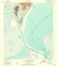
 1957 Port Arthur1958 Print · USGSCoastal Texas and Louisiana are mapped during a period of rapid industrial expansion and shoreline change. Genealogists and local historians can trace the mid-century footprints of Groves, locate family plots at Johnson Cem, or explore the old docks at Johnsons Bayou Landing.2 unique versions available
 - 1958 Map of Port Arthur
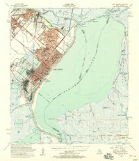
 1958 Port Arthur1958 Print · USGSThe Texas and Louisiana coastlines meet in the late fifties at the busy industrial port of Port Arthur. Historians and genealogists can trace the early rail networks of the Southern Pacific and locate coastal settlements like Cameron, Pecan Island, and Abbeville.
 - 1959 Map of Port Arthur
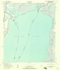
 1959 Port Arthur1959 Print · USGSThe Texas and Louisiana coastlines meet in this late-fifties study of a landscape defined by industry and wildlife preserves. Trace the Intracoastal Waterway past Pecan Island and Abbeville, or locate the shipping channels at Sabine Pass.
End of results
Showing maps 1-21 of 21
Top cities of Jefferson County
- Beaumont historical maps
- Port Arthur historical maps
- Nederland historical maps
- Groves historical maps
- Port Neches historical maps
- Bevil Oaks historical maps
See more
Frequently asked questions
- What are the different types of historical maps available for Jefferson County?
- What is the oldest map of Jefferson County?
- Where can I purchase historical maps of Jefferson County for my home or office?
- Where can I download high-res historical maps of Jefferson County?
- Are there historical topographic maps available for Jefferson County?
- Is there historical aerial imagery available for Jefferson County?
- Where are historical maps of Jefferson County sourced from?