Old Maps of Jim Wells County, Texas for Hiking & Exploration
Hike through history with 147 historic maps of Jim Wells County. Explore old trails, ghost towns, and forgotten backroads — perfect for outdoor adventurers and local explorers.
- Rediscover forgotten places: Map out old mining camps, roads, and footpaths that no longer exist on modern maps.
- Layer with modern tools: Combine with LiDAR or satellite views to plan hikes through historical terrain.
- Made for exploration: Popular among hikers, overlanders, and local history lovers.
Use these maps to find adventure and explore the hidden past of Jim Wells County.
Jim Wells County, TX maps
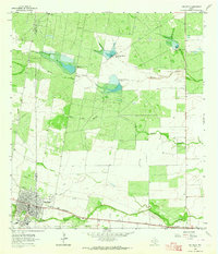
(147)- 1917 Map of Ben Bolt, 1956 Print
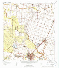
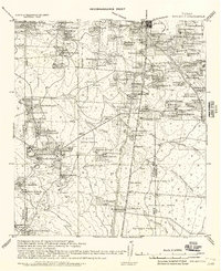 1917 Ben Bolt1956 Print · USGSSouth Texas ranching country comes into focus in this late-frontier era survey centered on the rail hub of Alice. Genealogists can trace family holdings like Hanson Ranch and Lopez Ranch, while finding landmarks like the Sugar Mill and regional Shipping Pens.
 - 1920 Map of Mikeska
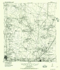
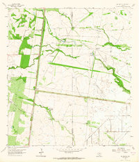
 1920 Mikeska1920 Print · USGSSouth Texas ranching country comes to life in this post-World War I tactical survey of the Live Oak County area. Genealogists and historians can trace family landholdings from OAKVILLE to George West, locating ancestral landmarks like Simmons City, Mikeska, and the O'Connor Ranch.
 - 1920 Map of San Diego, 1957 Print
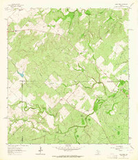
 1920 San Diego1957 Print · USGSSouth Texas ranching culture and early rail expansion are captured here at the start of the 1920s. Genealogists and historians can trace family landholdings across the Duval County Line, identifying sites like Luby Ranch, Bentonville, and the Texas Mexican Railroad corridor.
 - 1921 Map of Falfurrias
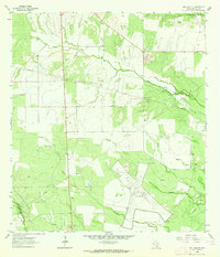
 1921 Falfurrias1921 Print · USGSBrooks and Jim Wells counties were defined by a sprawling ranching and citrus economy in the years following the Great War. Genealogists can trace family holdings and early infrastructure like Coyote Mills, the Concepcion Ruins, and the Seymour Citrus Farm.
 - 1925 Map of Mathis No. 3
 1925 Mathis No. 31925 Print · USGSSouth Texas ranching country and the winding banks of the river come alive in this mid-twenties survey of the Live Oak and Jim Wells county line. Genealogy researchers can trace the early footprints of Lagarto and Sandia near the Nueces River.
 - 1927 Map of Mathis
 1927 Mathis1927 Print · USGSSouth Texas at the height of the railroad era reveals a landscape of cattle-ranching hubs and river crossings. Genealogists can trace family connections to rural settlements like Lagarto and Sandia, or follow the path of the old Alice and Beeville Road.2 unique versions available
 - 1950 Map of Corpus Christi, 1953 Print
 1950 Corpus Christi1953 Print · USGSThe South Texas coast comes into focus during the early fifties, showing the interplay between booming oil fields and expansive ranching operations. Genealogists and historians can trace the Texas Mexican rail line through Kingsville or locate heritage sites like Chapman Ranch and Riviera Beach.
 - 1953 Map of Crystal City
 1953 Crystal City1953 Print · USGSSouth Texas in the early fifties was a landscape of expanding oil fields and vital rail connections. Genealogists and researchers can trace family lands along the Nueces River or locate heritage sites in Asherton, Big Wells, and Batesville.
 - 1953 Map of Beeville
 1953 Beeville1953 Print · USGSThe Texas Coastal Bend in the early fifties shows a landscape of growing regional hubs and vital maritime corridors. Trace the rail-and-river economy through Goliad, locate the Matagorda Lighthouse, and explore the sprawling Aransas National Wildlife Refuge.
 - 1954 Map of Orange Grove, 1956 Print
 1954 Orange Grove1956 Print · USGSSouth Texas at the height of the mid-century oil boom reveals a landscape defined by ranching heritage and energy extraction. Genealogists and historians can trace family-named sites and vanished landmarks like Leona Sch, Fort Lipantitlan, and the Old San Patricio Cemetery.
 - 1954 Map of Mathis, 1956 Print
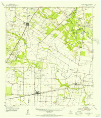
 1954 Mathis1956 Print · USGSThe Mathis area in the mid-1950s shows a landscape defined by the Nueces River and an expanding petroleum industry. Researchers can trace family-named sites like Wade Ranch and the lost siding at Swinney Switch or locate the old Drive-in Theater.2 unique versions available
 - 1954 Map of Kingsville, 1956 Print
 1954 Kingsville1956 Print · USGSCoastal Bend life in the 1950s centered on the growing college town of Kingsville and the nearby naval installations. Local historians can trace the early footprint of the Texas College of Arts and Industries, the Celanese Plant, and the borders of the King Ranch.2 unique versions available
 - 1955 Map of Crystal City, 1976 Print
 1955 Crystal City1976 Print · USGSSouth Texas ranching and oil country come into focus in the mid-fifties as the rail lines and rivers connect growing hubs. Researchers can trace the development of energy fields like Washburn Oil Field or locate historic settlements from Asherton to Three Rivers.
 - 1956 Map of Corpus Christi
 1956 Corpus Christi1956 Print · USGSThe South Texas coast and the burgeoning port of Corpus Christi are captured here during the mid-fifties. Genealogists and historians can trace the rail-and-oil economy through labels like Robstown Airpark, Chapman Ranch, and the Missouri Pacific railroad.
 - 1956 Map of Beeville
 1956 Beeville1956 Print · USGSCoastal Texas and the brush country interior are shown in the mid-fifties, from the coastal bays to the inland oil fields. Trace the old rail lines of the Southern Pacific RR or locate the historic Matagorda Lighthouse and the Aransas National Wildlife Refuge.2 unique versions available
 - 1956 Map of Laredo, 1960 Print
 1956 Laredo1960 Print · USGSSouth Texas in the mid-fifties reveals a landscape shaped by border commerce, military aviation, and a booming oil industry. Trace the historic Texas and Mexican RR line through Hebbronville or locate the sprawling Mirando City Oil Field and Laredo AFB.3 unique versions available
 - 1960 Map of Beeville
 1960 Beeville1960 Print · USGSCoastal Texas in the mid-fifties reveals a landscape of growing towns and vital military outposts like Foster AFB. Researchers can trace old rail lines including the Missouri Pacific and explore the vast Aransas National Wildlife Refuge.
 - 1960 Map of Corpus Christi
 1960 Corpus Christi1960 Print · USGSCoastal South Texas and the Nueces County hinterlands are detailed in this mid-century survey. Genealogists and historians can trace early settlement patterns and rural landmarks like Casa Blanca during a period of steady regional growth.
 - 1961 Map of Crystal City
 1961 Crystal City1961 Print · USGSSouth Texas in the early sixties reveals a landscape of massive cattle ranches and emerging oil fields. Genealogists and historians can trace the Missouri Pacific rail lines through Crystal City, or locate water features like Espantosa Lake and Boynton Reservoir.
 - 1963 Map of Ben Bolt SE, 1964 Print
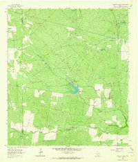
 1963 Ben Bolt SE1964 Print · USGSThe South Texas ranchlands come into focus in the early sixties as a network of windmills and seasonal lakes. Genealogists and historians can trace family-named sites like Los Machos Ranch, find the Kingsville Airport, and follow the Southern Pacific rail line.
 - 1963 Map of Anna Rose, 1964 Print
 1963 Anna Rose1964 Print · USGSSouth Texas ranching and oil production are on full display in the early 1960s at the junction of Live Oak and Jim Wells counties. Trace family history and land use through landmarks like Rancho de la Parrita, Anna Rose, and the Calabaza Windmill.2 unique versions available
 - 1963 Map of San Diego NE, 1964 Print
 1963 San Diego NE1964 Print · USGSCoastal plains and inland prairies in Jim Wells County meet the jet-age infrastructure of the early sixties. Researchers can trace land use from the Orange Grove Naval Auxiliary Airfield to historic sites like Dilworth Cem and the Amargosa Oil Field.3 unique versions available
 - 1963 Map of San Diego, 1964 Print
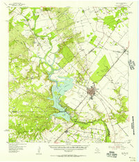
 1963 San Diego1964 Print · USGSSan Diego and the surrounding brush country are captured here in the early sixties as the regional water infrastructure was expanding. Genealogists and historians can trace the Texas Mexican rail line, find the local Cem, or locate the series of Chiltipin-San Fernando Dam No 6 reservoirs.2 unique versions available
 - 1963 Map of Shaeffer Ranch, 1964 Print
 1963 Shaeffer Ranch1964 Print · USGSSouth Texas ranching country in the early sixties is captured here along the Duval and Jim Wells county line. Genealogists and historians can locate the San Jose Cem near Mendieta, old family landmarks like the Shaeffer Ranch, and dozens of named windmills and tanks.2 unique versions available
 - 1963 Map of Premont West, 1964 Print
 1963 Premont West1964 Print · USGSJim Wells County in the early 1960s was a hub of energy production and ranching at the meeting point of three counties. Genealogists and historians can trace the Southern Pacific rail corridor through Premont and La Gloria, and locate rural landmarks like the La Gloria Sch and the Drive-in Theater.
Showing maps 1-25 of 147
Top cities of Jim Wells County
Frequently asked questions
- What are the different types of historical maps available for Jim Wells County?
- What is the oldest map of Jim Wells County?
- Where can I purchase historical maps of Jim Wells County for my home or office?
- Where can I download high-res historical maps of Jim Wells County?
- Are there historical topographic maps available for Jim Wells County?
- Is there historical aerial imagery available for Jim Wells County?
- Where are historical maps of Jim Wells County sourced from?