1970s Maps of Kerr County, Texas
Explore 7 historic maps of Kerr County from the 1970s. These maps offer a rare glimpse into what life looked like during the 1970s — showing old roads, neighborhoods, homes, and landmarks that have changed or disappeared over time.
Whether you're researching your family's past, planning a metal detecting trip, or studying how Kerr County's landscape evolved across the 1970s, these high-resolution maps are a powerful tool for exploring the history of this region.
- Focus on a specific era: All maps on this page are from the 1970s, giving you a focused view of this time period.
- See what’s changed: Compare century-old streets, trails, and buildings to today's modern landscape using overlays and satellite layers.
- Research with precision: Use these maps for genealogy, historical research, land use analysis, or educational projects.
- View, download, or print: Maps are fully viewable online in high resolution, and can be downloaded or printed for your own records.
Start exploring Kerr County's history through authentic maps from the 1970s. This is your window into the past.
Kerr County, TX maps
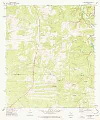
(7)- 1971 Map of Earwood Creek, 1974 Print
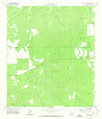 1971 Earwood Creek1974 Print · USGSThe Texas Hill Country at the meeting of Edwards, Real, and Kerr counties was a land of remote ranching and deep draws in the early seventies. Genealogists and historians can locate family-named landmarks like Dardy Windmill and trace the paths of Earwood Creek and Wildcat Draw.
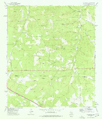
 - 1971 Map of Horse Camp Waterhole, 1974 Print
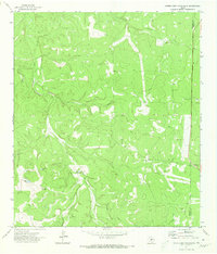 1971 Horse Camp Waterhole1974 Print · USGSThe ranching heart of the Hill Country in the early 1970s reveals a landscape of isolated outposts and vital water sources. Researchers can trace land use through landmarks like Bandy-Ross Ranch, Horse Camp Waterhole, and Sampson Windmill.
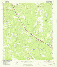
 - 1974 Map of Junction SE, 1977 Print
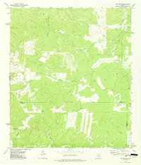 1974 Junction SE1977 Print · USGSThe Texas Hill Country at the intersection of Kimble, Edwards, and Kerr Counties is captured here in the mid-1970s. Researchers can trace land-use patterns across Chalk Creek or locate local water sources like Boiling Springs and the Preserve.
 - 1974 Map of Harper West, 1977 Print
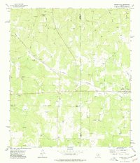 1974 Harper West1977 Print · USGSThe Pedernales River headwaters area comes alive in the 1970s, showing a landscape defined by ranching and gravel extraction. Trace local family history through landmarks like Bur Oak Windmill, Shin Oak Spring, and the settlement of Harper.
 - 1974 Map of Allen Creek, 1977 Print
 1974 Allen Creek1977 Print · USGSRanching life on the Kimble and Kerr county line is captured here in the mid-1970s. Genealogists and historians can trace family-named landmarks like the Bee Waterhole Windmill, the Cem on Segovia Road, and the isolated Two Dot Windmill.2 unique versions available
 - 1974 Map of Old Noxville, 1977 Print
 1974 Old Noxville1977 Print · USGSThe ranching country of the Texas Hill Country is captured here in the mid-seventies, spanning the Kimble and Kerr county line. Researchers can trace the legacy of Old Noxville through the Noxville Cem and numerous named water sources like The Big Springs.
 - 1974 Map of Mudge Draw, 1977 Print
 1974 Mudge Draw1977 Print · USGSThe ranchlands of the Texas Hill Country were still defined by water and wind in the mid-seventies. Genealogists and local historians can trace family-named sites like Bierschwale Windmill and Garrett Windmill along the Kimble Co Kerr Co boundary.
End of results
Showing maps 1-7 of 7
Top cities of Kerr County
- Kerrville historical maps
- Center Point historical maps
- Ingram historical maps
- Camp Verde historical maps
Frequently asked questions
- What are the different types of historical maps available for Kerr County?
- What is the oldest map of Kerr County?
- Where can I purchase historical maps of Kerr County for my home or office?
- Where can I download high-res historical maps of Kerr County?
- Are there historical topographic maps available for Kerr County?
- Is there historical aerial imagery available for Kerr County?
- Where are historical maps of Kerr County sourced from?