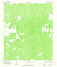
1971 Map of Earwood Creek
USGS Topo · Published 1974About this map
Earwood Creek and Hunger Creek drain the Edwards Plateau in this early 1970s survey, where the borders of Edwards, Real, and Kerr counties converge. The landscape is defined by its deep draws and hollows, such as Wildcat Draw and the distinctive geological depression known as The Kettle. This period shows a ranching-focused environment reliant on remote water sources, evidenced by several named windmills including the Tin Windmill, Black Jack Windmill, and Dardy Windmill.
Find a feature on this map
21 named features on this map. Tap any name to fly to it.
Don’t see what you’re looking for? This feature index may not catch every label — zoom into the map to look around manually.
Map Details
Editions of this 1971 Earwood Creek Map
This is the sole edition of this map. No revisions or reprints were ever made.
Other maps of this area

1954 · Llano
USGS Topo · 1:250,000

1954 · San Antonio
USGS Topo · 1:250,000

1955 · Llano
USGS Topo · 1:250,000

1956 · Llano
USGS Topo · 1:250,000

1957 · San Antonio
USGS Topo · 1:250,000

1963 · Garven Store
USGS Topo · 1:24,000

1963 · Y O Ranch
USGS Topo · 1:24,000

1964 · Hillcrest Ranch
USGS Topo · 1:24,000
1971 · Bradford Creek
USGS Topo · 1:24,000
1971 · Joy Hollow
USGS Topo · 1:24,000