
1963 Map of Garven Store
USGS Topo · Published 1966About this map
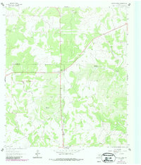
Garven Store serves as a central landmark in this 1963 survey of the Edwards Plateau region, situated along the county line where Real and Kerr counties meet. The landscape is characterized by its reliance on dispersed water sources, evidenced by the presence of Hackberry Waterhole and Black Jack Waterhole. These natural features, along with specialized infrastructure like the Buffalo Windmill and Buckhorn Windmill, illustrate the vital importance of water management for ranching and settlement in this semi-arid Texas environment.
Find a feature on this map
12 named features on this map. Tap any name to fly to it.
Don’t see what you’re looking for? This feature index may not catch every label — zoom into the map to look around manually.
Map Details
Editions of this 1963 Garven Store Map
2 editions found
Other maps of this area

1954 · Llano
USGS Topo · 1:250,000

1954 · San Antonio
USGS Topo · 1:250,000

1955 · Llano
USGS Topo · 1:250,000

1956 · Llano
USGS Topo · 1:250,000

1957 · San Antonio
USGS Topo · 1:250,000

1963 · Y O Ranch
USGS Topo · 1:24,000

1964 · Hillcrest Ranch
USGS Topo · 1:24,000

1964 · Boneyard Draw
USGS Topo · 1:24,000

1964 · Well Hollow
USGS Topo · 1:24,000

1964 · Live Oak Ranch
USGS Topo · 1:24,000