
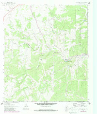
1964 Map of Boneyard Draw
USGS Topo · Published 1966About this map
The North Fork Guadalupe River snakes through the central portion of this Kerr County landscape, providing the primary drainage for the surrounding Edwards Plateau terrain. In the mid-1960s, this area was defined by its water management and ranching infrastructure, evidenced by numerous named wells such as the Sampson Windmill, Bobcat Windmill, and Stowers Corner Windmill. Significant portions of the eastern half of the map are dedicated to the Kerr Wildlife Management Area, showing the region's early efforts toward land conservation and wildlife habitat preservation.
Find a feature on this map
24 named features on this map. Tap any name to fly to it.
Don’t see what you’re looking for? This feature index may not catch every label — zoom into the map to look around manually.
Map Details
Editions of this 1964 Boneyard Draw Map
2 editions found
Other maps of this area

1894 · Kerrville
USGS Topo · 1:125,000

1954 · Llano
USGS Topo · 1:250,000

1954 · San Antonio
USGS Topo · 1:250,000

1955 · Llano
USGS Topo · 1:250,000

1956 · Tuff
USGS Topo · 1:62,500

1956 · Llano
USGS Topo · 1:250,000

1957 · San Antonio
USGS Topo · 1:250,000

1963 · Garven Store
USGS Topo · 1:24,000

1963 · Y O Ranch
USGS Topo · 1:24,000

1964 · Hillcrest Ranch
USGS Topo · 1:24,000