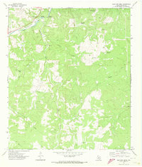
1971 Map of Bradford Creek
USGS Topo · Published 1973About this map
The South Llano River carves through the northern reaches of Edwards County, defining a landscape of canyons and draws in this early 1970s survey. Significant water features like the Blue Hole on the Llano and Dripping Springs highlight the importance of the river system to this ranching country. The terrain is characterized by the confluence of Contrary Creek and Bradford Creek, which feed into the main river valley from the south.
Find a feature on this map
20 named features on this map. Tap any name to fly to it.
Don’t see what you’re looking for? This feature index may not catch every label — zoom into the map to look around manually.
Map Details
Editions of this 1971 Bradford Creek Map
This is the sole edition of this map. No revisions or reprints were ever made.
Other maps of this area

1893 · Rock Springs
USGS Topo · 1:125,000

1926 · Segovia 2-c
USGS Topo · 1:48,000

1932 · Junction
USGS Topo · 1:62,500

1954 · Llano
USGS Topo · 1:250,000

1954 · Sonora
USGS Topo · 1:250,000

1955 · Llano
USGS Topo · 1:250,000

1956 · Llano
USGS Topo · 1:250,000

1958 · Sonora
USGS Topo · 1:250,000

1962 · Hill Ranch
USGS Topo · 1:24,000
1971 · Paint Rock Spring
USGS Topo · 1:24,000