Old Maps of Kerr County, Texas for Genealogy
Trace your family roots with 202 historic maps of Kerr County. These high-res maps reveal old neighborhoods, homesites, landmarks, and streets — helping you uncover where your ancestors lived and how the area evolved over time.
- Explore historic neighborhoods: Identify where your relatives may have lived in the 1800s or 1900s.
- Compare maps over time: Trace the changes in streets, buildings, and landmarks for multi-generational research.
- Perfect for genealogy & ancestry research: Used by family historians and researchers to map out lineage and migration.
These maps are an incredible resource for exploring your personal connection to Kerr County's past.
Kerr County, TX maps
(202)- 1894 Map of Fredericksburg
 1894 Fredericksburg1894 Print · USGSTexas Hill Country life in the late 1800s is centered on Fredericksburg and the banks of the Pedernales River. Genealogists and historians can trace early settlements and post offices like Martinsburgh, Westbrook, and the curiously named Blowout.4 unique versions available
 - 1894 Map of Kerrville
 1894 Kerrville1894 Print · USGSThe Texas Hill Country in the late nineteenth century was a land of river-valley outposts and high divides. Genealogists and researchers can trace the early footprints of Kerrville, Harper, and Ingram, or locate rural landmarks like Johnson Resort and Steamboat Mountain.4 unique versions available
 - 1932 Map of Junction
 1932 Junction1932 Print · USGSJunction and the surrounding Hill Country are captured in the early thirties as the local road network began to formalize. Genealogists and researchers can trace the locations of Evergreen Sch, Paint Rock Sch, and the riverside settlement of Telegraph.2 unique versions available
 - 1954 Map of Llano, 1964 Print
 1954 Llano1964 Print · USGSThe Texas Hill Country and Highland Lakes appear in the mid-fifties, just as new reservoirs began reshaping the landscape. Trace ranching history and river routes from Mason to Llano, or follow the Gulf Colorado and Santa Fe RR past Buchanan Lake.2 unique versions available
 - 1954 Map of San Antonio, 1964 Print
 1954 San Antonio1964 Print · USGSSan Antonio and the Texas Hill Country are captured here in the mid-fifties, showing a landscape defined by massive military air bases and the rising Canyon Reservoir. Trace family ties through historic rail towns like D'Hanis and Castroville or explore the Cold War footprint of Lackland AFB and Randolph AFB.3 unique versions available
 - 1955 Map of Llano
 1955 Llano1955 Print · USGSCentral Texas and the Hill Country are seen here during the mid-1950s growth of the Highland Lakes. Trace old settlements and geologic landmarks from Enchanted Rock and Longhorn Cavern to the small community of Luckenbach.
 - 1956 Map of Comfort
 1956 Comfort1956 Print · USGSThe Guadalupe River valley in the mid-fifties shows a landscape of rural schools and Hill Country retreats. Genealogists can trace family landmarks like the Hermann Sons Home, Camp Idlewilde, and the Union Valley School along the rail lines.
 - 1956 Map of Tuff
 1956 Tuff1956 Print · USGSTexas Hill Country ranching and river life are captured in the mid-fifties, showing the rugged divide between Kerr and Bandera counties. Researchers can trace historic family holdings like Dryden Ranch and small, forgotten communities such as Lima and Tuff.
 - 1956 Map of Center Point
 1956 Center Point1956 Print · USGSTexas Hill Country ranching and river life are captured here in the mid-fifties, centered on the Center Point valley. Genealogists can locate named homesteads like Jacksons Ranch and M Hopkins while tracing the Old Spanish Trail and Bandera Pass.
 - 1956 Map of Llano, 1976 Print
 1956 Llano1976 Print · USGSThe Texas Hill Country comes alive in this mid-seventies survey of the Llano Uplift and Colorado River lakes. Genealogists and historians can trace family roots through settlements like Luckenbach and Castell or locate the famed L B J Ranch and Enchanted Rock.
 - 1957 Map of San Antonio
 1957 San Antonio1957 Print · USGSSan Antonio and the Texas Hill Country are shown here during the mid-fifties, capturing the region's expanding post-war military and transportation footprint. Genealogists and local historians can trace the early residential boundaries of Alamo Heights or locate rural landmarks like St Hedwig and Medina Lake.
 - 1963 Map of Garven Store, 1966 Print
 1963 Garven Store1966 Print · USGSThe Texas Hill Country at the edge of the Divide is captured in the early sixties as a ranching landscape defined by the Real and Kerr county line. Researchers can locate remote landmarks like the Divide Community House, Garven Store, and Buffalo Windmill.2 unique versions available
 - 1963 Map of Y O Ranch, 1968 Print
 1963 Y O Ranch1968 Print · USGSThe Texas Hill Country ranching economy is preserved here during the early sixties, showing a landscape shaped by water and livestock. Researchers can trace historic family dwellings like Needham House and specialized ranch features including the Landing Strip and Gobblers Knob.2 unique versions available
 - 1964 Map of Comfort, 1966 Print
 1964 Comfort1966 Print · USGSThe Texas Hill Country comes alive in the mid-sixties as the Southern Pacific railroad tracks and the Guadalupe River converge at Comfort. Researchers can trace old family burial sites at Hermann Sons Cem or locate the site of the Rodeo Ground and Wolkenburg.2 unique versions available
 - 1964 Map of Oak Crest Park, 1966 Print
 1964 Oak Crest Park1966 Print · USGSGillespie County is shown during the mid-sixties, capturing a landscape of Hill Country ranching and rural aviation. Genealogists can trace family footprints at Morris Ranch and Eckert Cem or locate the Wieder Community House along the Pedernales River.3 unique versions available
 - 1964 Map of Morris Ranch, 1966 Print
 1964 Morris Ranch1966 Print · USGSThe Gillespie County hill country in the mid-1960s is defined by the winding Pedernales River and sprawling ranching estates. Genealogists and researchers can trace family landmarks and rural burials at Hill Crest Cem, Morris Ranch, and the Triple H Ranch.
 - 1964 Map of Hillcrest Ranch, 1966 Print
 1964 Hillcrest Ranch1966 Print · USGSRanching life in the Texas Hill Country during the mid-sixties centered on sprawling family estates and vital water sources. Researchers can trace land boundaries and legacy sites from Hillcrest Ranch to Frio Ranch, as well as local landmarks like Yellow Bluff.
 - 1964 Map of Nott Branch, 1966 Print
 1964 Nott Branch1966 Print · USGSIn the mid-sixties, this portion of the Texas Hill Country remained a landscape of established family holdings and river-fed ranch lands. Researchers can trace historic property markers and burial sites like Peril Cem and landmarks such as Pillar Rock or the Circle D Ranch.3 unique versions available
 - 1964 Map of Center Point, 1966 Print
 1964 Center Point1966 Print · USGSThe Guadalupe River valley in the mid-1960s reveals a landscape of enduring Hill Country ranches and riverside settlements. Genealogists and historians can trace family sites like the Wharton Cem, the grounds of Old Camp Verde, and the H-Bar-H Ranch.2 unique versions available
 - 1964 Map of Cypress Creek, 1966 Print
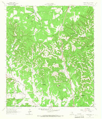 1964 Cypress Creek1966 Print · USGSThe ranching country along the Kerr and Kendall county line comes into focus in the mid-1960s, showing a land of springs and limestone peaks. Genealogists and historians can locate family holdings like Hasenwinkel Ranch and Turkey Hollow Ranch among landmarks like Rattlesnake Mountain.3 unique versions available
 - 1964 Map of Boneyard Draw, 1966 Print
 1964 Boneyard Draw1966 Print · USGSThe Texas Hill Country in the mid-sixties reveals a landscape of isolated cattle ranches and early conservation efforts. Genealogists and local historians can trace family-named landmarks like Benson Ranch, the Divide Sch, and numerous working wells including the Sampson Windmill.2 unique versions available
 - 1964 Map of Well Hollow, 1967 Print
 1964 Well Hollow1967 Print · USGSThe headwaters of the Guadalupe and Medina rivers meet at the Kerr and Bandera county line during the mid-sixties. Researchers can trace the rugged drainage of Well Hollow, find a remote Landing Strip, and locate early water infrastructure like the Water Tank.
 - 1964 Map of Diamond S Ranch, 1967 Print
 1964 Diamond S Ranch1967 Print · USGSThe Texas Hill Country along the Kerr and Bandera county line is shown here in the mid-1960s, dominated by large private ranching estates. You can trace the boundaries and features of the Diamond S Ranch, Lynxhaven Lodge, and the Landing Strip along the South Fork Guadalupe River.2 unique versions available
 - 1964 Map of Contrary Creek, 1967 Print
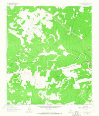 1964 Contrary Creek1967 Print · USGSKerr County ranching and rural life are captured here in the mid-1960s, showing a landscape carved by the waters of Johnson Creek. Genealogists can trace family landmarks like East Windmill and the community centers at Midway Station and Mountain Home.
 - 1964 Map of Echo Hill Ranch, 1967 Print
 1964 Echo Hill Ranch1967 Print · USGSThe Texas Hill Country of the 1960s is defined here by sprawling family estates and the intricate drainage of the Medina River. Researchers can trace the boundaries of the Echo Hill Ranch, locate the Medina Childrens Home, or find family-named sites like the Porter Ranch.
Showing maps 1-25 of 202
Top cities of Kerr County
- Kerrville historical maps
- Center Point historical maps
- Ingram historical maps
- Camp Verde historical maps
Frequently asked questions
- What are the different types of historical maps available for Kerr County?
- What is the oldest map of Kerr County?
- Where can I purchase historical maps of Kerr County for my home or office?
- Where can I download high-res historical maps of Kerr County?
- Are there historical topographic maps available for Kerr County?
- Is there historical aerial imagery available for Kerr County?
- Where are historical maps of Kerr County sourced from?