1960s Maps of Ingram, Texas
Explore 2 historic maps of Ingram from the 1960s. These maps offer a rare glimpse into what life looked like during the 1960s — showing old roads, neighborhoods, homes, and landmarks that have changed or disappeared over time.
Whether you're researching your family's past, planning a metal detecting trip, or studying how Ingram's landscape evolved across the 1960s, these high-resolution maps are a powerful tool for exploring the history of this region.
- Focus on a specific era: All maps on this page are from the 1960s, giving you a focused view of this time period.
- See what’s changed: Compare century-old streets, trails, and buildings to today's modern landscape using overlays and satellite layers.
- Research with precision: Use these maps for genealogy, historical research, land use analysis, or educational projects.
- View, download, or print: Maps are fully viewable online in high resolution, and can be downloaded or printed for your own records.
Start exploring Ingram's history through authentic maps from the 1960s. This is your window into the past.
Ingram, TX maps
(2)- 1964 Map of Kerrville, 1967 Print
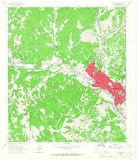 1964 Kerrville1967 Print · USGSThe Texas Hill Country centers on the winding Guadalupe River during a period of steady institutional and residential growth in the mid-sixties. Genealogists and historians can locate family landmarks like the Nichols Cem, the Schreiner Institute campus, and the early grounds of Old Lake Ingram.3 unique versions available
 - 1964 Map of Hunt, 1967 Print
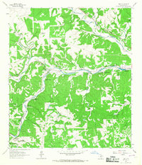 1964 Hunt1967 Print · USGSThe Texas Hill Country near the forks of the Guadalupe River was a hub for summer camps and family ranches in the early 1960s. Genealogists and historians can trace the foundations of Hunt, local burials at Hunt Cem, and recreation at Camp Rio Vista or Camp Stewart.3 unique versions available
End of results
Showing maps 1-2 of 2
Top cities near Ingram
- Kerrville historical maps
- Center Point historical maps
- Harper historical maps
- Camp Verde historical maps
Frequently asked questions
- What are the different types of historical maps available for Ingram?
- What is the oldest map of Ingram?
- Where can I purchase historical maps of Ingram for my home or office?
- Where can I download high-res historical maps of Ingram?
- Are there historical topographic maps available for Ingram?
- Is there historical aerial imagery available for Ingram?
- Where are historical maps of Ingram sourced from?