Old Maps of Kleberg County, Texas for Hiking & Exploration
Hike through history with 184 historic maps of Kleberg County. Explore old trails, ghost towns, and forgotten backroads — perfect for outdoor adventurers and local explorers.
- Rediscover forgotten places: Map out old mining camps, roads, and footpaths that no longer exist on modern maps.
- Layer with modern tools: Combine with LiDAR or satellite views to plan hikes through historical terrain.
- Made for exploration: Popular among hikers, overlanders, and local history lovers.
Use these maps to find adventure and explore the hidden past of Kleberg County.
Kleberg County, TX maps
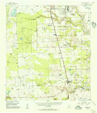
(184)- 1917 Map of Ben Bolt, 1956 Print
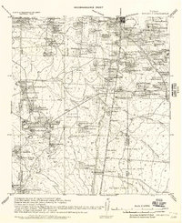 1917 Ben Bolt1956 Print · USGSSouth Texas ranching country comes into focus in this late-frontier era survey centered on the rail hub of Alice. Genealogists can trace family holdings like Hanson Ranch and Lopez Ranch, while finding landmarks like the Sugar Mill and regional Shipping Pens.
 - 1921 Map of Falfurrias
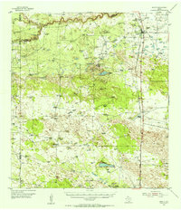
 1921 Falfurrias1921 Print · USGSBrooks and Jim Wells counties were defined by a sprawling ranching and citrus economy in the years following the Great War. Genealogists can trace family holdings and early infrastructure like Coyote Mills, the Concepcion Ruins, and the Seymour Citrus Farm.
 - 1924 Map of Petronilla
 1924 Petronilla1924 Print · USGSCoastal Texas ranching and cotton farming come to life in the twenties as rail lines connected these plains to wider markets. Trace family lands and rural school sites like Norwood School alongside cattle operations at Ratamosa Ranch and Santa Cruz Ranch.2 unique versions available
 - 1925 Map of Oso Creek
 1925 Oso Creek1925 Print · USGSThe Texas coastline near Corpus Christi is captured in the mid-1920s, revealing a landscape of coastal ranching and rural schoolhouses. Genealogists and local historians can trace family-named sites like El Camito Ranch, the Morgan Gin, and the Aberdeen Church.2 unique versions available
 - 1928 Map of Sarita
 1928 Sarita1928 Print · USGSSouth Texas ranching country and the coastal prairies are shown here during the early twentieth century. Researchers can trace family-named holdings like Kennedy Farm, ranch outposts at Novillos Mott, and rail sidings at Mifflin.
 - 1950 Map of Corpus Christi, 1953 Print
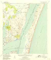
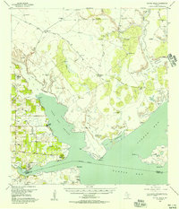
 1950 Corpus Christi1953 Print · USGSThe South Texas coast comes into focus during the early fifties, showing the interplay between booming oil fields and expansive ranching operations. Genealogists and historians can trace the Texas Mexican rail line through Kingsville or locate heritage sites like Chapman Ranch and Riviera Beach.
 - 1951 Map of South Bird Island, 1953 Print
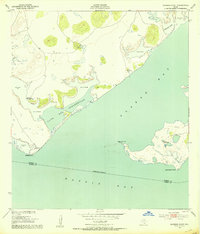
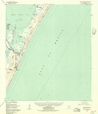
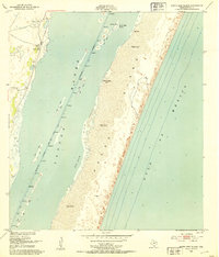 1951 South Bird Island1953 Print · USGSThe Texas coast near Kleberg County in the early fifties shows a wild landscape of shifting dunes and essential maritime channels. Genealogists and researchers can trace local landmarks like Lobo Windmill (C) and the footprint of Outlying Field 42 (Inactive).
 - 1951 Map of South Bird Island SE, 1953 Print
 1951 South Bird Island SE1953 Print · USGSCoastal Texas in the early fifties is mapped here along the shifting sands of Padre Island and Laguna Madre. Researchers can trace the precise contours of Green Hill and Big Ball Hill or find the county line at Boggy Slough.3 unique versions available
 - 1951 Map of South Bird Island NW, 1953 Print
 1951 South Bird Island NW1953 Print · USGSCoastal Kleberg County ranchlands are documented here in the early 1950s, showing a landscape defined by vital water sources and private range roads. Genealogists and researchers can trace family-named sites like Sordo and Becerra Well alongside the shores of Alazan Bay.2 unique versions available
 - 1951 Map of Point Of Rocks, 1953 Print
 1951 Point Of Rocks1953 Print · USGSThe Kleberg and Kenedy county line runs through the coastal waters of the mid-century Texas Gulf. Researchers can trace the early dredging of the Intracoastal Waterway and locate remote outposts like El Martillo and Griffins Point.2 unique versions available
 - 1951 Map of Kleberg Point, 1953 Print
 1951 Kleberg Point1953 Print · USGSCoastal Texas at the midpoint of the century is captured here in this survey of the Baffin Bay shoreline. Researchers can trace the exact locations of remote water sources like Aceitera Artesian Well and Viboras Well along the edge of Alazan Bay.2 unique versions available
 - 1951 Map of Crane Islands SW, 1953 Print
 1951 Crane Islands SW1953 Print · USGSThe Texas coast near the Nueces and Kleberg county line is captured here in the early fifties, showing the raw landscape of the barrier islands. Researchers can locate County Park No 1, the local landmark Fourmile Hill, and the project depth of the Intracoastal Waterway.
 - 1951 Map of Riviera Beach NE, 1953 Print
 1951 Riviera Beach NE1953 Print · USGSKleberg County ranchlands and coastal inlets are captured here in the early fifties, showing a landscape defined by cattle and tide. Genealogists and historians can locate family-named outposts like Jaboncellos Ranch and trace water sources from Hinojosena Artesian Well to Cayo Del Mazon.3 unique versions available
 - 1951 Map of Oso Creek, 1953 Print
 1951 Oso Creek1953 Print · USGSThe Texas Gulf Coast comes alive in the early fifties as military aviation and ranching shape the outskirts of Corpus Christi. Local researchers can trace the growth of Flour Bluff, locate the historic Chapman Ranch, and identify numerous military sites like Rodd Field.2 unique versions available
 - 1951 Map of Crane Islands, 1957 Print
 1951 Crane Islands1957 Print · USGSThe Texas barrier islands are caught in a moment of post-war coastal development and military expansion. Trace the early layout of the Corpus Christi Naval Air Station and maritime routes through Corpus Christi Pass and Packery Channel.
 - 1951 Map of South Bird Island, 1957 Print
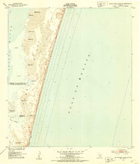
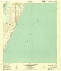
 1951 South Bird Island1957 Print · USGSThe Texas Gulf Coast in the early fifties shows a landscape of expansive cattle ranches and shifting dunes. Genealogists and historians can trace private ranch landmarks like Ojo de Agua, Becerra Wells, and the military footprint at Naval Outlying Field 42 (Practice).2 unique versions available
 - 1952 Map of Riviera Beach, 1953 Print
 1952 Riviera Beach1953 Print · USGSThe South Texas coast comes alive in the early fifties as coastal settlements like Loyola Beach and Riviera Beach began to take shape. Researchers can trace the military and industrial landscape through the Naval Reservation Auxiliary Field and isolated sites like Visnaga Well.4 unique versions available
 - 1952 Map of Riviera Beach NW, 1953 Print
 1952 Riviera Beach NW1953 Print · USGSCoastal Kleberg County was a landscape of remote naval outposts and family-named windmills in the early fifties. Genealogists and historians can trace ranching landmarks like Telephone Well or the bounds of Outlying Field 52.2 unique versions available
 - 1952 Map of Riviera Beach, 1957 Print
 1952 Riviera Beach1957 Print · USGSCoastal Kleberg County comes alive in the early fifties, showing the ranching and maritime landscape of the South Texas bays. Genealogists and historians can trace family-named sites like Jaboncillos Ranch, artesian wells, and shoreline spots like Loyola Beach and La Parra Landing.
 - 1954 Map of Sarita, 1956 Print
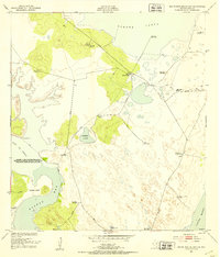
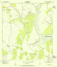
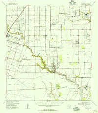
 1954 Sarita1956 Print · USGSThe ranching heart of South Texas comes into focus in the mid-1950s, centered on the railroad town of Sarita. Researchers can trace the massive cattle estates of the era, including La Paloma Ranch, and follow the Missouri Pacific line through landmarks like Turcotte.
 - 1954 Map of Kingsville, 1956 Print
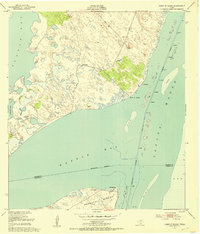
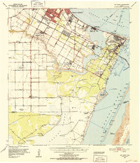
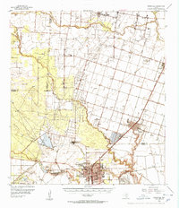 1954 Kingsville1956 Print · USGSCoastal Bend life in the 1950s centered on the growing college town of Kingsville and the nearby naval installations. Local historians can trace the early footprint of the Texas College of Arts and Industries, the Celanese Plant, and the borders of the King Ranch.2 unique versions available
 - 1954 Map of Petronila, 1956 Print
 1954 Petronila1956 Print · USGSThe South Texas coastal plain during the mid-fifties shows a fascinating transition from ranching to a landscape of oil fields and naval aviation. Researchers can trace historic properties like Laureles Ranch alongside petroleum landmarks like the Luby Oil Field and numerous inactive training sites such as Naval Auxiliary Field 22.
 - 1954 Map of Riviera, 1957 Print
 1954 Riviera1957 Print · USGSKleberg County in the mid-fifties is captured here as a landscape of military aviation, large-scale ranching, and emerging oil fields. Researchers can trace family windmills, old school sites like San Fernando Sch, and the grounds of the Texas and Mexican Industrial Institute.
 - 1956 Map of Corpus Christi
 1956 Corpus Christi1956 Print · USGSThe South Texas coast and the burgeoning port of Corpus Christi are captured here during the mid-fifties. Genealogists and historians can trace the rail-and-oil economy through labels like Robstown Airpark, Chapman Ranch, and the Missouri Pacific railroad.
 - 1956 Map of Laredo, 1960 Print
 1956 Laredo1960 Print · USGSSouth Texas in the mid-fifties reveals a landscape shaped by border commerce, military aviation, and a booming oil industry. Trace the historic Texas and Mexican RR line through Hebbronville or locate the sprawling Mirando City Oil Field and Laredo AFB.3 unique versions available
Showing maps 1-25 of 184
Top cities of Kleberg County
Frequently asked questions
- What are the different types of historical maps available for Kleberg County?
- What is the oldest map of Kleberg County?
- Where can I purchase historical maps of Kleberg County for my home or office?
- Where can I download high-res historical maps of Kleberg County?
- Are there historical topographic maps available for Kleberg County?
- Is there historical aerial imagery available for Kleberg County?
- Where are historical maps of Kleberg County sourced from?