1960s Maps of Kleberg County, Texas
Explore 12 historic maps of Kleberg County from the 1960s. These maps offer a rare glimpse into what life looked like during the 1960s — showing old roads, neighborhoods, homes, and landmarks that have changed or disappeared over time.
Whether you're researching your family's past, planning a metal detecting trip, or studying how Kleberg County's landscape evolved across the 1960s, these high-resolution maps are a powerful tool for exploring the history of this region.
- Focus on a specific era: All maps on this page are from the 1960s, giving you a focused view of this time period.
- See what’s changed: Compare century-old streets, trails, and buildings to today's modern landscape using overlays and satellite layers.
- Research with precision: Use these maps for genealogy, historical research, land use analysis, or educational projects.
- View, download, or print: Maps are fully viewable online in high resolution, and can be downloaded or printed for your own records.
Start exploring Kleberg County's history through authentic maps from the 1960s. This is your window into the past.
Kleberg County, TX maps
(12)- 1960 Map of Corpus Christi
 1960 Corpus Christi1960 Print · USGSCoastal South Texas and the Nueces County hinterlands are detailed in this mid-century survey. Genealogists and historians can trace early settlement patterns and rural landmarks like Casa Blanca during a period of steady regional growth.
 - 1963 Map of Ben Bolt SE, 1964 Print
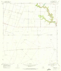
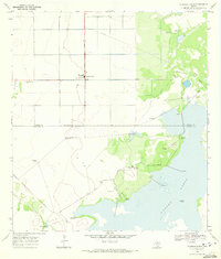
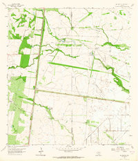 1963 Ben Bolt SE1964 Print · USGSThe South Texas ranchlands come into focus in the early sixties as a network of windmills and seasonal lakes. Genealogists and historians can trace family-named sites like Los Machos Ranch, find the Kingsville Airport, and follow the Southern Pacific rail line.
 - 1963 Map of Premont East, 1964 Print
 1963 Premont East1964 Print · USGSThe South Texas brush country at the height of the mid-century energy boom is captured here in detail. Researchers can trace the development of the Tijerina Canales Blucher Oil Field or locate family sites near Palobla and Premont.2 unique versions available
 - 1963 Map of Alice South, 1964 Print
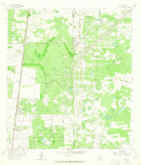
 1963 Alice South1964 Print · USGSSouth Texas petroleum and rail commerce thrive in the early sixties near the Kleberg County line. Genealogists and local historians can trace the foundations of Alice and Ben Bolt, locating sites like Fraternal Cem and the Southern Pacific line.
 - 1963 Map of Ella, 1965 Print
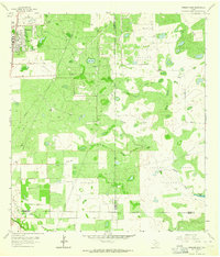
 1963 Ella1965 Print · USGSJim Wells County ranchlands met the industrial boom in the early sixties as petroleum extraction transformed the local pastures. Genealogists and historians can trace old homesteads and ranching life through features like Ebanito Camp, Ella, and the Seeligson Oil Field.2 unique versions available
 - 1966 Map of Corpus Christi
 1966 Corpus Christi1966 Print · USGSThe Texas Coastal Bend in the mid-1960s reveals a landscape where massive cattle empires and strategic military bases meet the Gulf. Trace the vast reaches of King Ranch or locate aviation history at the Corpus Christi Air Station and Kingsville Air Station.
 - 1968 Map of Crane Islands SW, 1977 Print
 1968 Crane Islands SW1977 Print · USGSThe barrier island landscape of the Texas coast is captured here during the late sixties and seventies, showing the transition between maritime industry and recreation. Researchers can trace the shifting dunes at Fourmile Hill and the early development of County Park near Bob Hall Pier.
 - 1969 Map of South Bird Island, 1970 Print
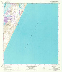
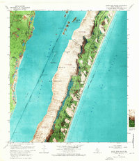 1969 South Bird Island1970 Print · USGSThe Texas coast near Kleberg County comes to life in the late sixties as a place of shifting sands and maritime activity. Researchers can trace the early Malaquite Beach Development or locate ranching markers like the Lobo Windmill.
 - 1969 Map of Pita Island, 1972 Print
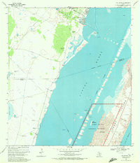 1969 Pita Island1972 Print · USGSThe Kleberg County coast in the late sixties reveals a landscape of isolated ranch windmills and early energy exploration. Researchers can trace the development of the Padre Island National Seashore and find family landmarks like Sebastian Windmill and Matanza Windmill.3 unique versions available
 - 1969 Map of Concordia, 1972 Print
 1969 Concordia1972 Print · USGSNueces County ranching and oil interests are captured here in the late sixties, just north of the Kleberg line. Researchers can trace rural landmarks and family holdings through the St Paul Cem and numerous named sites like the Mota Redonda Windmill.2 unique versions available
 - 1969 Map of Laureles Ranch, 1972 Print
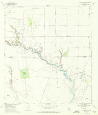 1969 Laureles Ranch1972 Print · USGSCoastal Texas ranching and oil production intersect in the late sixties along the winding path of Petronila Creek. Researchers can trace the industrial footprint of Luby Field or locate family-named landmarks like the Don Roberto Windmill and Laureles Ranch.2 unique versions available
 - 1969 Map of Chapin Ranch, 1972 Print
 1969 Chapin Ranch1972 Print · USGSCoastal Nueces County in the late sixties is a landscape of expansive ranching operations and emerging energy infrastructure. Genealogists and local historians can trace family-named landmarks like Doches Windmill, locate the Chapman Ranch Cem, and see the early footprint of gas production near Laguna Larga.2 unique versions available
End of results
Showing maps 1-12 of 12
Top cities of Kleberg County
Frequently asked questions
- What are the different types of historical maps available for Kleberg County?
- What is the oldest map of Kleberg County?
- Where can I purchase historical maps of Kleberg County for my home or office?
- Where can I download high-res historical maps of Kleberg County?
- Are there historical topographic maps available for Kleberg County?
- Is there historical aerial imagery available for Kleberg County?
- Where are historical maps of Kleberg County sourced from?