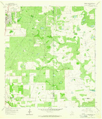
1963 Map of Premont East
USGS Topo · Published 1964About this map
Premont anchors this early 1960s landscape, serving as a hub for the surrounding South Texas rangeland and energy infrastructure. The map illustrates a region defined by extensive fossil fuel extraction, dominated by the Tijerina Canales Blucher Oil Field, Falfurrias Oil Field, and the Seeligson Oil Field. These industrial zones are interspersed with established ranching tracts such as Alazan Pasture and Laguna Larga Pasture, showing the dual use of the land during this period. Transport is facilitated by the Southern Pacific railroad corridor, which skirts the western edge of the quadrangle. Local landmarks like Big Lake and several Cem markers provide points of interest for genealogists and local historians, while the small settlement of Palobla sits near the southern boundary, where Los Olmos Creek and Paisano Creek drain the brush country.
Find a feature on this map
24 named features on this map. Tap any name to fly to it.
Don’t see what you’re looking for? This feature index may not catch every label — zoom into the map to look around manually.
Map Details
Editions of this 1963 Premont East Map
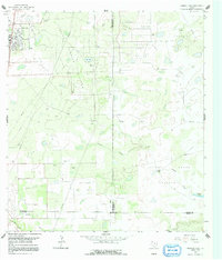
2 editions found
Other maps of this area

1921 · Falfurrias
USGS Topo · 1:125,000

1928 · Sarita
USGS Topo · 1:125,000

1950 · Corpus Christi
USGS Topo · 1:250,000

1954 · Sarita
USGS Topo · 1:62,500

1954 · Riviera
USGS Topo · 1:62,500

1956 · Corpus Christi
USGS Topo · 1:250,000

1956 · Laredo
USGS Topo · 1:250,000

1960 · Corpus Christi
USGS Topo · 1:250,000

1963 · Flowella
USGS Topo · 1:24,000

1963 · Premont West
USGS Topo · 1:24,000