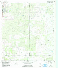
1963 Map of Premont East
USGS Topo · Published 1991About this map
Oil and gas development defines this landscape on the edge of the Brush Country during the early 1960s. The town of Premont sits in the northwest corner, characterized by a tight street grid and community infrastructure like an Athletic Field and a nearby Landing Strip. Extensive industrial activity is mapped through the Seeligson Oil Field and the sprawling Tijerina Canales Blucher Oil Field, where numerous Gas Wells and pumping stations are connected by a web of pipelines.
Find a feature on this map
26 named features on this map. Tap any name to fly to it.
Don’t see what you’re looking for? This feature index may not catch every label — zoom into the map to look around manually.
Map Details
Editions of this 1963 Premont East Map
2 editions found
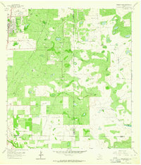
Other maps of this area

1921 · Falfurrias
USGS Topo · 1:125,000

1928 · Sarita
USGS Topo · 1:125,000

1950 · Corpus Christi
USGS Topo · 1:250,000

1954 · Sarita
USGS Topo · 1:62,500

1954 · Riviera
USGS Topo · 1:62,500

1956 · Corpus Christi
USGS Topo · 1:250,000

1956 · Laredo
USGS Topo · 1:250,000

1960 · Corpus Christi
USGS Topo · 1:250,000

1963 · Flowella
USGS Topo · 1:24,000

1963 · Premont West
USGS Topo · 1:24,000