1950s Maps of Llano County, Texas
Explore 13 historic maps of Llano County from the 1950s. These maps offer a rare glimpse into what life looked like during the 1950s — showing old roads, neighborhoods, homes, and landmarks that have changed or disappeared over time.
Whether you're researching your family's past, planning a metal detecting trip, or studying how Llano County's landscape evolved across the 1950s, these high-resolution maps are a powerful tool for exploring the history of this region.
- Focus on a specific era: All maps on this page are from the 1950s, giving you a focused view of this time period.
- See what’s changed: Compare century-old streets, trails, and buildings to today's modern landscape using overlays and satellite layers.
- Research with precision: Use these maps for genealogy, historical research, land use analysis, or educational projects.
- View, download, or print: Maps are fully viewable online in high resolution, and can be downloaded or printed for your own records.
Start exploring Llano County's history through authentic maps from the 1950s. This is your window into the past.
Llano County, TX maps
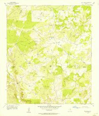
(13)- 1954 Map of Llano, 1964 Print
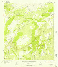
 1954 Llano1964 Print · USGSThe Texas Hill Country and Highland Lakes appear in the mid-fifties, just as new reservoirs began reshaping the landscape. Trace ranching history and river routes from Mason to Llano, or follow the Gulf Colorado and Santa Fe RR past Buchanan Lake.2 unique versions available
 - 1955 Map of Llano
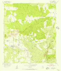
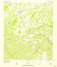
 1955 Llano1955 Print · USGSCentral Texas and the Hill Country are seen here during the mid-1950s growth of the Highland Lakes. Trace old settlements and geologic landmarks from Enchanted Rock and Longhorn Cavern to the small community of Luckenbach.
 - 1955 Map of Magill Mountain, 1956 Print
 1955 Magill Mountain1956 Print · USGSThe Texas Hill Country at the San Saba and Llano county line is captured in the mid-fifties, showing a rugged ranching landscape. Genealogists and historians can trace family land via the Gray Cemetery and numerous windmills near Magill Mountain.3 unique versions available
 - 1955 Map of Valley Spring, 1956 Print
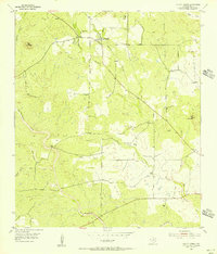 1955 Valley Spring1956 Print · USGSLlano County ranching country is captured here in the mid-fifties, showing the rural settlement patterns of the Texas Hill Country. Genealogists and historians can locate Valley Spring Cem, Shiloh Ch, and the cattle-country windmills dotting the banks of Sand Spring Creek.3 unique versions available
 - 1955 Map of Llano North, 1956 Print
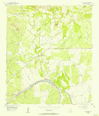
 1955 Llano North1956 Print · USGSLlano was a thriving rail and river hub in the mid-1950s, serving as the gateway to the northern cattle and granite country. You can trace early family sites like Mayes Chapel Cem or locate vintage infrastructure like the Texas and New Orleans (SP) railroad and the County Airport.2 unique versions available
 - 1955 Map of Smoothingiron Mountain, 1956 Print
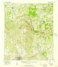
 1955 Smoothingiron Mountain1956 Print · USGSThe Texas Hill Country at the mid-century reveals a landscape of isolated ranches and granite peaks along the Mason and Llano County line. Researchers can locate family burial sites like Newsom Cem and trace the drainage patterns of San Fernando Creek and North Willow Creek.2 unique versions available
 - 1955 Map of Pontotoc, 1956 Print
 1955 Pontotoc1956 Print · USGSTexas ranching life and early county boundaries converge at the mid-century tri-point of Mason, San Saba, and Llano counties. Genealogists can locate family sites like the Old Pontotoc Cem or the 9-Bar Ranch, and trace the now-quiet Hutchinson Sch.2 unique versions available
 - 1955 Map of Valley Spring, 1957 Print
 1955 Valley Spring1957 Print · USGSLlano County ranching and rural life are preserved here in the mid-fifties, showing the rugged topography near the San Saba border. Researchers can trace family history through sites like New Pontotoc Cem, the Hutchinson Sch (Aban'd), and Smoothingiron Mountain.
 - 1956 Map of Indian Hills
 1956 Indian Hills1956 Print · USGSThe San Saba and Llano County line was a landscape of remote ranching and rugged uplands in the mid-fifties. Researchers can trace the drainage of the Little Llano River and locate family-named landmarks like Jones Windmill and Marley Peaks.
 - 1956 Map of Cherokee
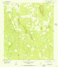
 1956 Cherokee1956 Print · USGSThe hills of San Saba and Llano Counties appear here in the mid-fifties, centered on the rural communities of Cherokee and Babyhead. Genealogists can locate family landmarks like Kuykendall Cem and the Babyhead Sch (Aband) near Babyhead Mountain.2 unique versions available
 - 1956 Map of Lone Grove
 1956 Lone Grove1956 Print · USGSLlano County in the mid-fifties remains a landscape of quiet ranching settlements and winding river valleys. Genealogists can locate family landmarks like Board Branch Cem and Bluffton Cem, or trace early commerce through the Stolz station and a local Rock Quarry.
 - 1956 Map of Cherokee, 1957 Print
 1956 Cherokee1957 Print · USGSIn the mid-fifties, this Llano and San Saba County borderland reveals a shifting rural landscape where old foundations meet new infrastructure. Genealogists can trace the Babyhead community through its Babyhead Cem or locate the remote Board Branch Cem and Kuykendall Cem in the hills.
 - 1956 Map of Llano, 1976 Print
 1956 Llano1976 Print · USGSThe Texas Hill Country comes alive in this mid-seventies survey of the Llano Uplift and Colorado River lakes. Genealogists and historians can trace family roots through settlements like Luckenbach and Castell or locate the famed L B J Ranch and Enchanted Rock.
End of results
Showing maps 1-13 of 13
Top cities of Llano County
- Horseshoe Bay historical maps
- Llano historical maps
- Sunrise Beach Village historical maps
- Baby Head historical maps
Frequently asked questions
- What are the different types of historical maps available for Llano County?
- What is the oldest map of Llano County?
- Where can I purchase historical maps of Llano County for my home or office?
- Where can I download high-res historical maps of Llano County?
- Are there historical topographic maps available for Llano County?
- Is there historical aerial imagery available for Llano County?
- Where are historical maps of Llano County sourced from?