Old Maps of Madison County, Texas
Explore 105 old maps of Madison County, spanning from 1925 to today. These high-resolution historic maps reveal how streets, neighborhoods, landmarks, and natural features evolved over time — perfect for genealogy, metal detecting, research, and local history exploration.
What you can do with these maps:
- See how Madison County changed over time: Compare historical maps to modern-day views to trace roads, homesites, rail lines & more.
- View detailed metadata: Each map includes creators, publishers, year, scale, and archive source.
- Overlay maps with satellite & LiDAR: Visualize the past alongside modern tools to explore terrain & human change.
- Trusted historical sources: Maps sourced from the USGS, Library of Congress, and other archives.
- Access maps your way: View online, download high-res files, or order prints for personal or research use.
Start exploring old maps of Madison County to uncover forgotten places, hidden landmarks, and the deep history beneath your feet.
Madison County, TX maps
(105)- 1925 Map of Iola No 2
 1925 Iola No 21925 Print · USGSThe Navasota River bottomlands at the Madison and Leon county line appear here in the mid-1920s as a landscape of winding oxbows and rural farmsteads. Researchers can locate family landmarks such as Keefer Cemetery, Burns Store, and the Morning Star School site.
 - 1931 Map of Iola
 1931 Iola1931 Print · USGSThe Navasota River basin in the mid-1920s shows a landscape of river-bottom lakes and rural outposts. Genealogists can locate family landmarks like Keefer Cem and Nash Cem or the local hub at Burns Store.2 unique versions available
 - 1953 Map of Palestine, 1964 Print
 1953 Palestine1964 Print · USGSEast Texas was defined by its deep pine forests and burgeoning energy sector in the mid-1950s. Genealogists and historians can trace the rail-and-river economy through settlements like Tennessee Colony and Pollok or explore the early footprints of the Cayuga Oil Field and Davy Crockett National Forest.2 unique versions available
 - 1954 Map of Waco, 1964 Print
 1954 Waco1964 Print · USGSCentral Texas during the mid-fifties shows a landscape defined by the expansion of Fort Hood Military Reservation and the Brazos river system. Trace the rail lines and early airfields like James Connally Air Force Base and settlements like Temple or McGregor.2 unique versions available
 - 1954 Map of Beaumont, 1964 Print
 1954 Beaumont1964 Print · USGSSoutheast Texas in the mid-fifties reveals a landscape of massive national forests, emerging reservoirs, and a booming oil economy. Genealogists and researchers can trace rural settlements like Dallardsville and Village Mills or locate early drilling sites at Sour Lake Oil Field.3 unique versions available
 - 1954 Map of Austin, 1964 Print
 1954 Austin1964 Print · USGSCentral Texas is captured during a period of steady growth as the capital city and its neighboring farm towns began to modernize. Researchers can trace historic rail corridors like the Southern Pacific RR or locate landmarks such as Bergstrom Air Force Base and Pilot Knob.4 unique versions available
 - 1955 Map of Waco
 1955 Waco1955 Print · USGSCentral Texas at the peak of the Cold War reveals a landscape defined by military expansion and major water projects. Researchers can trace the footprints of Fort Hood, the waters of Lake Waco, and regional hubs like Temple or Mexia.
 - 1957 Map of Beaumont
 1957 Beaumont1957 Print · USGSSoutheast Texas in the mid-fifties is defined by the timber-rich lands between the Trinity River and Beaumont. Trace the history of the Alabama and Coushatti Indian Reservation or locate early campus sites like Prairie View College.
 - 1957 Map of Palestine
 1957 Palestine1957 Print · USGSEast Texas in the mid-fifties reveals a landscape of deep pine forests and winding river valleys before the era of massive reservoir construction. Researchers can trace the legacy of the timber and rail industries through labels for the Missouri Pacific RR, Davy Crockett National Forest, and Nacogdoches.
 - 1959 Map of Clear Lake, 1960 Print
 1959 Clear Lake1960 Print · USGSThe Navasota River bottomlands are captured here in the late fifties at the meeting of Brazos, Madison, and Grimes Counties. Researchers can trace rural landmarks like Williamson Cem, find old river transits at Democrat Crossing, or locate Brushy Lake.3 unique versions available
 - 1962 Map of Connor, 1964 Print
 1962 Connor1964 Print · USGSThe Madison and Walker county line runs through this early 1960s rural landscape as the local infrastructure begins to modernize. Genealogists and researchers can locate family sites like Burrows Cemetery, the South Bethel School, and the Jenkins settlement.
 - 1962 Map of Wyser Bottom, 1965 Print
 1962 Wyser Bottom1965 Print · USGSThe Trinity River valley in the early 1960s reveals a landscape of oxbow lakes and riverine bluffs. Genealogists can trace family landmarks like Spivey Cem, Mason Cem, and the rural New Hope Ch near the settlement of Whites.2 unique versions available
 - 1962 Map of Baker Lake, 1966 Print
 1962 Baker Lake1966 Print · USGSIn the early sixties, the Trinity River bottomlands were defined by massive agricultural institutions and quiet rural hamlets. Researchers can trace the roots of local communities at Shaw Prairie Ch, Bucks Cem, and the old settlement at Bald Prairie.2 unique versions available
 - 1963 Map of Bedias, 1964 Print
 1963 Bedias1964 Print · USGSThe rural landscape of southeast Texas is captured here in the early sixties as local life centered around the town of Bedias. Genealogists and researchers can trace family-named locations such as Upchurch and country landmarks like Lone Star Ch and the Old Railroad Grade.
 - 1963 Map of Steep Branch, 1964 Print
 1963 Steep Branch1964 Print · USGSThe rural borderlands of Walker, Madison, and Grimes counties come alive in the early sixties as a landscape of winding creeks and community anchors. Trace family history through landmarks like McAdams Cem, Oak Grove Sch, and the small settlement of Mossy Grove.
 - 1963 Map of Madisonville, 1964 Print
 1963 Madisonville1964 Print · USGSMadison County in the early sixties centers on the energy and community life of its county seat. Genealogists can trace rural roots through the Parten Sch, High Prairie Cem, and the extensive Madisonville Oil Field.2 unique versions available
 - 1964 Map of Sand Ridge, 1967 Print
 1964 Sand Ridge1967 Print · USGSThe Trinity River valley in the mid-1960s shows a landscape of rural Texas settlements and river bottomlands. Genealogists can locate family landmarks like Boatman Cem, Union Grove Ch, and the grounds of the Eastham State Prison Farm.3 unique versions available
 - 1964 Map of Normangee, 1967 Print
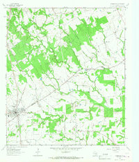 1964 Normangee1967 Print · USGSThe railroad junction at Normangee thrived in the mid-sixties at the crossing of the Fort Worth and Denver and Rock Island lines. Researchers can trace local lineage through Randolph Cem, Tenmile Cem, and the rural Carter Sch.2 unique versions available
 - 1964 Map of Elwood, 1967 Print
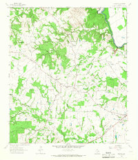 1964 Elwood1967 Print · USGSMadison County's river-border country is captured here in the mid-1960s as the Trinity River winds past rural homesteads. Local researchers can trace family landmarks like the Alphie Cem, the settlement at Old Elwood, and the community hub at Midway.2 unique versions available
 - 1964 Map of Hilltop Lakes, 1967 Print
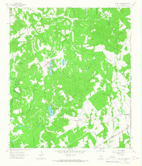 1964 Hilltop Lakes1967 Print · USGSMid-century development meets rural Texas tradition in this Leon County survey as the aviation-themed resort of Hilltop Lakes begins to take shape. Researchers can trace family roots through the Greer Cem and explore the older settlements of Wealthy and Normangee.2 unique versions available
 - 1964 Map of Leona SW, 1967 Print
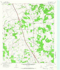 1964 Leona SW1967 Print · USGSSettled along the Madison and Leon county line in the mid-1960s, this area reflects a quiet rural economy. Genealogists can trace family names at Mount Tabor Cem and locate community hubs like the Sweet Home Ch and Cross Roads.
 - 1965 Map of Iola, 1967 Print
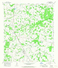 1965 Iola1967 Print · USGSGrimes and Madison counties are captured here in the mid-sixties, showing a landscape defined by small-town rail stops and rural churches. Genealogists can trace family locations near Iola, Zion Cem, and several country churches like Concord Ch.3 unique versions available
 - 1965 Map of North Zulch, 1967 Print
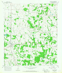 1965 North Zulch1967 Print · USGSMadison County's rural landscape is captured here in the mid-1960s, showing the intersection of heavy rail and emerging petroleum interests. Genealogists can locate several remote burial sites and congregations, such as Oxford Cemetery, Willow Hole Church, and Sand Prairie Cemetery.2 unique versions available
 - 1965 Map of Canary, 1968 Print
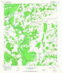 1965 Canary1968 Print · USGSMadison and Leon counties are mapped here in the mid-sixties, showing a landscape of river bottoms and rural landings. Genealogists can locate family landmarks like Plainview Cem, Manning Ch, and the crossing at Bundy Crossing.2 unique versions available
 - 1984 Map of Beaumont
 1984 Beaumont1984 Print · USGSSoutheast Texas in the late seventies and early eighties shows a landscape of expanding reservoirs and deep timber industry. Researchers can trace the development of the Sam Houston National Forest or locate regional landmarks like Grabbs Prairie and the Wynne State Prison Farm.3 unique versions available
Showing maps 1-25 of 105
Top cities of Madison County
Frequently asked questions
- What are the different types of historical maps available for Madison County?
- What is the oldest map of Madison County?
- Where can I purchase historical maps of Madison County for my home or office?
- Where can I download high-res historical maps of Madison County?
- Are there historical topographic maps available for Madison County?
- Is there historical aerial imagery available for Madison County?
- Where are historical maps of Madison County sourced from?