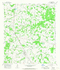
1965 Map of Iola
USGS Topo · Published 1967About this map
The settlement of Iola serves as the focal point of this mid-1960s survey along the Madison Co Grimes Co border. The landscape is a network of small rural communities and family-centered landmarks, connected by the Chicago Rock Island and Pacific and Fort Worth and Denver railroad line. This corridor links Iola with the smaller whistle-stops of Hicks and Cross, illustrating the continued importance of the rail line to the local agricultural economy during this era.
Find a feature on this map
31 named features on this map. Tap any name to fly to it.
Don’t see what you’re looking for? This feature index may not catch every label — zoom into the map to look around manually.
Map Details
Editions of this 1965 Iola Map
Other maps of this area

1925 · Iola No 2
USGS Topo · 1:48,000

1931 · Iola
USGS Topo · 1:62,500

1954 · Beaumont
USGS Topo · 1:250,000

1954 · Austin
USGS Topo · 1:250,000

1956 · Carlos
USGS Topo · 1:62,500

1957 · Beaumont
USGS Topo · 1:250,000

1959 · Clear Lake
USGS Topo · 1:24,000

1959 · Reliance
USGS Topo · 1:24,000

1961 · Singleton
USGS Topo · 1:24,000

1962 · Keith
USGS Topo · 1:24,000