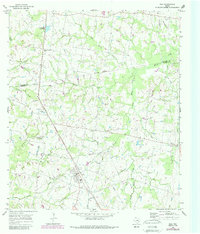
1965 Map of Iola
USGS Topo · Published 1989About this map
Iola serves as the primary hub of this East Texas landscape, where the boundary between Madison Co and Grimes Co crosses through timbered bottomlands and rolling prairies. Surveyed in the mid-1960s with updates reflecting the early 1980s, the map reveals a rural community structured around small gathering places and family landmarks. Rural life is anchored by a network of country churches like Concord Ch and Shiloh Ch, alongside numerous family and community burial grounds such as Bethel Cem and Zion Cem.
Find a feature on this map
30 named features on this map. Tap any name to fly to it.
Don’t see what you’re looking for? This feature index may not catch every label — zoom into the map to look around manually.
Map Details
Editions of this 1965 Iola Map
Other maps of this area

1925 · Iola No 2
USGS Topo · 1:48,000

1931 · Iola
USGS Topo · 1:62,500

1954 · Beaumont
USGS Topo · 1:250,000

1954 · Austin
USGS Topo · 1:250,000

1956 · Carlos
USGS Topo · 1:62,500

1957 · Beaumont
USGS Topo · 1:250,000

1959 · Clear Lake
USGS Topo · 1:24,000

1959 · Reliance
USGS Topo · 1:24,000

1961 · Singleton
USGS Topo · 1:24,000

1962 · Keith
USGS Topo · 1:24,000