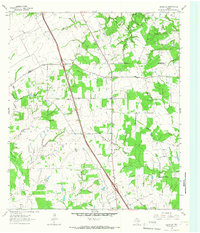
1964 Map of Leona SW
USGS Topo · Published 1967About this map
The Leon River winds along the western edge of this landscape, marking a rural boundary between Leon and Madison counties. In the mid-1960s, this area was defined by a network of creek branches and small-scale community landmarks. Local life centered around small intersections and congregational hubs like Cross Roads, Tabor Ch, and Sweet Home Ch. The map provides significant detail for genealogists, recording several family-named burial sites including Mount Tabor Cem, Greer Cem, and Greenbriar Cem. While an Oil Field and Gravel Pit indicate localized industrial activity, much of the terrain is occupied by large landholdings such as the Seven J Ranch. Extensive drainage systems like Twomile Creek and Larrison Creek carve through the wooded terrain, illustrating the hydrologic character of this East Texas region before modern expansion.
Find a feature on this map
32 named features on this map. Tap any name to fly to it.
Don’t see what you’re looking for? This feature index may not catch every label — zoom into the map to look around manually.
Map Details
Editions of this 1964 Leona SW Map
This is the sole edition of this map. No revisions or reprints were ever made.
Other maps of this area

1931 · Iola
USGS Topo · 1:62,500

1953 · Palestine
USGS Topo · 1:250,000

1954 · Waco
USGS Topo · 1:250,000

1954 · Beaumont
USGS Topo · 1:250,000

1954 · Austin
USGS Topo · 1:250,000

1955 · Waco
USGS Topo · 1:250,000

1957 · Beaumont
USGS Topo · 1:250,000

1957 · Palestine
USGS Topo · 1:250,000

1962 · Connor
USGS Topo · 1:24,000

1963 · Madisonville
USGS Topo · 1:24,000