
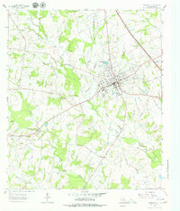
1963 Map of Madisonville
USGS Topo · Published 1964About this map
The county seat of Madisonville anchors this mid-century landscape, serving as a hub for the surrounding ranching and petroleum interests during the early 1960s. The town's community infrastructure is well-defined, featuring the Rodeo Grounds, Anderson High Sch, and the Parten Sch. Beyond the residential grid, the Madisonville Oil Field dominates the southwest, marked by a dense concentration of wells and access roads that signify the importance of the energy industry to the local economy.
Find a feature on this map
42 named features on this map. Tap any name to fly to it.
Don’t see what you’re looking for? This feature index may not catch every label — zoom into the map to look around manually.
Map Details
Editions of this 1963 Madisonville Map
2 editions found
Other maps of this area

1931 · Iola
USGS Topo · 1:62,500

1953 · Palestine
USGS Topo · 1:250,000

1954 · Waco
USGS Topo · 1:250,000

1954 · Beaumont
USGS Topo · 1:250,000

1954 · Austin
USGS Topo · 1:250,000

1955 · Waco
USGS Topo · 1:250,000

1957 · Beaumont
USGS Topo · 1:250,000

1957 · Palestine
USGS Topo · 1:250,000

1962 · Connor
USGS Topo · 1:24,000

1963 · Bedias
USGS Topo · 1:24,000