1970s Maps of Mason County, Texas
Explore 6 historic maps of Mason County from the 1970s. These maps offer a rare glimpse into what life looked like during the 1970s — showing old roads, neighborhoods, homes, and landmarks that have changed or disappeared over time.
Whether you're researching your family's past, planning a metal detecting trip, or studying how Mason County's landscape evolved across the 1970s, these high-resolution maps are a powerful tool for exploring the history of this region.
- Focus on a specific era: All maps on this page are from the 1970s, giving you a focused view of this time period.
- See what’s changed: Compare century-old streets, trails, and buildings to today's modern landscape using overlays and satellite layers.
- Research with precision: Use these maps for genealogy, historical research, land use analysis, or educational projects.
- View, download, or print: Maps are fully viewable online in high resolution, and can be downloaded or printed for your own records.
Start exploring Mason County's history through authentic maps from the 1970s. This is your window into the past.
Mason County, TX maps
(6)- 1970 Map of Calf Creek, 1973 Print
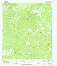
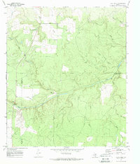 1970 Calf Creek1973 Print · USGSCentral Texas ranch land at the turn of the 1970s is defined by the winding San Saba River. Researchers can trace old river crossings like Twentymile Crossing and locate isolated landmarks like the Block House Ranch and Blue Hole.2 unique versions available
 - 1970 Map of Katemcy, 1973 Print
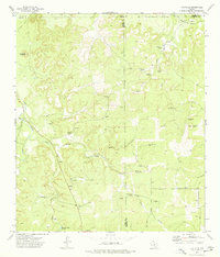
 1970 Katemcy1973 Print · USGSMason and McCulloch counties are captured here in the early 1970s, showing a landscape defined by the San Saba River and small rural outposts. Researchers can trace family history at the Camp San Saba Cem and locate historic community centers like Bethel Ch or Katemcy.2 unique versions available
 - 1970 Map of Long Mountain, 1973 Print
 1970 Long Mountain1973 Print · USGSThe Mason and Menard county line comes alive in the early seventies, showcasing a classic Hill Country ranching landscape. Genealogists can trace family roots at Jacoby Cem or Coffey Cem and locate the Long Mountain Community Center.2 unique versions available
 - 1970 Map of Grit, 1973 Print
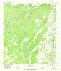
 1970 Grit1973 Print · USGSMason County ranching country is captured here during the 1970s as Highway 29 and 377 converge. Family historians can trace rural roots at Grit Cem and Cavness Cem or locate the small settlements of Grit and Streeter.
 - 1974 Map of Noxville, 1977 Print
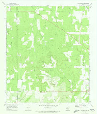
 1974 Noxville1977 Print · USGSThe rural crossing at Noxville and the winding James River define this Kimble County landscape in the 1970s. Genealogists and local historians can locate remote landmarks like North Trap Windmill and family-named springs such as Walker Spring.
 - 1974 Map of The Falls, 1977 Print
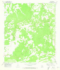
 1974 The Falls1977 Print · USGSThe rugged junction of Mason, Kimble, and Gillespie counties is captured here in the mid-1970s. Researchers can trace family ranching roots through the Anderegg Cem, Rock House Windmill, and Hermans Point.
End of results
Showing maps 1-6 of 6
Top cities of Mason County
Frequently asked questions
- What are the different types of historical maps available for Mason County?
- What is the oldest map of Mason County?
- Where can I purchase historical maps of Mason County for my home or office?
- Where can I download high-res historical maps of Mason County?
- Are there historical topographic maps available for Mason County?
- Is there historical aerial imagery available for Mason County?
- Where are historical maps of Mason County sourced from?