1900s (20th Century) Maps of Mason County, Texas
Explore 37 historic maps of Mason County from the 1900s (20th Century). These maps offer a rare glimpse into what life looked like during the 1900s — showing old roads, neighborhoods, homes, and landmarks that have changed or disappeared over time.
Whether you're researching your family's past, planning a metal detecting trip, or studying how Mason County's landscape evolved across the 1900s, these high-resolution maps are a powerful tool for exploring the history of this region.
- Focus on a specific era: All maps on this page are from the 1900s, giving you a focused view of this time period.
- See what’s changed: Compare century-old streets, trails, and buildings to today's modern landscape using overlays and satellite layers.
- Research with precision: Use these maps for genealogy, historical research, land use analysis, or educational projects.
- View, download, or print: Maps are fully viewable online in high resolution, and can be downloaded or printed for your own records.
Start exploring Mason County's history through authentic maps from the 1900s. This is your window into the past.
Mason County, TX maps
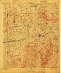
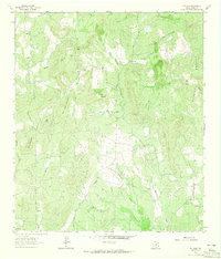
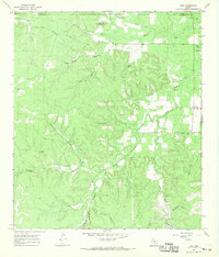
(37)- 1904 Map of Llano
 1904 Llano1904 Print · USGSThe Texas Hill Country around the turn of the century centered on the rail hub of Llano and the winding Llano River. Genealogists can trace early homesteads like Kuykendall's Ranch and locate remote landmarks such as Hesterville Church and the Iron Mine.
 - 1909 Map of Llano
 1909 Llano1909 Print · USGSCentral Texas at the first decade of the new century shows a landscape of cattle ranches and growing rail towns. Genealogists can locate family landmarks such as Atkinson's Ranch, Oxford, and rural social centers like Kennedy School or Wooten Church.3 unique versions available
 - 1918 Map of Llano
 1918 Llano1918 Print · USGSThe Llano River country during the Great War era reveals a landscape of isolated cattle ranches and early mining efforts. Genealogists can trace family landmarks like Atkinson's Ranch and Taylorville or locate long-gone community centers like Kennedy School and Wooten Church.
 - 1954 Map of Llano, 1964 Print
 1954 Llano1964 Print · USGSThe Texas Hill Country and Highland Lakes appear in the mid-fifties, just as new reservoirs began reshaping the landscape. Trace ranching history and river routes from Mason to Llano, or follow the Gulf Colorado and Santa Fe RR past Buchanan Lake.2 unique versions available
 - 1955 Map of Llano
 1955 Llano1955 Print · USGSCentral Texas and the Hill Country are seen here during the mid-1950s growth of the Highland Lakes. Trace old settlements and geologic landmarks from Enchanted Rock and Longhorn Cavern to the small community of Luckenbach.
 - 1955 Map of Smoothingiron Mountain, 1956 Print
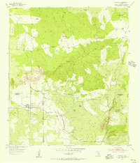
 1955 Smoothingiron Mountain1956 Print · USGSThe Texas Hill Country at the mid-century reveals a landscape of isolated ranches and granite peaks along the Mason and Llano County line. Researchers can locate family burial sites like Newsom Cem and trace the drainage patterns of San Fernando Creek and North Willow Creek.2 unique versions available
 - 1955 Map of Pontotoc, 1956 Print
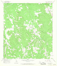
 1955 Pontotoc1956 Print · USGSTexas ranching life and early county boundaries converge at the mid-century tri-point of Mason, San Saba, and Llano counties. Genealogists can locate family sites like the Old Pontotoc Cem or the 9-Bar Ranch, and trace the now-quiet Hutchinson Sch.2 unique versions available
 - 1955 Map of Valley Spring, 1957 Print
 1955 Valley Spring1957 Print · USGSLlano County ranching and rural life are preserved here in the mid-fifties, showing the rugged topography near the San Saba border. Researchers can trace family history through sites like New Pontotoc Cem, the Hutchinson Sch (Aban'd), and Smoothingiron Mountain.
 - 1956 Map of Llano, 1976 Print
 1956 Llano1976 Print · USGSThe Texas Hill Country comes alive in this mid-seventies survey of the Llano Uplift and Colorado River lakes. Genealogists and historians can trace family roots through settlements like Luckenbach and Castell or locate the famed L B J Ranch and Enchanted Rock.
 - 1962 Map of Purdy Hill, 1964 Print
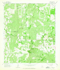
 1962 Purdy Hill1964 Print · USGSMason and the surrounding ranchlands are captured here in the early sixties, showing the town's expansion toward the Mason Mountains. Genealogists can locate family burial sites like Behrens Cem and Crosby Cem, or trace the settlement at Koockville.2 unique versions available
 - 1962 Map of Fly Gap, 1965 Print
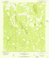
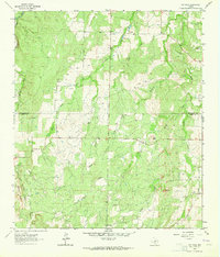
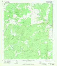
 1962 Fly Gap1965 Print · USGSMason County ranching and mining country is captured here in the early sixties, showing the rural lifestyle of the Texas Hill Country. Genealogists and historians can locate family-named sites like Leifeste Cem, the Spiller Mine, and the Fly Gap Sch.2 unique versions available
 - 1962 Map of Fredonia, 1965 Print
 1962 Fredonia1965 Print · USGSThe ranchlands of the Texas Hill Country meet at the three-county junction of Mason, McCulloch, and San Saba in the early 1960s. Genealogists and local historians can trace the rural landscape of Fredonia, finding the Union Band Ch and family sites near Deer Creek Cem.2 unique versions available
 - 1963 Map of Spy Rock, 1964 Print
 1963 Spy Rock1964 Print · USGSThe hill country of McCulloch and Mason counties is captured here in the early sixties, as the ranching landscape remained defined by family-run tracts. Genealogists and local historians can locate remote burial sites like Blackjack Cem and prominent landmarks including Spy Rock and Tabor Mountain.2 unique versions available
 - 1967 Map of Cherry Mountain, 1969 Print
 1967 Cherry Mountain1969 Print · USGSIn the Texas Hill Country during the late sixties, this survey captures a landscape of family ranching and small community hubs. Genealogists can trace family names through the Marschall-Meusebach Cem, Dearing Cem, and the settlement at Crenwelge.
 - 1967 Map of Loyal Valley, 1969 Print
 1967 Loyal Valley1969 Print · USGSMason County in the late sixties reveals a landscape of quiet settlements and family landmarks. Genealogists can trace rural roots at Hilda and Loyal Valley, locating the Ellerbracht Cem and names like Meusebach Mountain.2 unique versions available
 - 1967 Map of Castell, 1969 Print
 1967 Castell1969 Print · USGSLife along the Llano River in the late sixties centered on the small riverside community of Castell. Genealogists and local historians can trace family roots through a remarkable number of burial sites, including Jedlicka Cem, Hoffman Cem, and Schneider Cem.2 unique versions available
 - 1967 Map of Panther Creek, 1969 Print
 1967 Panther Creek1969 Print · USGSThe Llano River country of Mason County is captured here in the late sixties, showcasing a landscape of isolated ranchlands and limestone ridges. Researchers can trace family-named landmarks like Bober Cem, the Cannon Mountains, and Eckert Spring.2 unique versions available
 - 1967 Map of Art, 1969 Print
 1967 Art1969 Print · USGSMason County ranching and river lands come into focus during the late sixties. Genealogists can trace family burial sites like Martin Cem and Bauer Cem while following the Llano River past Hedwigs Hill.2 unique versions available
 - 1967 Map of Doss, 1969 Print
 1967 Doss1969 Print · USGSThe Texas Hill Country at the Gillespie and Mason County border is captured here in the late sixties, showing a landscape of working ranches and spring-fed creeks. Genealogists can trace family landmarks like Satler Cem, Kensing Cem, and the Onion Creek Sch.
 - 1967 Map of Cherry Spring, 1969 Print
 1967 Cherry Spring1969 Print · USGSThe Mason and Gillespie county line runs through this Hill Country terrain in the late sixties, where small settlements like Cherry Spring and Doss anchor the rural landscape. Researchers can trace family history through several burial grounds and landmarks, such as Squaw Creek Cem, Mund Hill, and Langes Mill Road.
 - 1967 Map of Mason, 1970 Print
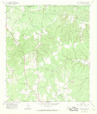
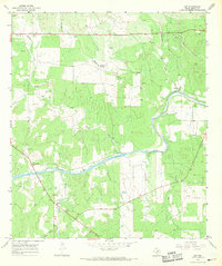
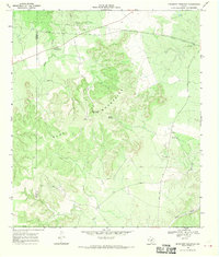
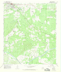 1967 Mason1970 Print · USGSThe Texas Hill Country town of Mason and its surrounding ranch lands are captured here in the late sixties. Genealogists and local historians can trace family-named sites such as Hick Springs, Grossville, and various Cem locations along the Llano River.2 unique versions available
 - 1967 Map of Monument Mountain SE, 1970 Print
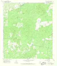
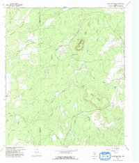
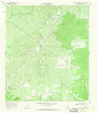 1967 Monument Mountain SE1970 Print · USGSMason County ranch lands are captured here in the late sixties as the James River valley integrated new industrial utility lines. Researchers can locate remote ranch infrastructure like the Landing Strip, Windmill Draw, and the prominent Monument Mountain.2 unique versions available
 - 1967 Map of House Mountain, 1992 Print
 1967 House Mountain1992 Print · USGSThe Mason and Llano county line bisects this Texas Hill Country landscape during the late sixties, a period of established ranching and rural life. Researchers can locate the Putman Cemetery and trace named drainages like Meusebach Creek and Blockhouse Creek.
 - 1968 Map of Monument Mountain, 1970 Print
 1968 Monument Mountain1970 Print · USGSThe Texas Hill Country at the end of the sixties reveals a landscape of isolated ranches and rugged highlands along the Mason-Kimble line. Researchers can locate community hubs like Blue Mountain Community Hall or trace the James River and Crocker Landing Strip.
 - 1968 Map of Turtle Creek, 1970 Print
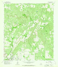
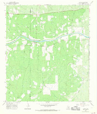
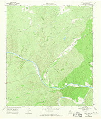 1968 Turtle Creek1970 Print · USGSThe Hill Country of Mason County is defined by the confluence of the Llano River and the James River during the late 1960s. Trace ranching history and early industry through sites like the Cem, the winding James River Road, and scattered Gravel Pits.2 unique versions available
Showing maps 1-25 of 37
Top cities of Mason County
Frequently asked questions
- What are the different types of historical maps available for Mason County?
- What is the oldest map of Mason County?
- Where can I purchase historical maps of Mason County for my home or office?
- Where can I download high-res historical maps of Mason County?
- Are there historical topographic maps available for Mason County?
- Is there historical aerial imagery available for Mason County?
- Where are historical maps of Mason County sourced from?